
South Africa Travel Final Part: Gold Reef City: Gold Mine Museum
Filed under: South Africa Travel Final Part: Gold Reef City: Gold Mine Museum
South Africa Travel Final Part: Gold Reef City: Gold Mine Museum
Friday, 2 Dec 2016
Gold Reef City: Gold Mine Museum
This Friday was our last day in South Africa before we went back to Malaysia, our homeland, in the evening. But we had one more place to visit in the morning. It was a gold mine museum which was in a theme park known as Gold Reef City that was located 7 km south-west of Johannesburg City. The museum offered an underground mine tour.
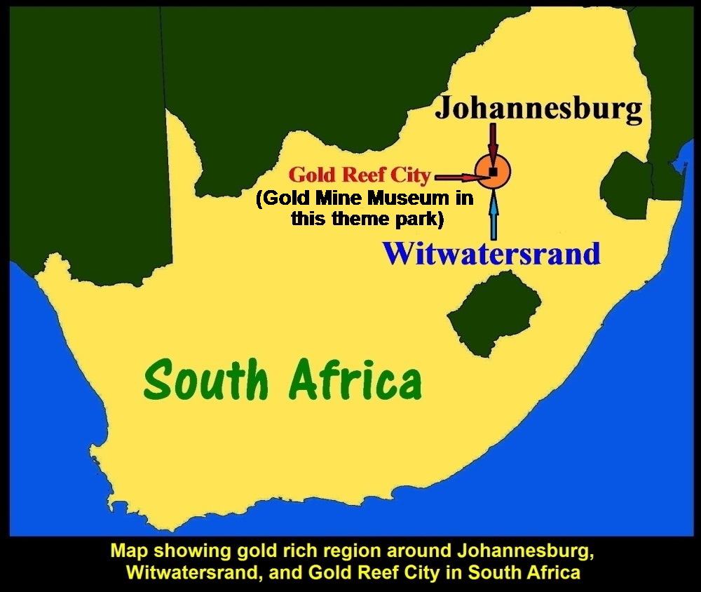
Map showing gold rich area, Witwatersrand, and Gold Reef City Theme Park
Underground Gold Deposit
Witwatersrand region around Johannesburg City has the largest underground gold deposit in the world. 50% of the world’s gold production is from this region.
When gold was first discovered in 1886 in this region gold prospectors from within and without South Africa rushed to the place and started drilling for the underground gold.
Crown Mines Group
Crown Mines Group, one of the gold prospectors, started mining in 1916 at the place known as Shaft 14 which is now located in Gold Reef City Theme Park. It closed Shaft 14 in 1977 when the depth of the mining level had reached 3293 metres below the surface. In 1979, it donated the land to Rand Mines which turned it into a museum.
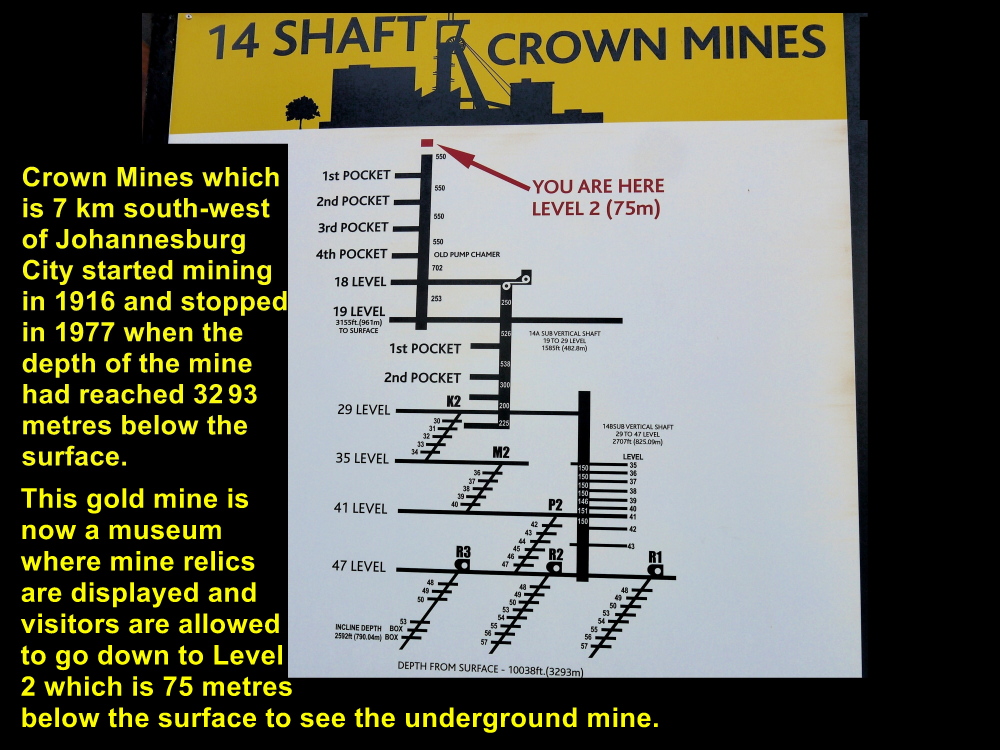
Crown Mines owned Shaft 14 and the diagram shows that gold had been mined to the level, 3293 metres below the surface.
Gold Mine Tour
After breakfast at Hotel Peermont Mondior that was near Johannesburg International Airport, we travelled to Gold Reef City, a theme park. When we reached the park, there were many people, young and old from all walks of life, waiting for the gate to be opened before they could go in and enjoy the kinds of thrills they liked inside.
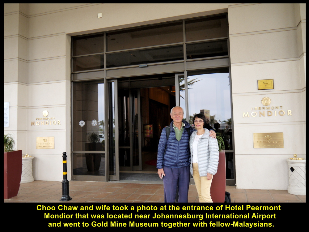
Choo Chaw taking a photo at Hotel Peermont Mondior before leaving for Gold Mine Museum
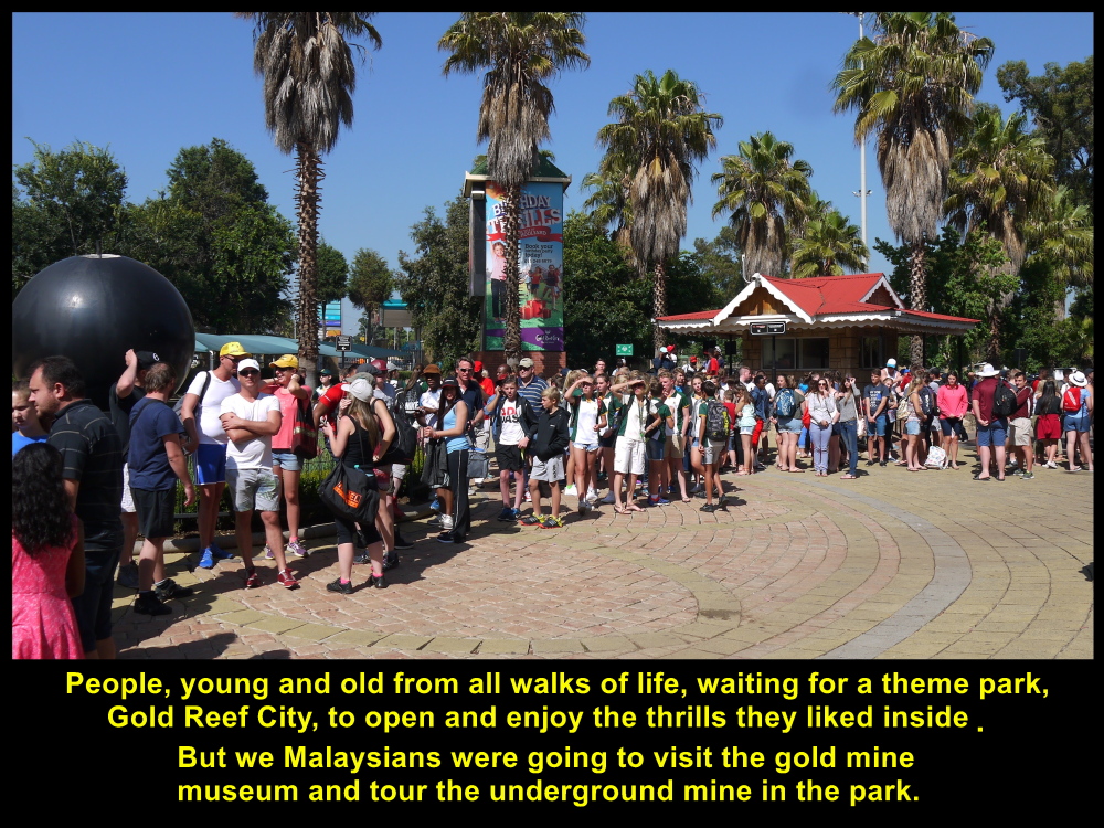
People of all ages and from all walks of life waiting outside Gold Reef City where they could enjoy many thrills
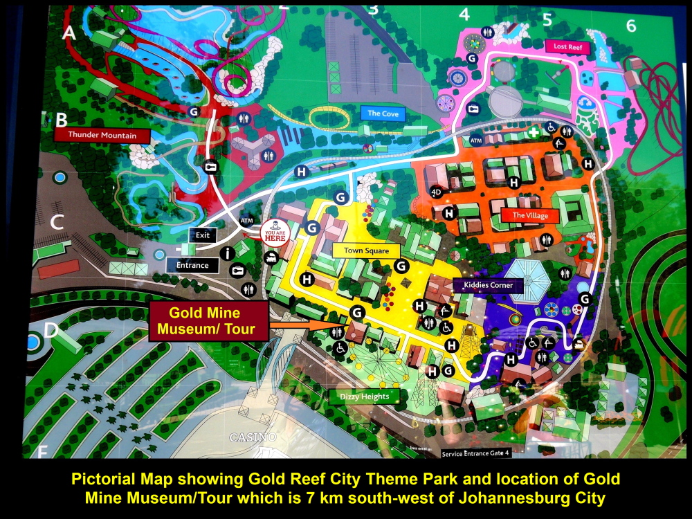
Pictorial map showing the locations of different thrills and Gold Mine Museum Tour
When it was opened, we passed through it to get to the gold mine museum. The mine was originally owned by Crown Mines Group which started mining the place in 1916 and closed it in 1977 when the shaft known as Shaft 14 reached a depth of 3293 metres below the surface.
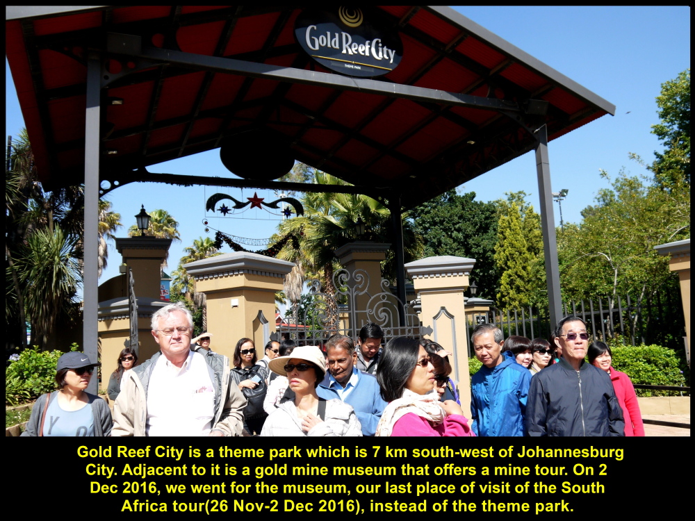
Entrance to Gold Reef City Theme Park and Gold Mine Museum which offers mine tour
Shaft 14
At the museum, a mine tour-guide greeted us and gave each of us a headlamp and safety-helmet. Then we followed him to Shaft 14, entered the shaft-cage or elevator which brought us to Level 2 that was 75 metres below the surface.
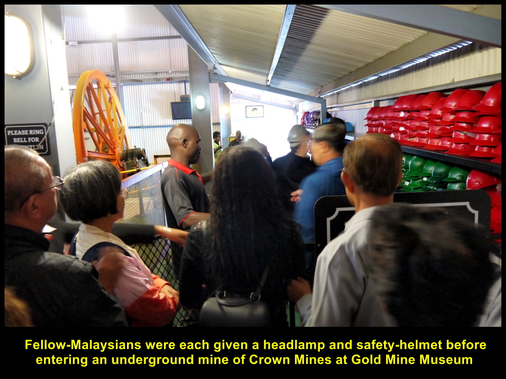
Headlamps and helmets were given to fellow-Malaysians before entering the underground gold mine.
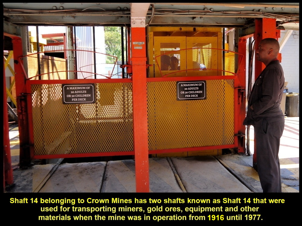
Shaft 14 of Crown Mines has two shafts for transporting miners, equipment and materials from 1916 until 1977

Fellow-Malaysians entering Shaft 14 for an underground mine tour
Head-Frame and Winder
The cage was lowered into Shaft 14 by a cable that went round a tall head-frame and to a hoist-machine or winder outside the shaft.

Head-frame for lowering or hoisting up shaft-cage or elevator with the help of hoist-machine
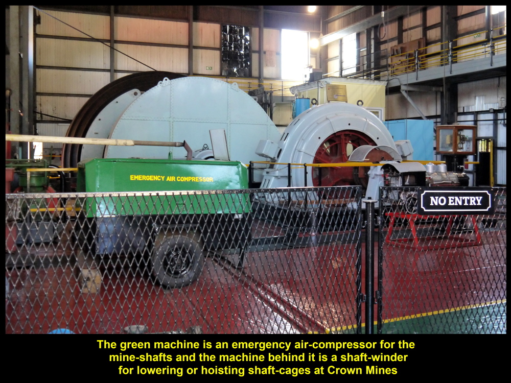
Air-compressor(green) for pumping air into shafts and shaft-winder for lowering or hoisting cage or elevator in shafts
Acid Mine Water
Although the maximum depth of the mine was about 3293 metres underground, most of the shafts had been filled with acid mine water. The acid was produced when rain-water flowed into the shaft and reacted with sulfides of iron in the underground rocks.
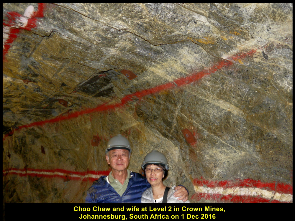
Choo Chaw and wife visiting underground gold mine
Underground Mine Tour
At Level 2, our mine-guide gave us a good lesson on mining, uses of machines, safety measures, first-aid given to injured miners, etc.
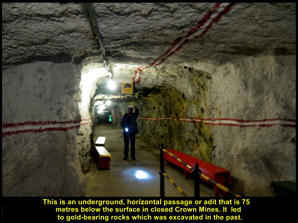
Adit or tunnel
leading to a place or stope where gold-ore was excavated
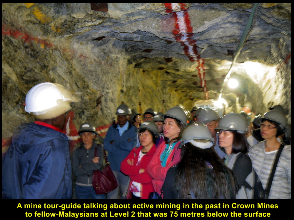
Mine tour-guide giving mining lesson to fellow-Malaysians at Level 2 of Shaft 14
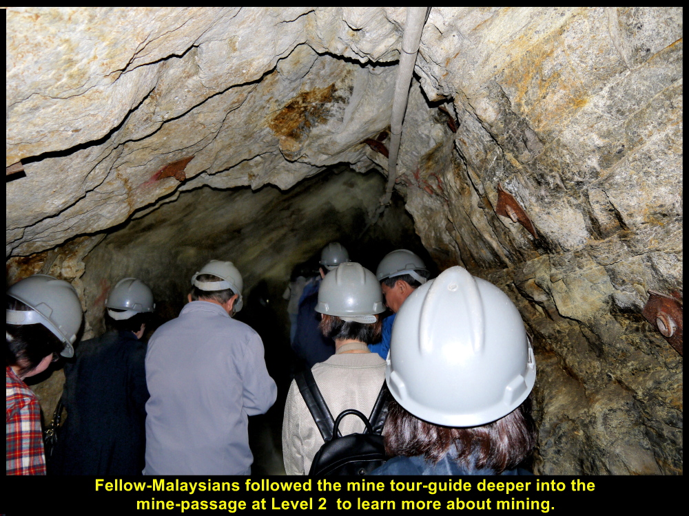
Fellow-Malaysians following the guide into the deep tunnel
Gold-Bearing Rocks
The rocks in the mine of Crown Mines consist of conglomerate pebbles, mostly of quartz, in sandy matrix with abundant pyrite(iron sulfide) in the cement. It is the cement that contains the gold and not the pebbles. Less than one gram of gold can be extracted from one ton of gold-bearing rock in the underground mine. But this amount varies from place to place.
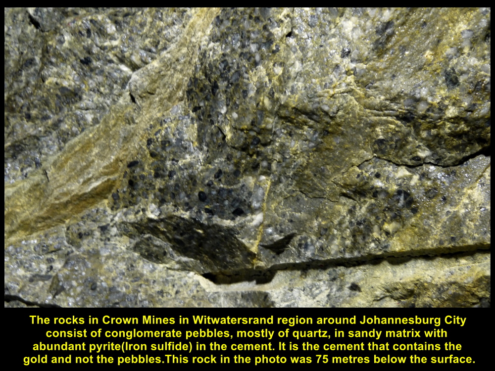
Gold-bearing rocks in a tunnel at Level 2
Relics at Level 2
There were several relics of the mine left behind at Level 2 for visitors to see, such as locomotive, wagons, explosives, fuses, mercury arc rectifier and a few more.

Locomotive for pulling wagons loaded with rocks and equipment
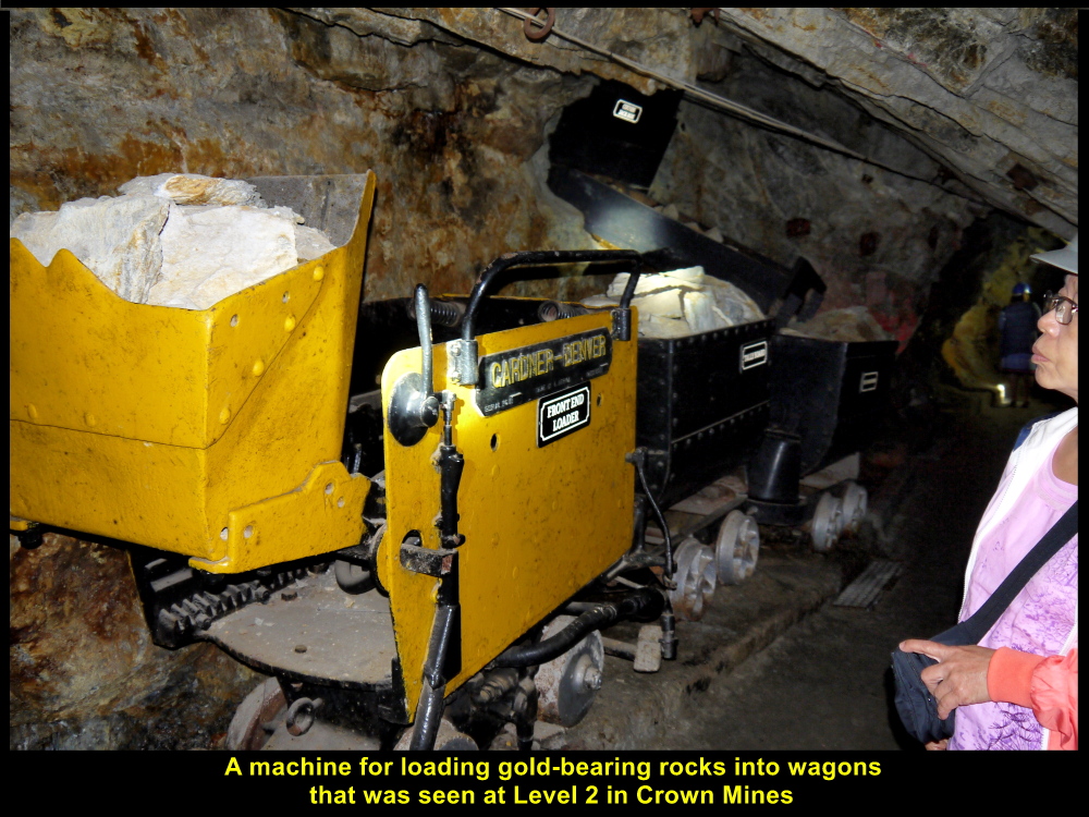
A machine for loading gold-bearing rocks into wagons
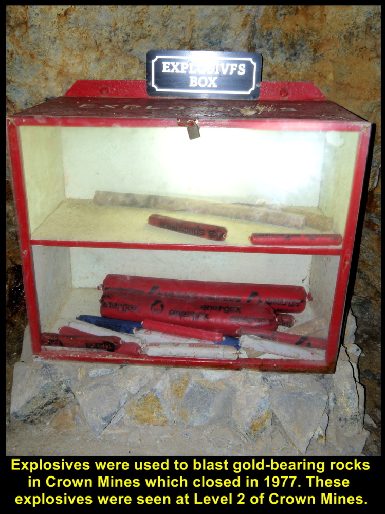
Explosives for blasting gold-bearing rocks
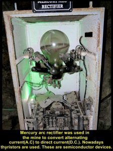
An old mercury arc rectifier for converting alternating current into direct current for machines in the gold mine
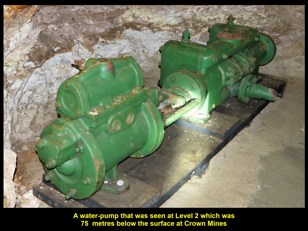
Pump for getting rid of water in the underground mine
Mine-Workers’ Jobs
In the mine dummies were used to show visitors the jobs mine-workers used to do, e.g. drilling, taking attendance of workers and loading rocks.
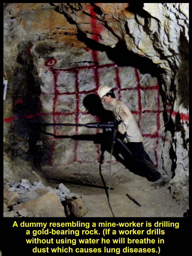
A dummy resembling a mine-worker drilling rocks to break them up
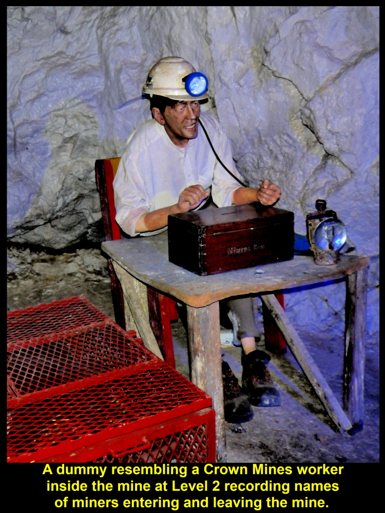
A clerk in the mine taking attendance of mine-workers
First Aid
A space at Level 2 in the mine was used for treating injured workers when the mine was in operation.
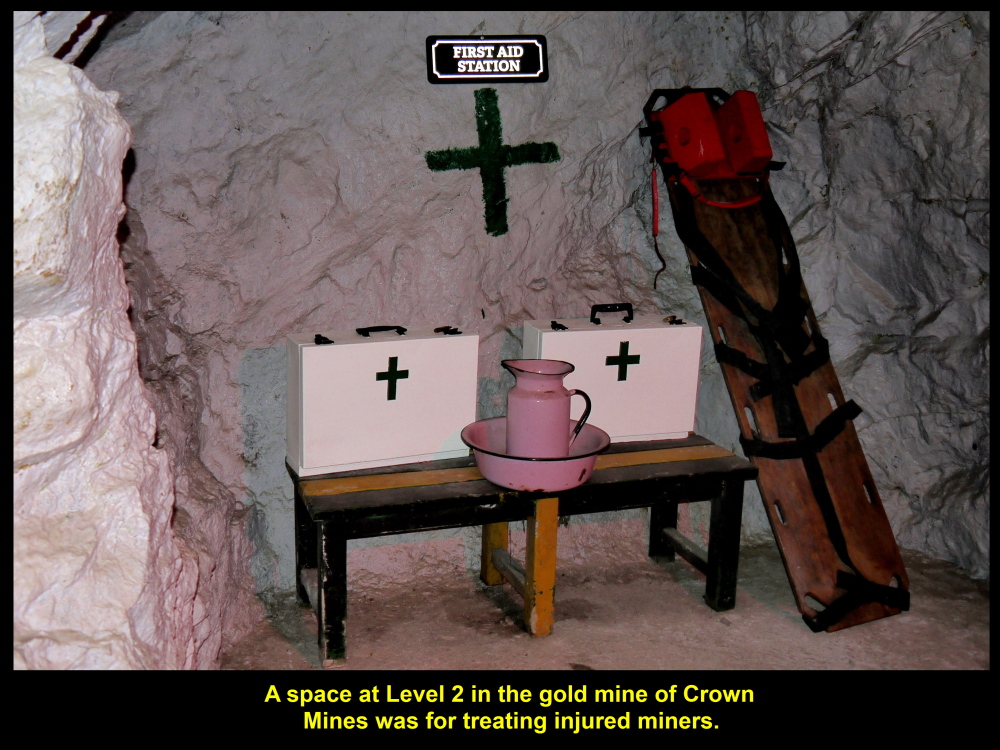
A space in the mine for treating injured miners
Escape Routes
The mine tour-guide showed us the inclined shafts in the diagram which workers could walk up or down to go to another level or used them as escape routes for evacuation in case of explosion, tunnel collapse or other dangerous happenings in the underground mine.
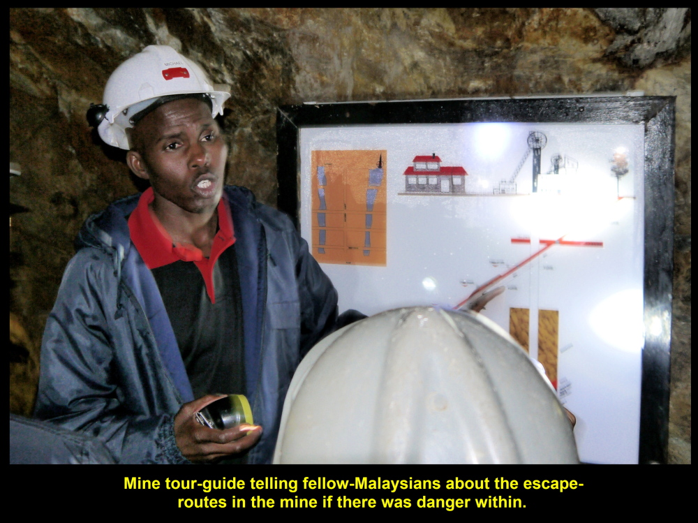
The mine tour-guide showing the escape-routes for evacuation in the diagram at Level 2.
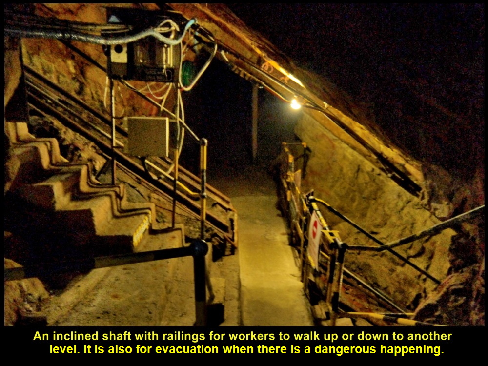
Inclined shaft for going to another level or evacuation when there is a dangerous happening
After an educational tour of the underground mine, we went back to the surface and waited for a hot liquid gold pouring demonstration in a room.
Relics left behind on the Ground by Crown Mines
While waiting for the demonstration, I looked around and saw some relics left behind by Crown Mines, e.g. locomotive, wagons, generators, water-pumps, winders, etc.
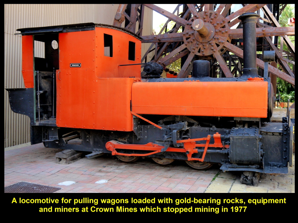
A locomotive for pulling wagons carrying rocks, equipment, workers, etc.
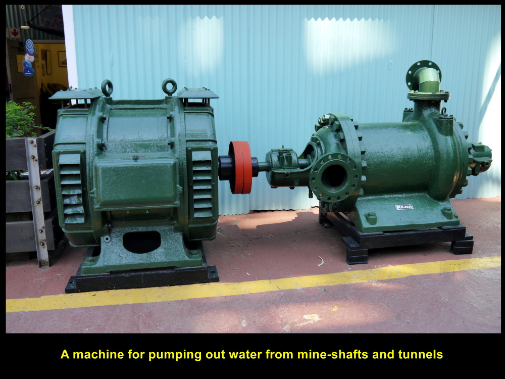
Pump used for pumping water out of mine
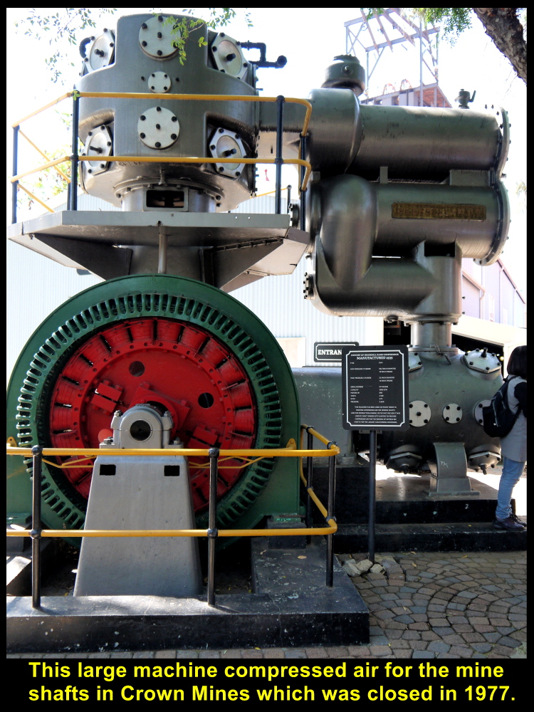
This machine pumped air into the underground mine
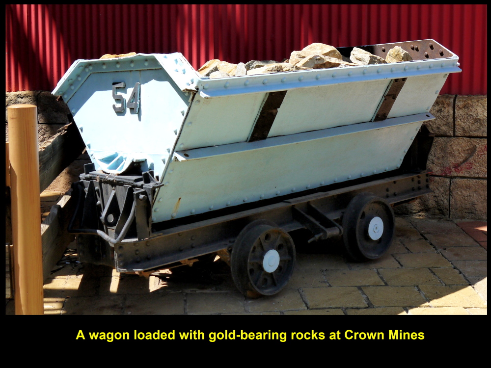
A wagon full of gold-bearing rocks
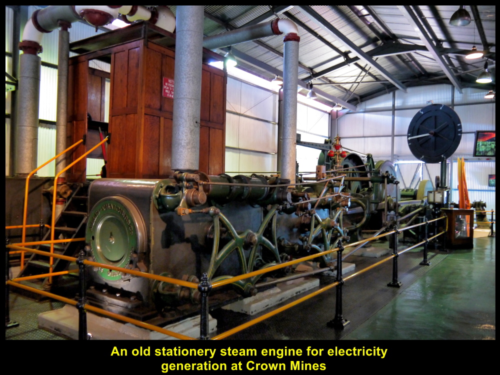
Old electric generator producing electricity for operating the mine
Gold Pour Demonstration
In the demonstration in a room, two men brought out a container of liquid gold from an oven with temperature of over 1063 degrees Celsius(melting point of gold is 1063 degree Celsius) and poured it into a mould. When gold solidified, it weighed about 12.5 kg.
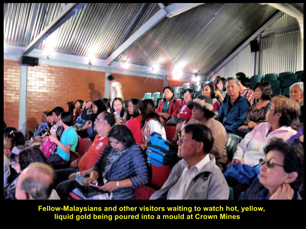
Visitors watching a hot liquid gold pour demonstration
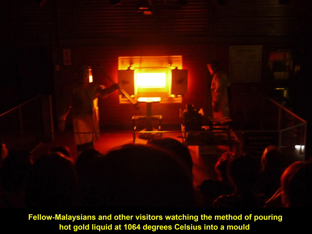
Oven heating gold to its melting point of 1063 degrees Celsius
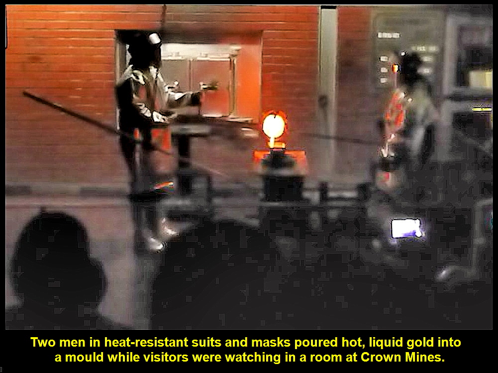
Two men pouring liquid gold into a mould
Gold Ingot or Bar
After the demonstration, visitors were asked to see a gold ingot or bar in front. Everybody was eager to touch the precious, yellow metal. The bar was about 99.5% and weighed 12.5 kg. It was worth about USD540,000 at the rate of about USD43,000 per kg on 2 Dec 2016, the day we watched the gold pour demonstration.
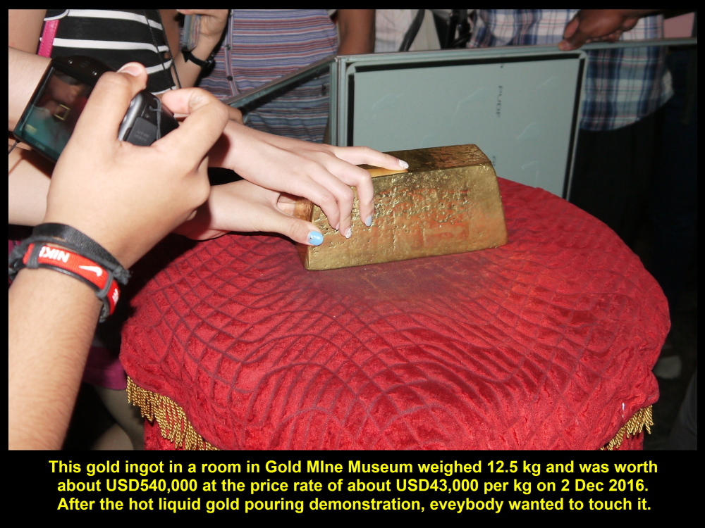
Everybody wanted to touch the gold bar weighing 12.5 kg and worth USD540,000 at current price rate on 2 Dec 2016.
Photo with Mine Tour-Guide
Before we left the gold mine museum for Johannesburg International Airport, my wife and I took a photo with the friendly mine tour-guide.

Choo Chaw and wife taking a photo with the gold mine tour-guide at the mine museum
Johannesburg International Airport
At 10.30 a.m. we, finally, left the museum and headed straight for Johannesburg International Airport or O.R. Tambo International Airport named after Oliver Tambo, a former President of African National Congress, in 2006.

Fellow-Malaysians and Choo Chaw checking in and flying off at Johannesburg International Airport on 2 Dec 2016 for home
Departure for Homeland, Malaysia
After checking in and waiting for a few hours at the airport, we, at last, flew away from Johannesburg at 2.30 p.m. to return to our homeland, Malaysia.
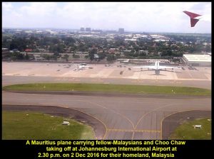
A Mauritius plane carrying fellow-Malaysians and Choo Chaw flying away from Johannesburg to their homeland, Malaysia, on 2 Dec 2016
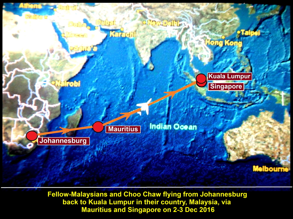
Air-route from Johannesburg to Kuala Lumpur taken by a Mauritius plane that carried fellow-Malaysians and Choo Chaw
An Unforgettable South African Tour from 28 Nov-2 Dec 2016
Well, that was an unforgettable tour in South Africa. We have gained quite a lot of knowledge about South Africa, like her landscapes, people’s way of life, wild animals, mining activities, and many more.
Thanks for reading about this tour and hope it is helpful to you, if you plan to make a trip there.
The End
Written by Choo Chaw
South Africa Travel Part I: Air Flight from KLIA to Cape Town, Cape Town Shantytowns
South Africa Travel Part II: Table Mountain, Malay Quarter, Castle of Good Hope. A & V Waterfront
South Africa Travel Part III: Hermanus, Cheetah Outreach, Stellenbosch, Jewel Africa
South Africa Travel Part V: Pilanesberg National Park(Game Drives/Safaris)
South Africa Travel Part VI: Sun City Resort, Union Buildings, Vootrekker Monument
South Africa Travel Part VII Kruger Museum, Church Square, Melrose House, Carnivore Restaurant
South Africa Travel Final Part Gold Reef City, Gold Mine Museum
South Africa Travel Part VI : Sun City Resort, Union Buildings, Voortrekker Monument
Filed under: South Africa Travel Part VI : Sun City, Union Buildings, Voortrekker Monument
South Africa Travel Part VI : Sun City Resort, Union Buildings, Voortrekker Monument
(Continue from South Africa Travel Part V)
Day 6 Thursday, 1 Dec 2016
Sun City Resort
After a game-drive(safari) in the morning in Pilanesberg National Park, we went to Sun City Resort located in a hilly area near the park.
Sun City Resort has four hotels with casinos ranging from 3 to 5 stars, world-class golf courses, a theme- park, a shopping centre, an artificial, sandy beach with palm-trees, two-metre high artificial waves, and many more.
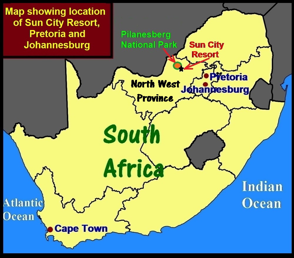
Map showing location of Sun City Resort, Pretoria and Johannesburg
The Palace
On arrival at the resort, we had a glimpse of the 5-star hotel, The Palace, which looked like ancient Arabian buildings we see in Aladdin’s movies.
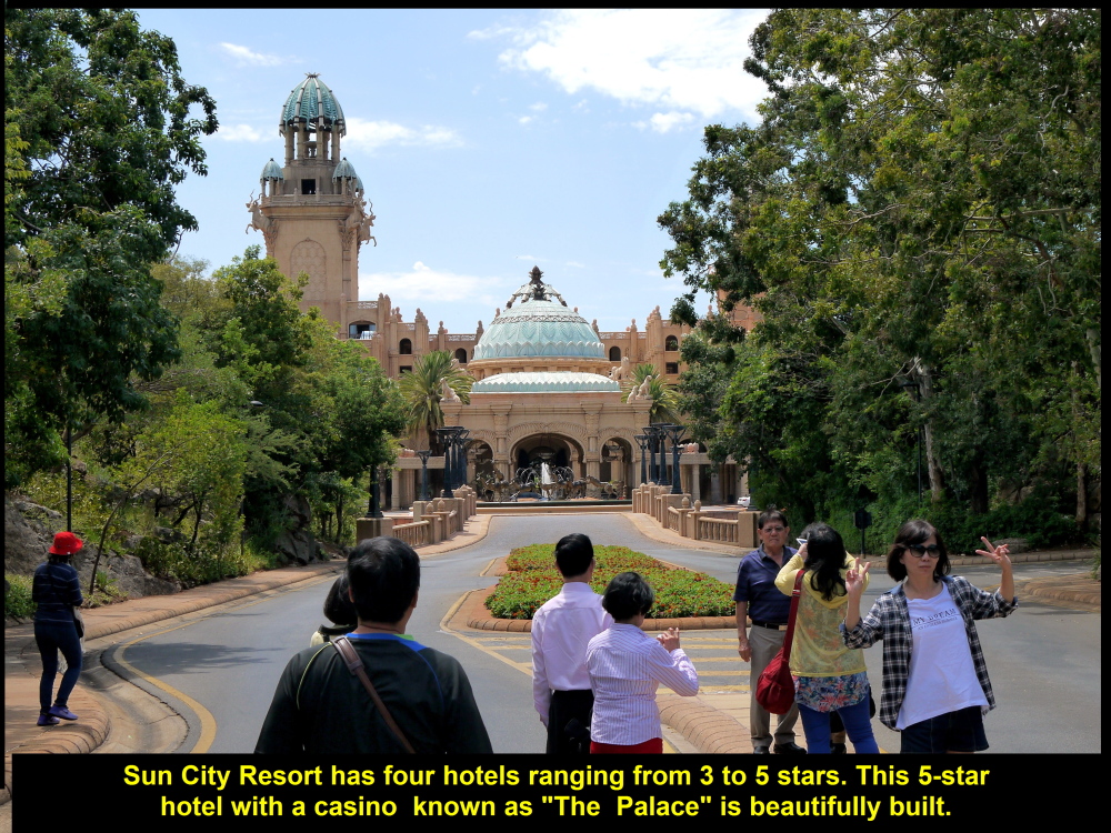
The Palace, a 5-star hotel with casino, in Sun City Resort, near Pilanesberg Natural Park, South Africa
Sun Central
Then we went to another building nearby, Sun Central, where visitors could shop. dine and play games. This building has hosted world-class conferences, national and world beauty-pageants, and other activities.
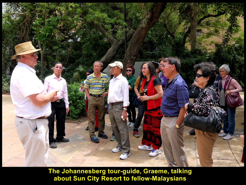
Johannesburg tour-guide, Graeme, talking about Sun City Resort to fellow-Malaysians

Front building of Sun Central, Sun City Resort, South Africa
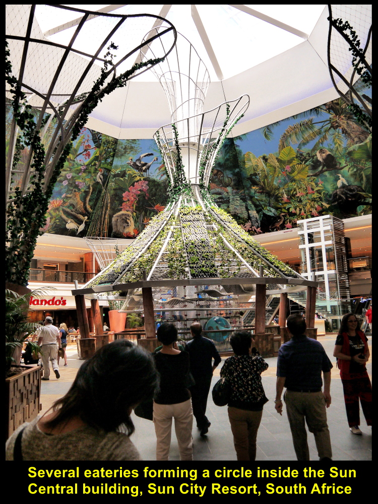
Several eateries in a circle inside the Sun Central building
Elephant Statues
At the back of Sun Central, we saw sculptures of two rows of life-sized, grey elephants with long tusks. The place looked like an elephant garden.
Valley of Waves
There was an artificial sea and sandy beach with palm-trees in the Valley of Waves which was further away from the garden. Every 90 seconds, a two-metre high wave was created in the sea sending the swimmers to the beach.

Two rows of elephants in the Elephant Garden behind Sun Central, Sun City Resort
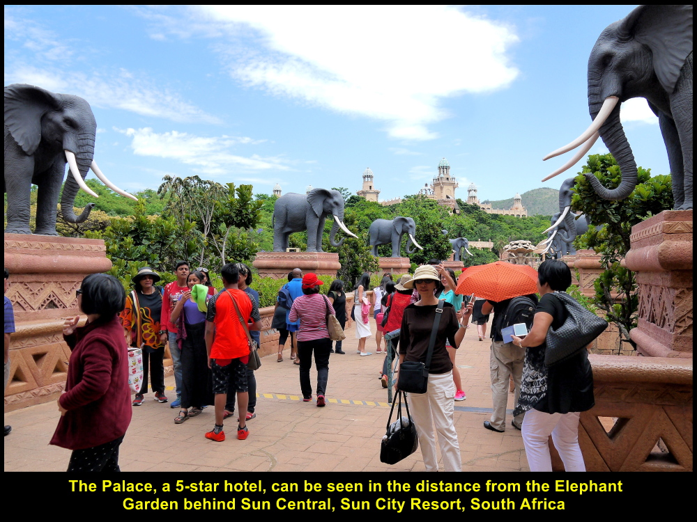
The Palace can be seen in the distance from the Elephant Garden, Sun Central, Sun City Resort
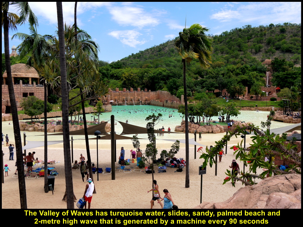
The Valley of Waves that has water, sandy beach, slides, large waves and palm trees
Union Buildings
We spent a short time at the resort and then travelled for two hours to Pretoria. When we reached the city, we went to the top of a hill, Meintjieskop where an important building was sited, Union Buildings. Built in neoclassical Italian renaissance architectural style in 1910 and completed in 1913, it is the seat of the government of South Africa and houses the President’s offices.
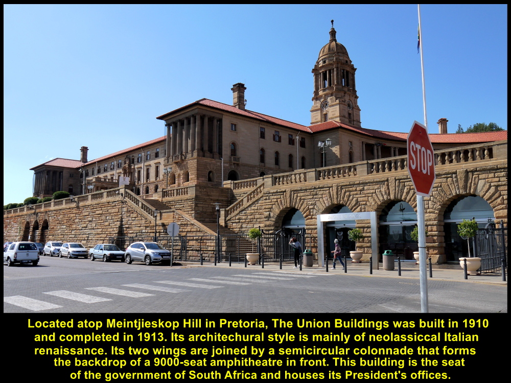
Union Buildings, built in 1910, is the seat of the government of South Africa and houses the President’s offices in Pretoria.
War Monument
Across the road in front of Union Buildings is a large, tall, cylindrical shaped structure with a bronze sculpture of two strong men taming a wild horse atop. It is erected there in memory of the South African soldiers who were killed in WW I(1914-1918) and WW II(1939-1945).
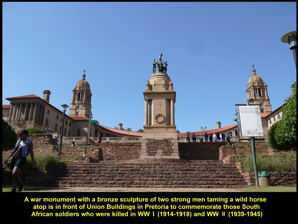
War Monument in memory of South African soldiers killed in WW I(1914-1918) and WW II(1939-1845)
Statue of Nelson Mandela
There are terraced, manicured gardens down the slope where a large, tall statue stands. It is the statue of the first elected President of South Africa, Nelson Mandela(1918-2013) unveiled on 16 Dec 2013, 11 days after his death. He held the office from 1994 until 1999.

Guni, fellow-Malaysian, standing with a V-sign in front of a 9-metre tall statue of Nelson Mandela at Union Buildings, Pretoria

A fellow-Malaysian couple standing in front of the tall statue of Nelson Mandela at Union Buildings, Pretoria

Chan Chee and wife, fellow-Malaysians, standing in front of the tall statue of Nelson Mandela
City of Pretoria
The statue of Nelson Mandela standing tall with open arms in the terraced garden on a slope in front of Union Buildings is facing the city of Pretoria in the distance and the scenery is picturesque.

The statue of Nelson Mandela facing the picturesque city of Pretoria
New Friends
In the garden I was surprised to see three of our fellow-Malaysians make friends with strangers, easily, and they took a photo with them, too.
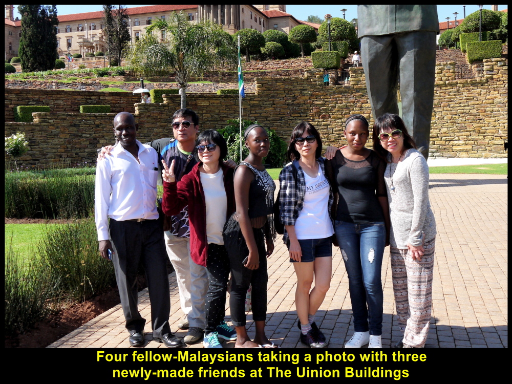
Four fellow-Malaysians made new friends, easily, at Union Buildings, Pretoria, South Africa
We spent an hour at Union Buildings keeping our cameras and phone-cameras busy.
Voortrekker Monument
Soon we left Union Buildings and went to a historic monument known as Voortrekker Monument located on a hill that is south of the city of Pretoria.
The Great Trek(1835-1854)
Voortrekker Monument was erected in memory of more the 10000 Voortrekkers(Dutch-speaking pioneers) who trekked across treacherous terrains from Cape Colony to the interior inhabited by unfriendly indigenous peoples in north-east of South Africa. They were in search of a homeland that was fertile for farming and free from the British rule. The exodus known as the Great Trek occurred between 1835 and 1854.

Map showing the routes of the Great Trek(1835-1854) taken by the Voortrekkers

Voortrekker Monument in memory of the Voortrekkers involved in the Great Trek(1835-1854)
Hall of Heroes
There are two halls in the monument, Hall of Heroes and Hall of Cenotaph. Fixed on the walls in the Hall of Heroes in the monument is a long frieze with 27 panels depicting the exodus of the Voortrekkers in the Great Trek, battles fought and treaties signed between the Voortrekkers and indigenous peoples, etc.

Over 10000 Voortrekkers, mostly farmers, moved to the interior in South Africa in search of new homeland free from the British rule in Cape Colony.
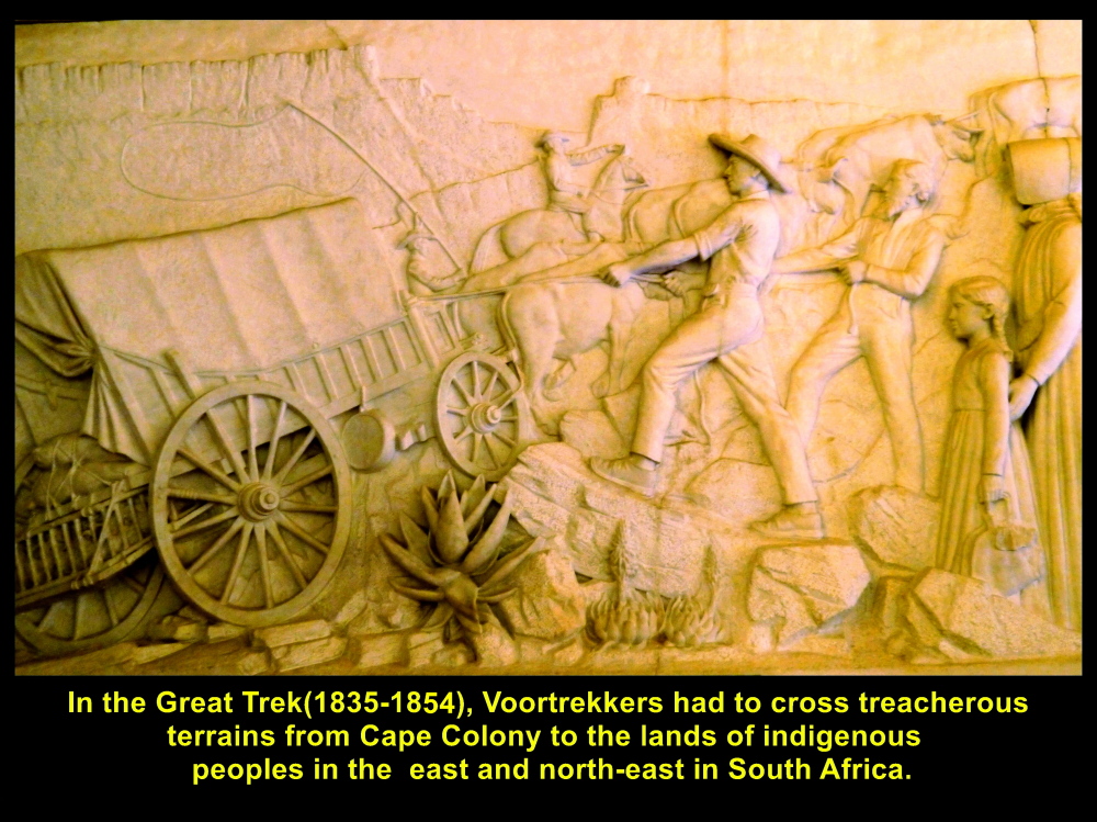
Voortrekkers encountered treacherous terrains in the Great Trek(1835-1854)
Battle of Blood River(1838)
The Voortrekkers in the Great Trek encountered many battles with the indigenous peoples resulting in many casualties. The well-known battle in the Great Trek was the Battle of Blood River that happened on 16 Dec 1838. It was fought between 470 Voortrekkers and between 15000 and 21000 Zulu attackers on the bank of Ncome River on 16 Dec 1838 resulting in 3000 Zulu casualties and 3 wounded Voortrekker commandos. The battle was won by the Voortrekkers.

Frequent battles between Voortrekkers and indigenous peoples in the Great Trek(1835-1854)

Historical Battle of Blood River on 16 Dec 1838 between 15000-21000 Zulu attackers and 470 Voortrekkers
The Vow
Before the Battle of Blood River on 16 Dec 1838, the Voortrekker men made a public vow together. A tablet in the compound of Voortrekker Monument carries the inscription of The Vow.
The Voortrekkers vowed to God that if He helped them to win the war, they would make that day like a holy Sabbath and build a house to worship Him. Besides, they would tell their future generations to glorify and honour Him.
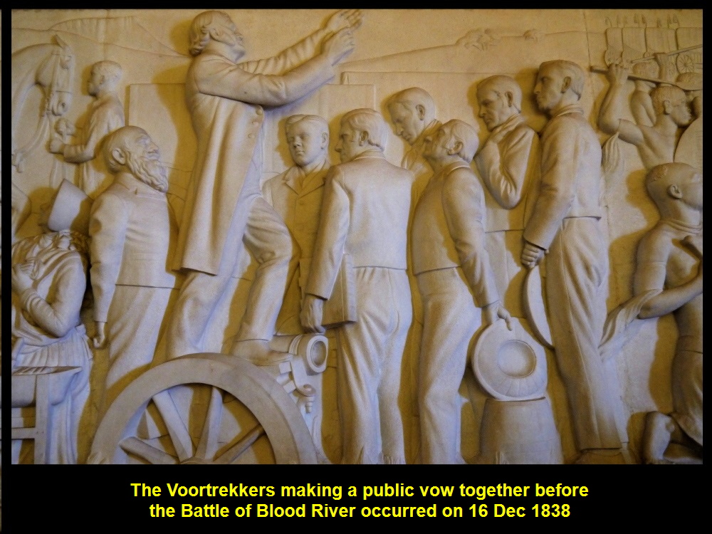
The Voortrekkers made a public vow together before the Battle of Blood River on 16 Dec 1838.
The Vow was made by the Voortrekker men before the Battle of Blood River was fought on 16 Dec 1838.
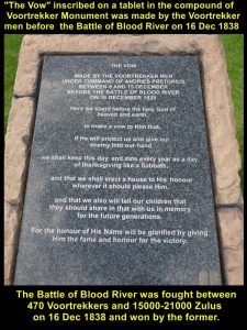
Treaties
After some battles, peace treaties were signed between the indigenous chiefs and Voortrekker leaders.
After some battles, treaties were signed between indigenous chiefs and Voortrekker leaders.
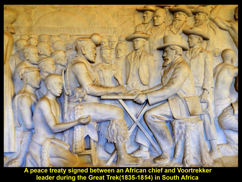
Hall of Cenotaph
In the Hall of Cenotaph which is below the Hall of Heroes, there is a cenotaph in the centre with an inscription in Afrikaans, “ONS VIR JOU SUID AFRIKA”(“We for thee, South Africa”). On 16 December every year, sunlight passes through a round glass-dome in the ceiling in Hall of Heroes and the dome focuses the light onto the words on the cenotaph at noon. The date has to do with that of the Voortrekkers’ victorious Battle of Blood River which was fought on 16 Dec 1838.
The glass dome focuses the sunlight onto the words on the cenotaph below at noon on 16 Dec every year. The white spot in the dome is the image of the sun.
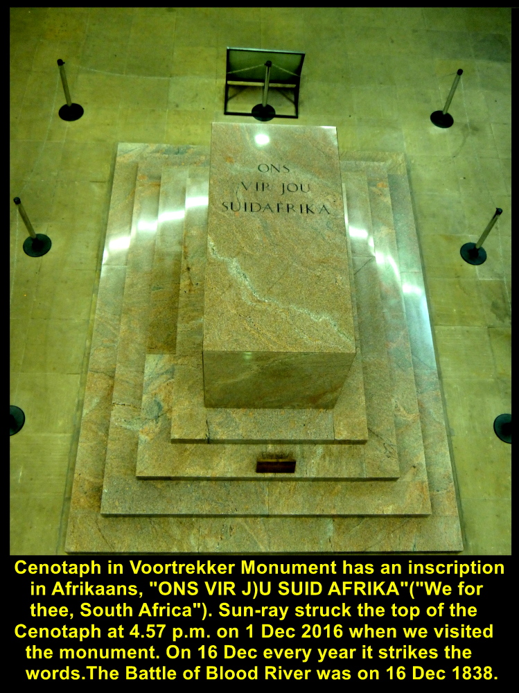
A focused sunlight strikes the top of the Cenotaph at 4.57 p.m. on 1 Dec 2916 when I was there, in Voortrekker Monument.
Voortrekker Woman
A bronze sculpture of a woman with her two children is erected at the base of Voortrekker Monument in recognition of the contributions, perseverance, courage and sacrifices of the Voortrekker women during the Great Trek(1835-1854).

A scuplture of a Voortrekker woman and her children erected at the base of Voortrekker Monument in recognition of the contributions, perseverance and sacrifices of the Voortrekker women during the Great Trek(1835-1854)
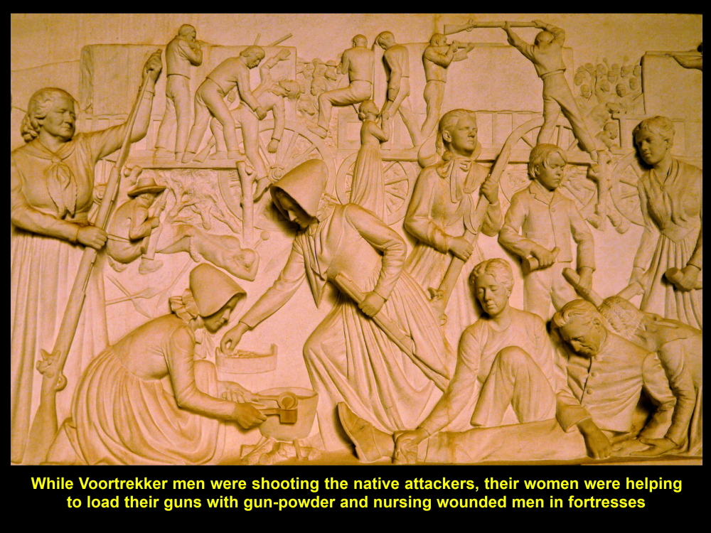
Voortrekker women helped men to load gun-powder and nursed the wounded during the battles against the natives.
Top of Voortrekker Monument
In the Hall of Heroes, we took a lift to the top of the monument which was more than 40 metres high. In the corridor of the monument top, the arches and walls were built in geometrical designs. Looking from the top, we could see a breathtaking view of the city of Pretoria and its surroundings.
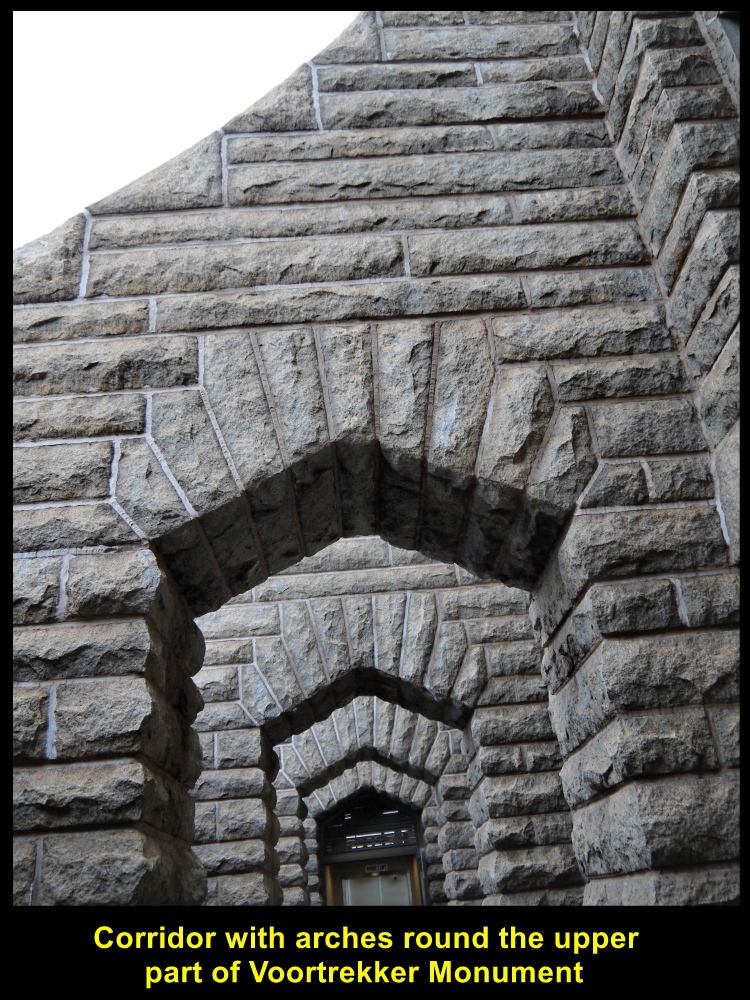
Arches of the top of Voortrekker Monument are built with a geometrical design.
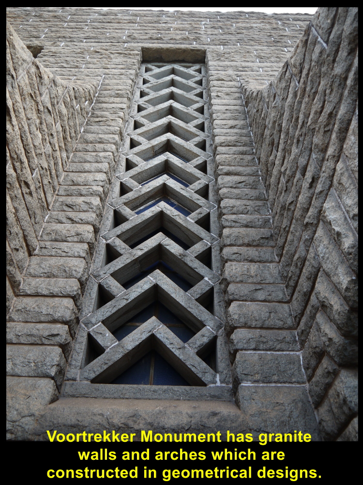
Some parts of the walls of the top of the monument have a common geometrical design.
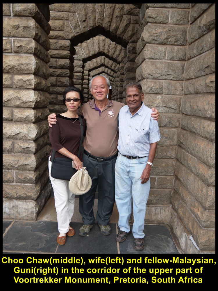
Choo Chaw(middle), wife(left) and Guni(right, a fellow-Malaysian) in the corridor of the top of Voortrekker Monument on 1 Dec 2016
Voortrekkers’ Wagons
Before we left Voortrekker Monument, I saw a wagon near the bottom of the steps of the monument. It was a replica of the ox-drawn wagons used in the Great Trek(1835-1854). Besides transporting heavy things, those wagons were arranged in a circle or laager as a defence against surprise attacks from the indigenous peoples in the interior of South Africa.
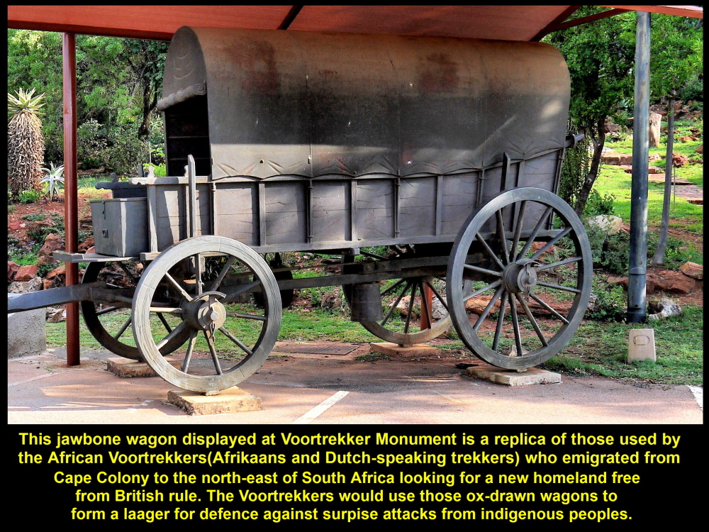
Voortrekkers used this kind of wagon to carry heavy things and arranged many of them in a circle as a defence against surprise attacks in the interior of South Africa.
We left Voortrekker Monument at 5.20 p.m. after spending an hour there. We have learned a lot about the history of Voortrekkers at the monument.
We would visit three more places, Kruger Museum, Church Square and Melrose House, before we had dinner at Carnivore Restaurant.
(continue in South Africa Travel Part VII)
Written by Choo Chaw
South Africa Travel Part I: Air Flight from KLIA to Cape Town, Cape Town Shantytowns
South Africa Travel Part II: Table Mountain, Malay Quarter, Castle of Good Hope. A & V Waterfront
South Africa Travel Part III: Hermanus, Cheetah Outreach, Stellenbosch, Jewel Africa
South Africa Travel Part V: Pilanesberg National Park(Game Drives)
South Africa Travel Part VI: Sun City Resort, Union Buildings, Vootrekker Monument,
South Africa Travel Part VII Kruger Museum, Church Square, Melrose House, Carnivore Restaurant
South Africa Travel Final Part Gold Reef City: Gold Mine Museum
South Africa Travel Part V: Cape Town to Johannesburg, Pilanesberg National Park(Game Drives)
Filed under: Pilanesberg National Park(Game Drives), South Africa Travel Part V: Cape Town to Johannesburg
South Africa Travel Part V: Cape Town to Johannesburg, Pilanesberg National Park(Game Drives)
(continue from South Africa Travel Part IV)
Day 5 Wednesday, 30 November 2016
Departure for Johannesburg from Cape Town
For the past few days we had visited many places in Cape Town City, east of the city and Cape Peninsula. Our next tour would be visiting interesting places in northern part of South Africa.
Malaysians flying from Cape Town to Johannesburg
Early in the morning of 30 Nov 2016, we left the hotel, Southern Sun Hotel in the city, and went to Cape Town International Airport. From the airport, we would fly to Johannesburg, 1262 km in the north-east, for another tour in the north of South Africa.
Farewell to Cape Town Tour Guide, Cindy
Before we flew off to Johannesburg we thanked and said farewell to our Cape Town tour guide, Cindy.
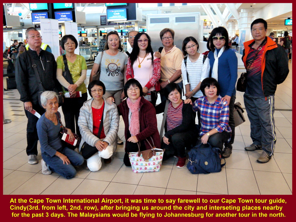
Some fellow-Malaysians taking a farewell photo with Cindy(3rd. person from the left in 2nd. row), the Cape Town tour guide, at Cape Town International Airport
Johannesburg Tour Guide, Graeme
At 9.30 a.m. our plane, a British Airways, finally departed Cape Town Two hours later, we landed at Johannesburg International Airport and were welcomed by a local tour guide, Graeme.
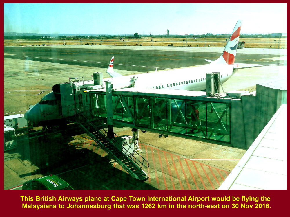
British Airways plane to Johannesburg
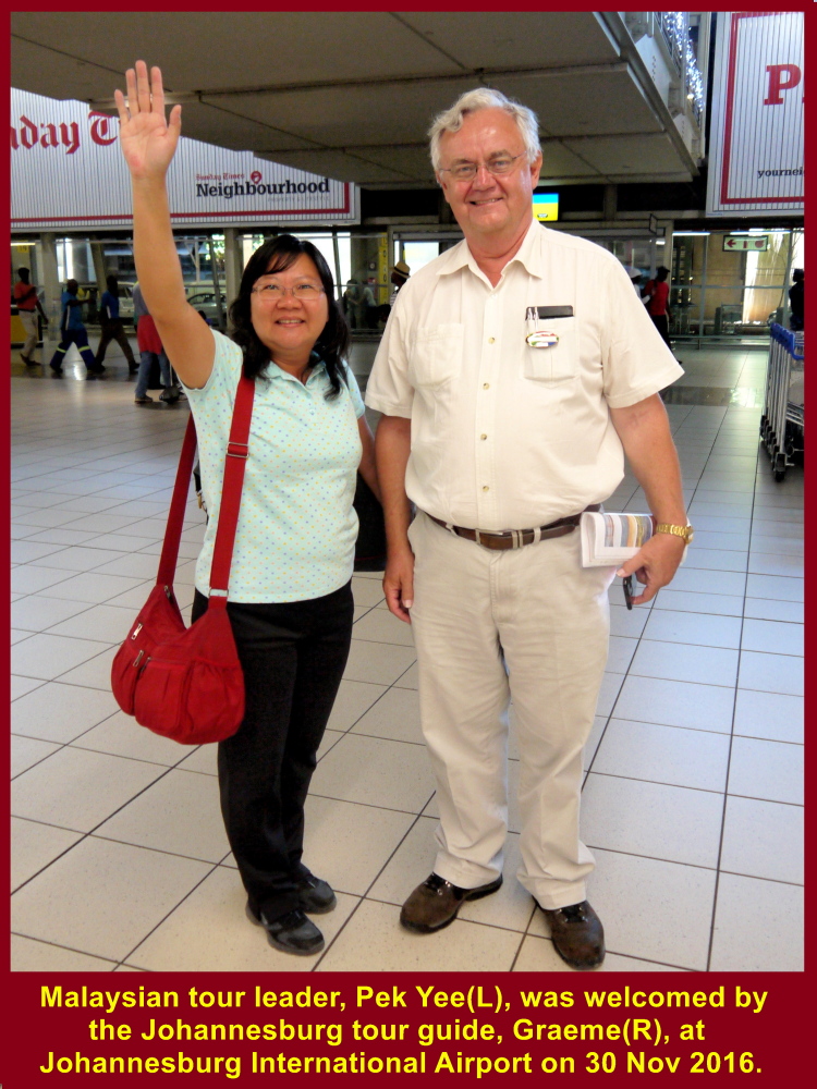
Johannesburg tour guide(R), Graeme, welcoming Malaysian tour leader(L) at airport
Lunch at Jasmine Palace, Pretoria
Then his coach drove us northwards to Pretoria, a distance of 54 km. On arrival at Pretoria at 1 p.m., we had lunch at a Chinese restaurant, Jasmine Palace.
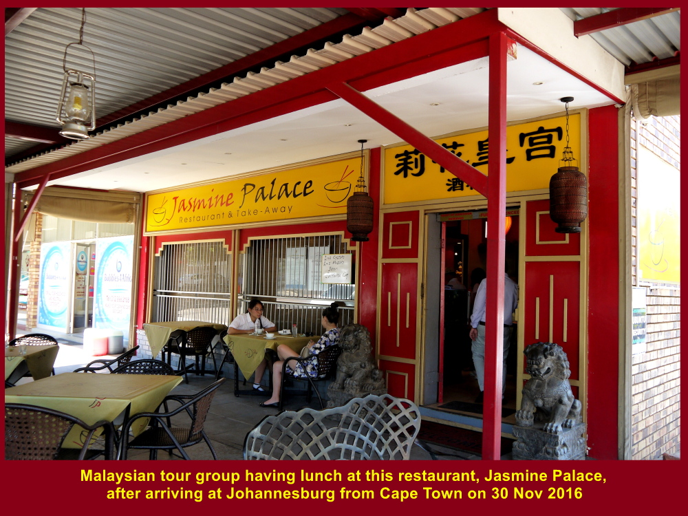
Jasmine Palace Restaurant at Pretoria
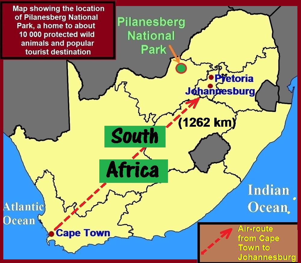
Pilanesberg National Park
After lunch we continued our journey to a well-known national park, Pilanesberg National Park, which was 160 km north-west of Pretoria. It was that place that we would want to watch wild animals, especially the “Big 5”, and birds.
Pilanesberg Natural Park in a Crater
This park is in a crater of an extinct, large volcano surrounded by rings of hills that are formed from solidified magma exposed by weathering and erosion. The last time the volcano erupted was 1.2 billion years ago.
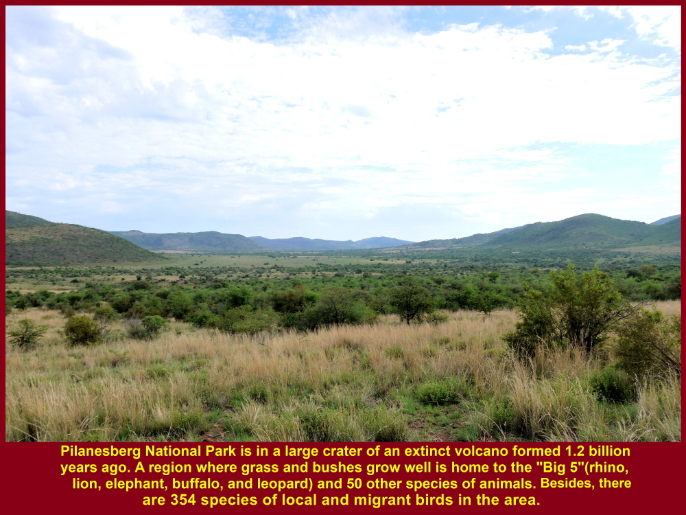
Pilanesberg National Park is in a crater of a large volcano that is extinct since 1.2 billion years ago. A home to 50 species of wild animals and 354 species of both migrant and non-migrant birds.
Now, the park is an area of about 570 sq. km of diverse vegetation and home to over 10 000 protected wild animals of 50 species and 354 species of migrant and non-migrant birds.
Bakubung Lodge, Pilanesberg National Park
The park has a few lodges and camps for tourists to stay and offer game-drives(safaris). In a game-drive, they use their vehicles to bring tourists to the park to see wild animals, including the “Big 5” of lion, elephant, leopard, rhino and buffalo. Bakubung Lodge is one of them where we stayed overnight. It is surrounded by an electrified fence to keep out wild animals.
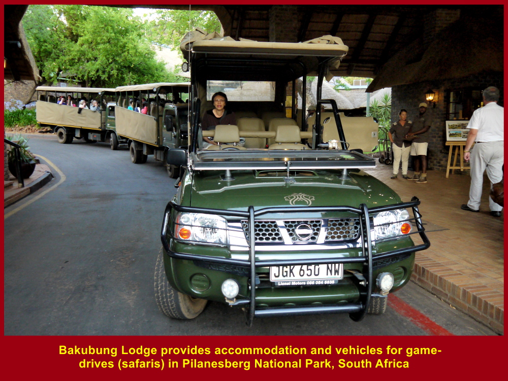
Bakubung Lodge provides accommodation and game-drives(safaris)
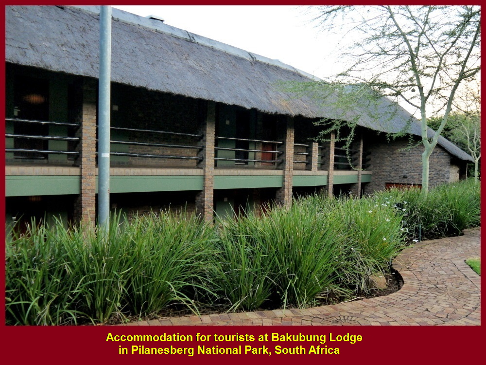
Accommodation for tourists at Bakubung Lodge in Pilanesberg National Park, South Africa

Main gate of Bakubung Lodge, Pilanesberg National Park
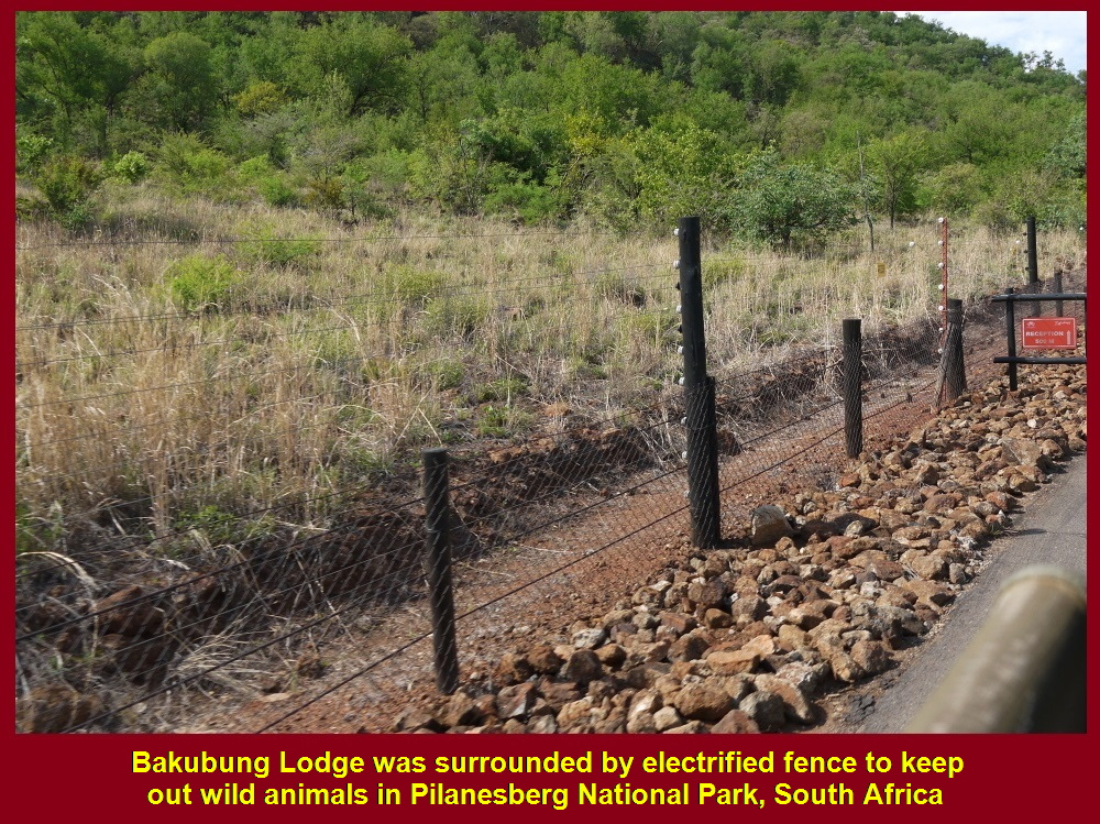
Electrified fence round Bakubung Lodge in Pilanesberg National Park to keep out wild animals
Late Afternoon Game-Drive(Safari)
At 4 p.m on the first day of our arrival in Pilanesberg National Park, 30 Nov 2016, we checked in at Bakubung Lodge and half an hour later, we began our late afternoon game-drive(safari) in the park.

Malaysians checked in at Bakubung Lodge on 30 Nov 2016
Jill, a Game-Ranger
A game-ranger of the lodge, Jill, drove seven of us in her 4×4 jeep while the other 21 fellow-Malaysians were driven by another game ranger in a large truck.
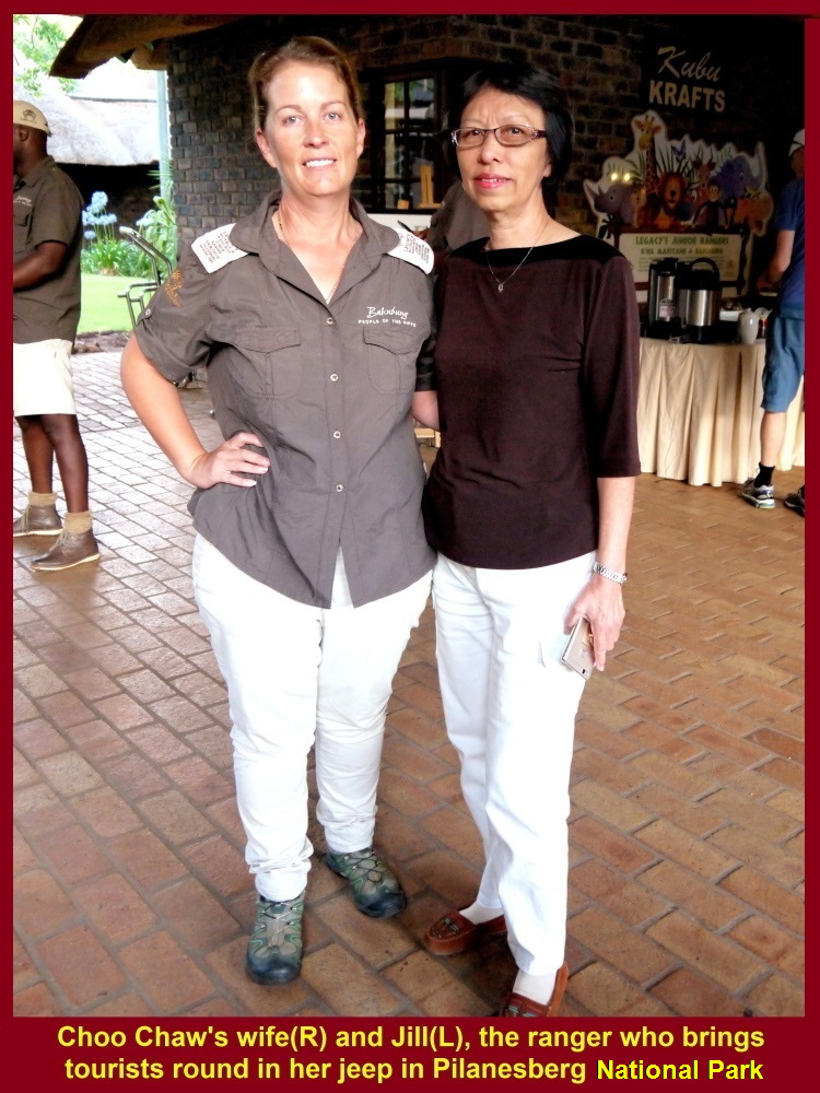
Game-Ranger(L) and Choo Chaw’s wife
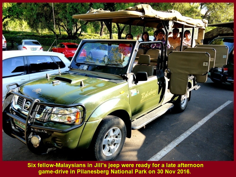
Six fellow-Malaysians in Jill’s jeep were ready for a late afternoon game-drive
As the game rangers drove their vehicles on dirt roads in the park they informed each other the places where animals were sighted through communication devices.
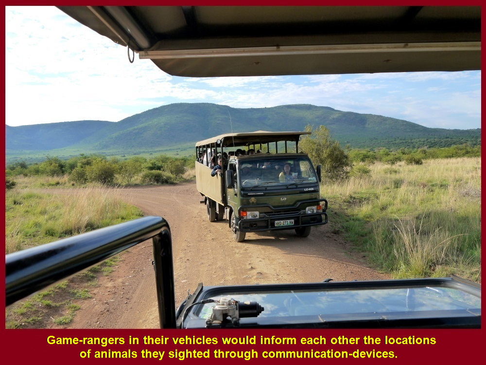
Game-rangers would inform each other the locations of animals they sighted
Animals in the Park
The first kind of animals we saw were some zebras grazing on a grassland. As Jill was driving further we felt excited seeing other kinds of wild animals, namely wildebeests, impalas, lions, rhinos and elephants.
Zebras
There are about 1700 zebras in Pilanesberg National Park in South Africa. Their enemies are lions, crocodiles, cheetahs, leopards and hyenas.
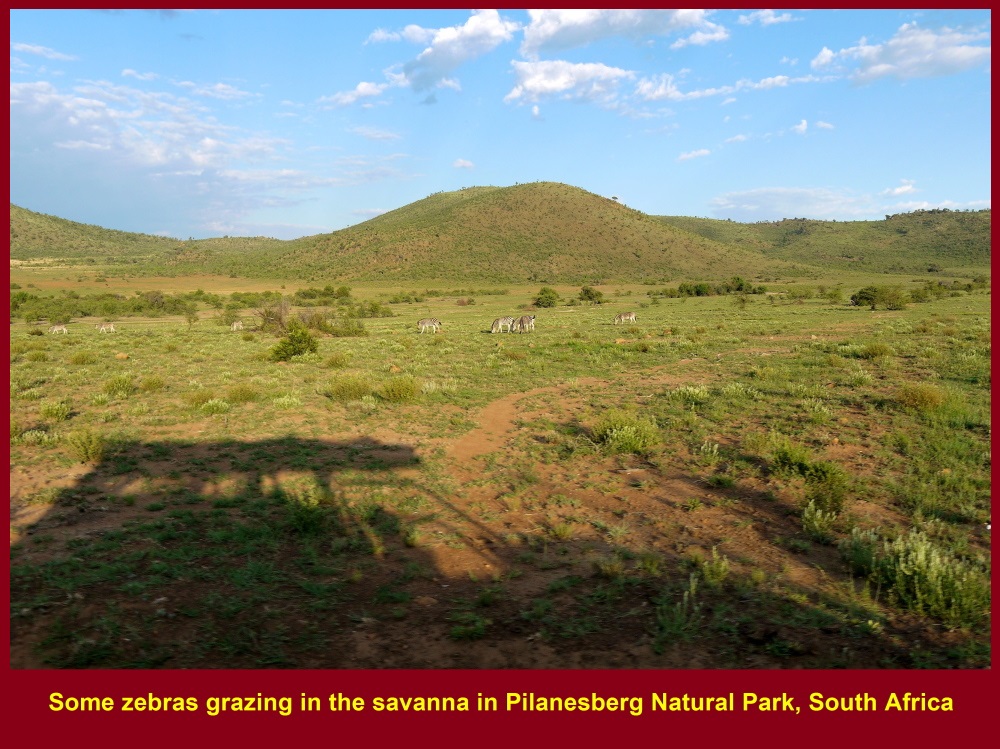
Some zebras grazing in savanna
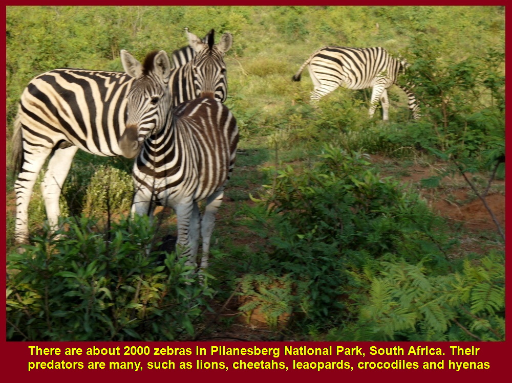
There are about 2000 zebras in Pilanesberg National Park
Wildebeests
There are about 500 wildebeests in the park and are hunted by lions, cheetahs, leopards and hyenas.
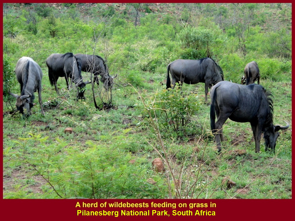
Wildebeests grazing on savanna(grassland)
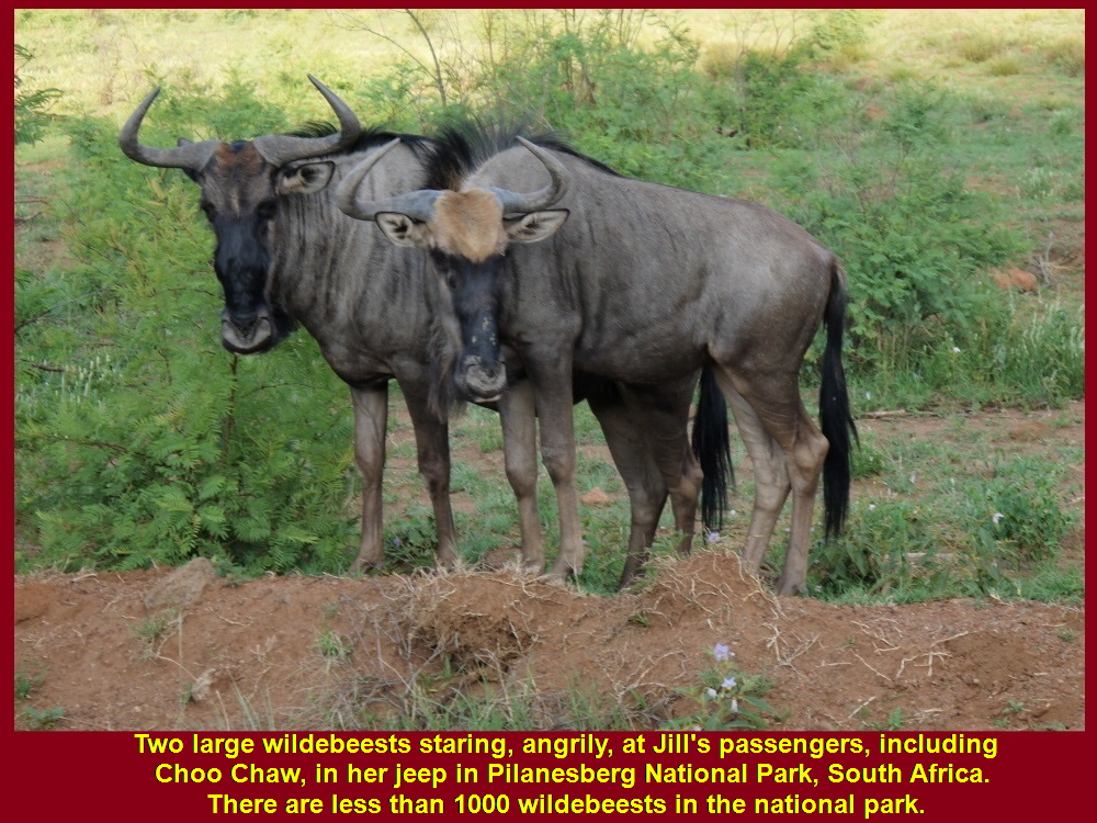
There were less than 1000 wildebeests in Pilanesberg National Park
Impalas
Impalas form the largest group of mammals in the park. Its total is about 3000. Like zebras and wildebeests they have the same predators.

Some impalas grazing in savanna
Lions
Lions are difficult to be spotted as there are about 50 of them in the park. We were lucky to watch one that came close to our jeep without fear and then walked away to the bushes on a sunny day, 30 Nov 2016.
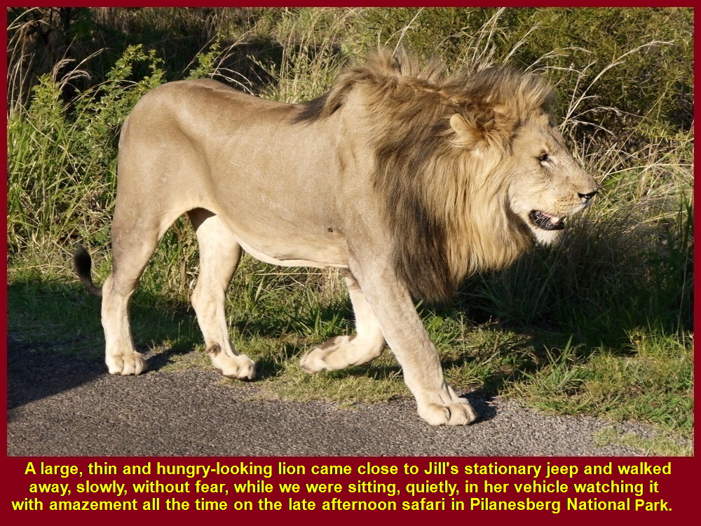
Lion walking close to vehicle without fear
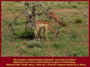
Now 1.5 million impalas remain in Africa
Jackal
A jackal was sighted at a small lake or water-hole. Its back was black. Black-backed jackals are considered the most aggressive of the jackals as it is known to attack animal prey many times its weight.
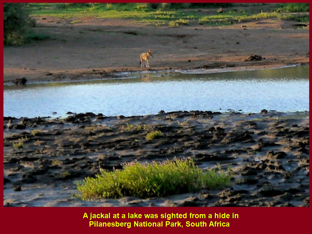
A black-backed jackal at a lake
Rhinos
The number of rhinos is decreasing, annually. Poachers kill them for their horns which are sold in East Asian countries, like China and Vietnam. The people in these countries believe that the horns can treat many ailments, like cancer, rheumatism, gout, fever, typhoid and other diseases.
According to U.S. Fish and Wildlife Service, “rhino horn is made up primarily of keratin – a protein found in hair, fingernails and animal hooves”.
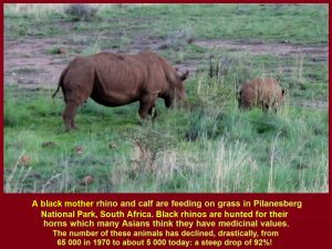
Mother rhino and calf eating grass
Elephants
About 220 elephants live in the park. These are the largest mammals in the park. An adult eats about 150 kg of foliage and drinks 40 litres of water a day. Poachers kill them for their ivory-tusks.
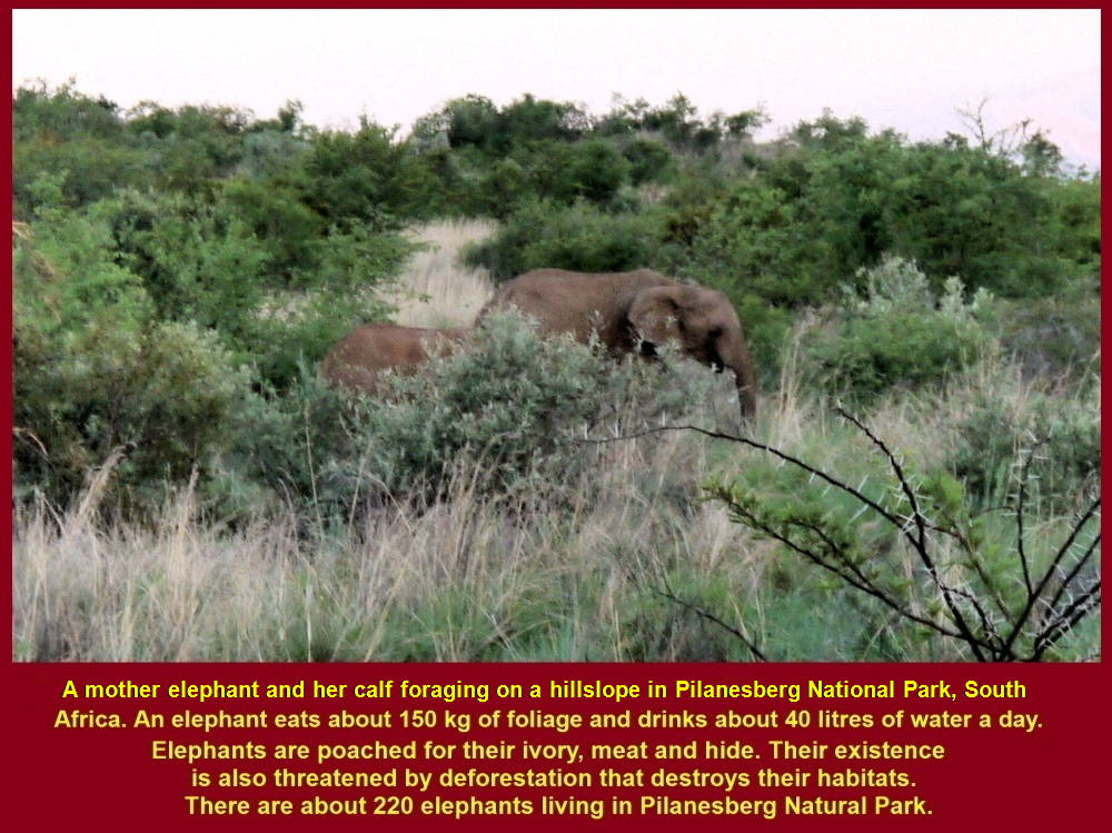
Elephant and calf foraging on a hillslope
Young male elephants are forced to leave their families and live alone or together with other young ones when they reach puberty at the age of 14-15 years old.
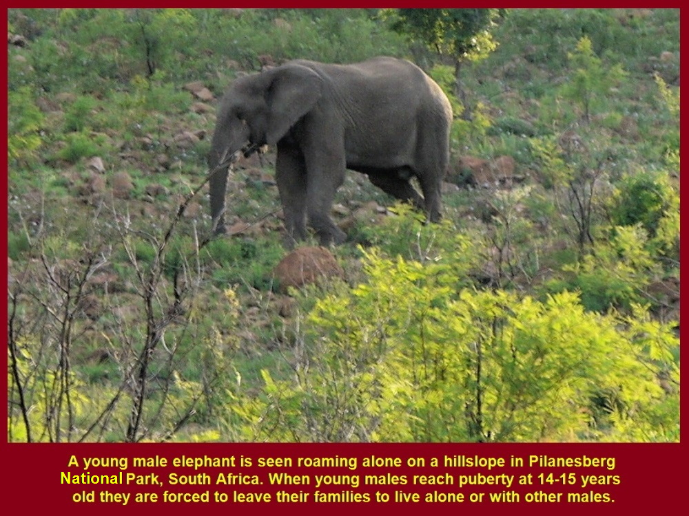
A young elephant roaming alone on a hillslope as it had reached puberty(14-15 years old)
Night-Time
When night fell, Jill tried to look for more animals with her spot-lamp. Several minutes later, she spotted a few impalas crossing the road we were travelling.
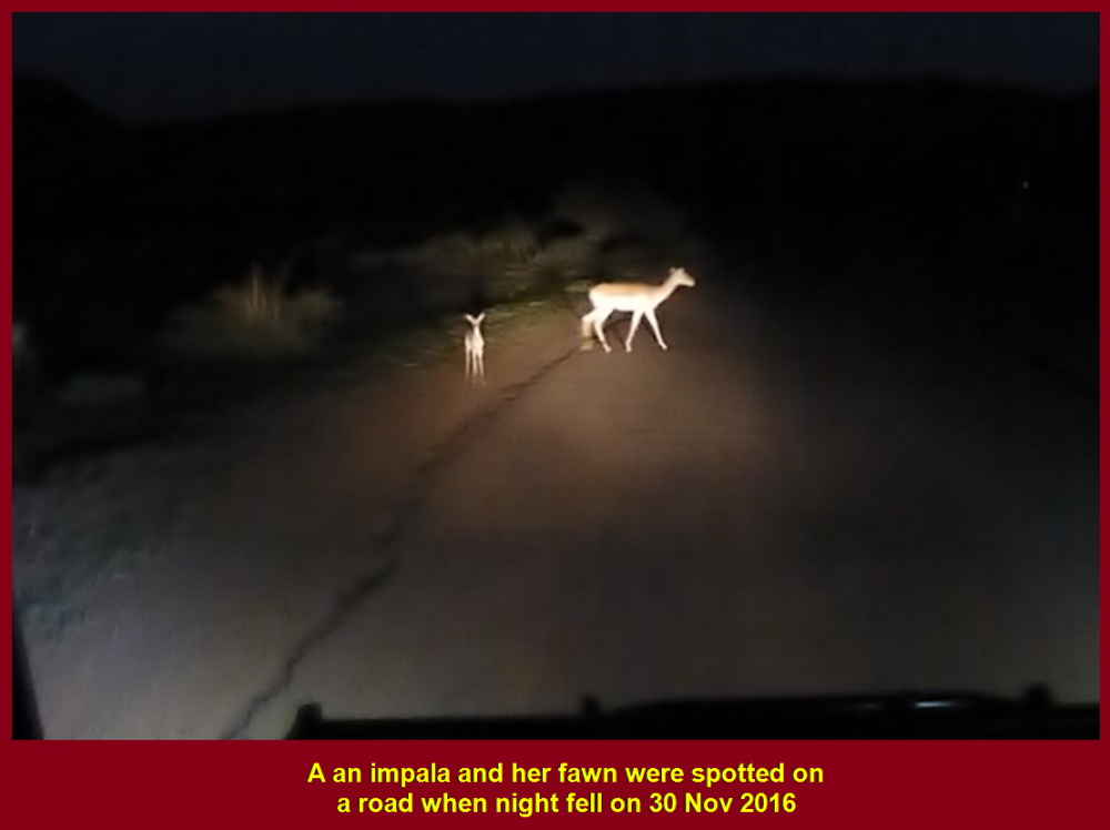
Impala abd her fawn spotted on a road when night fell
Animals seen in Late Afternoon Game-Drive
At about 8 p.m. Jill ended the late afternoon game-drive. Then I recalled the animals that we had spotted in the late afternoon. They were zebras, wildebeests, impalas, a lion, a jackal, rhinos and elephants. But we had not seen leopards and buffaloes belonging to the “Big 5” yet. We hoped to see them the following day.
Lots of Food for Dinner
After the late afternoon game-drive we went to a village to have dinner of native food. There was a lot of “free” food to eat, but we had to pay for drinks, like soft-drinks, beer and wine.
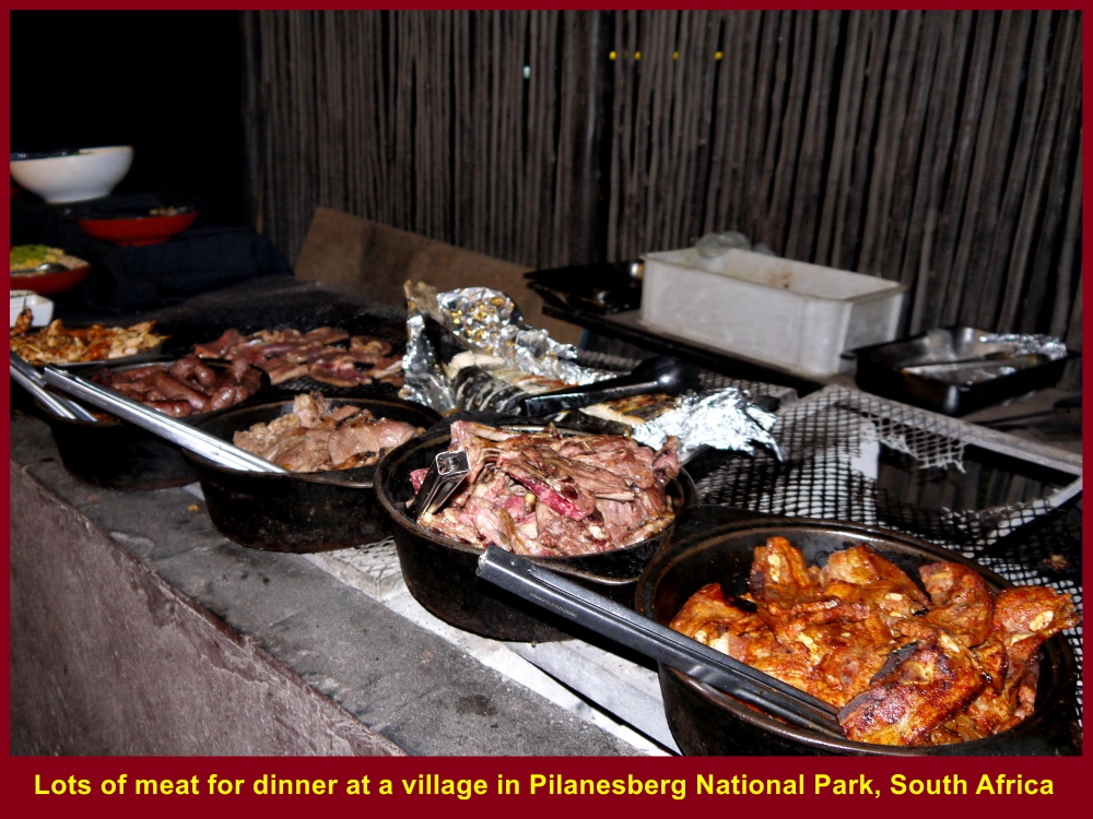
Lots of meat for dinner
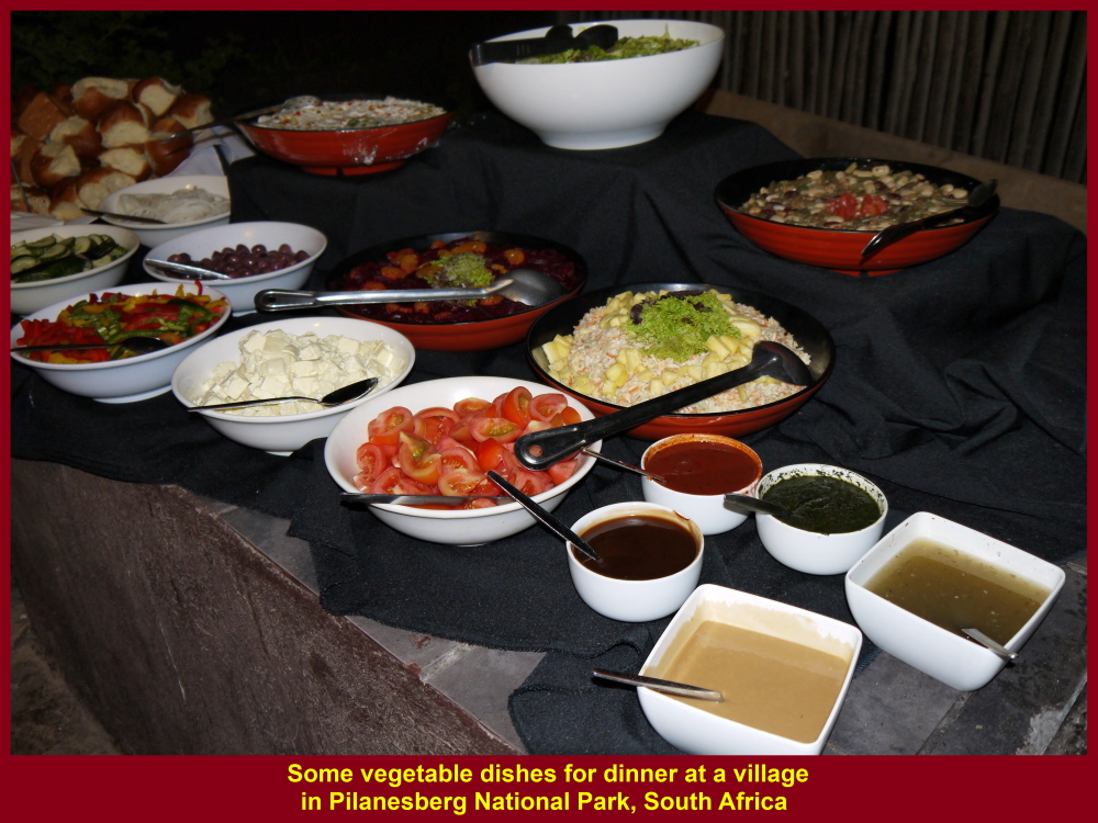
Vegetables for dinner
Lots of Drinks for Sale
Diners were spoilt for choice as there were so many kinds of drinks, but they had to pay for any drinks they chose.
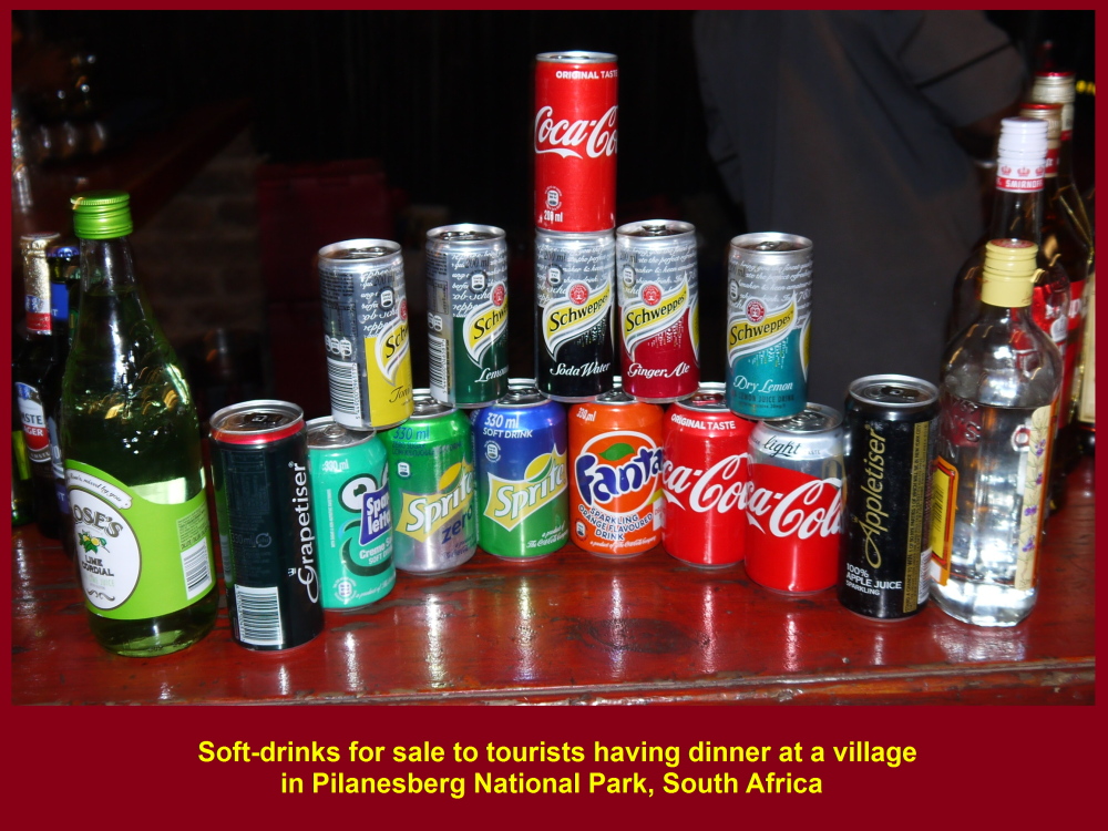
Soft-drinks for sale to diners
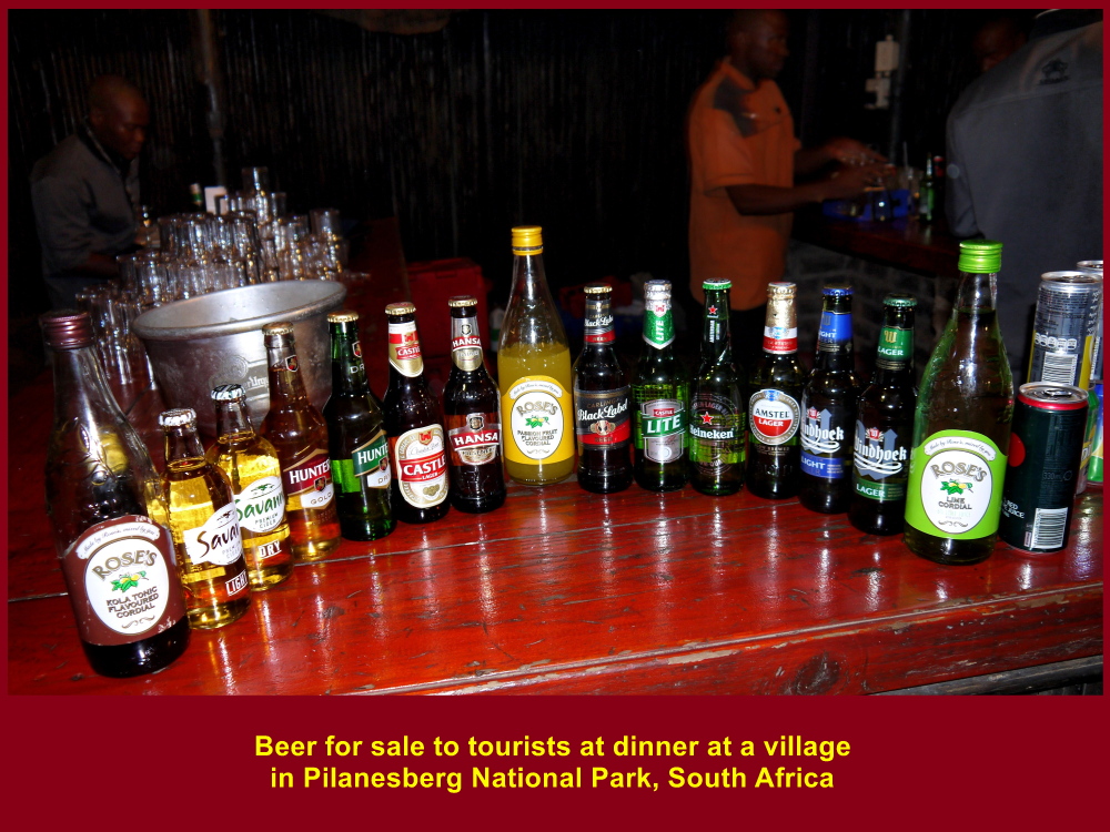
Beer for sale to diners

Wine for sale to diners
Dancing and Singing
While we were having the meal young native boys and girls danced and sang for us. Earlier, those children welcomed us for dinner. After dinner we were driven back to the lodge where we stayed overnight.
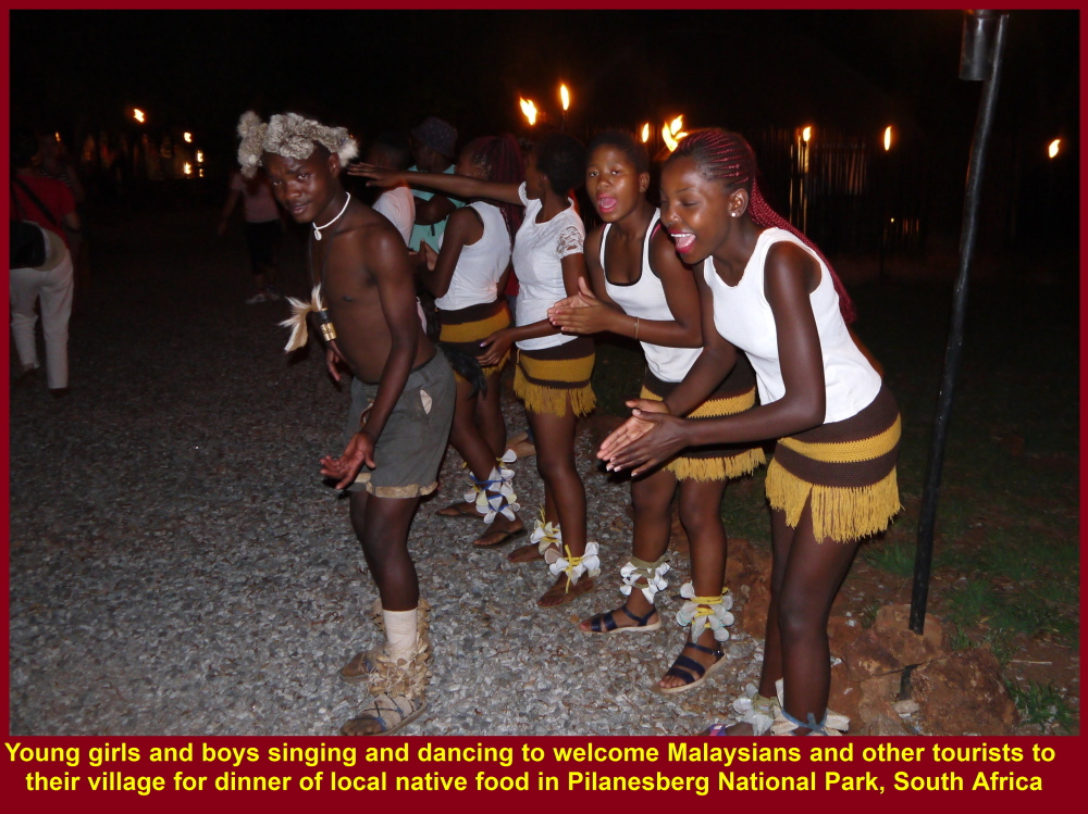
Young native boys and girls dancing and singing to welcome tourists for dinner.
and entertaining them at the meal
Day 6 Thursday, 1 Dec 2016
Morning Game-Drive
On the early following morning, Jill brought us to another part of the park for the morning game-drive(safari). In that part of the park, she told us the types of plants eaten by animals and some, like camomile flowers, were used as insect-repellents by animals.
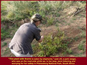
Jill told the Malaysians about the plant with thorns that was eaten by elephants
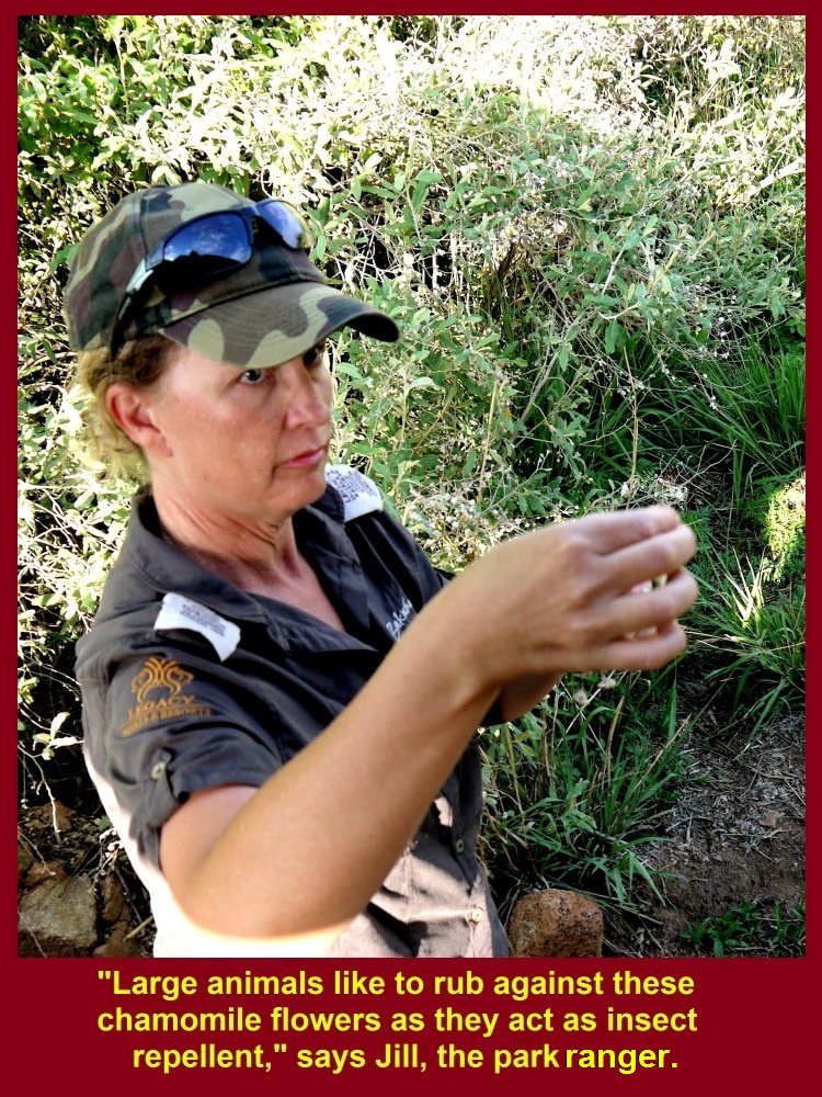
Jill said that those camomile flowers could be an insect-repellent for animals that rubbed against them
Elephants’ Digestion
Elephants are herbivores. They eat a lot of plants every day as 40% of the food is digested and their dung still contains 60% undigested food. Jill showed us a beetle that loved elephant-dung. She said that it would make the dung into a small ball and rolled it backward to its nest.
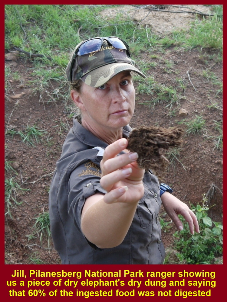
Jill told Malaysians that 60% of the ingested food was not digested by elephants.
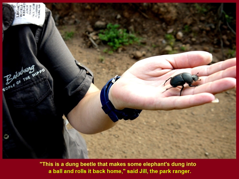
Jill showed Malaysians a beetle that loved to take home elephant-dung.
Foot-Prints of Animals
Besides, Jill showed us some foot-prints on road-sides and told us the animals that had those foot-prints. Every time Jill stepped out of her jeep to show us plants or foot-prints, we, Malaysians tourists sitting in her vehicle, were worried for her safety in Pilanesberg National Park where wild animals were lurking.
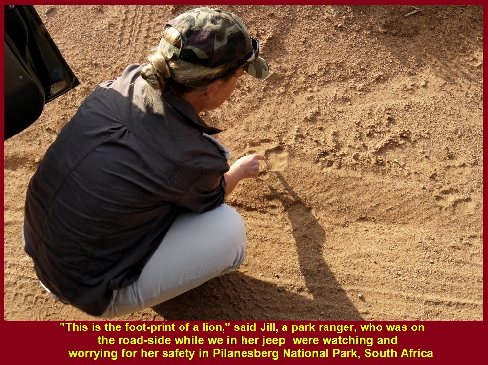
Jill showed the Malaysians in her jeep the foot-print of a lion.
Hide
Jill brought us to a hide to watch a few kinds of water-birds, e.g. herons, egrets, eagles, cormorants and kingfishers at a water-hole, and large lake where hippos lived and other animals quenched their thirst.
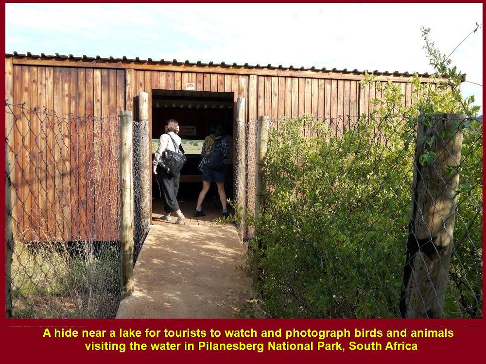
Malaysian tourists in this hide could watch water-birds and animals at a lake.
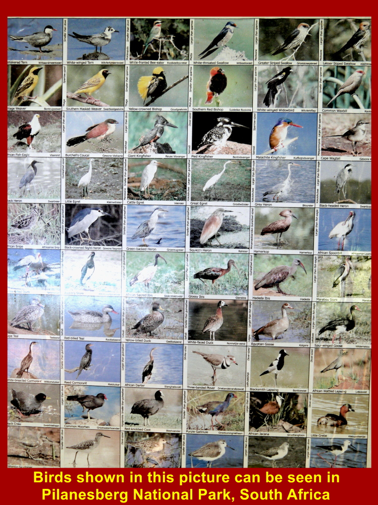
Birds in this picture can be seen in Pilanesberg National Park, South Africa
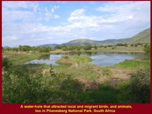
A water-hole that attracted local and migrant birds, and animals, too
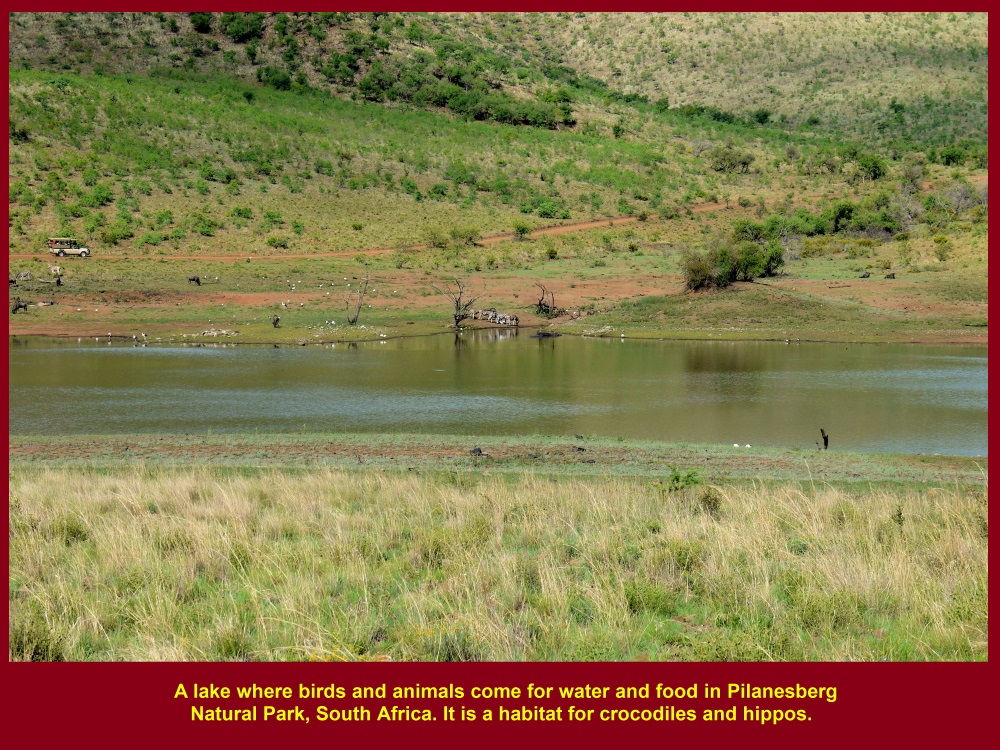
This large lake attracted many birds and animals that went for a drink. Two hippos were spotted in the water.
In the morning game-drive we saw the same animals on the previous day and three more kinds, i.e. giraffes, kudus and sable antelope.
Giraffes
Two young giraffes were seen by us eating leaves on the trees on a hillslope on the morning of 1 Dec 2016.. An adult eats about 34 kg of foliage a day. The number of these mammals that remain in Africa is about 98000 but about 170 live in Pilanesberg National Park.
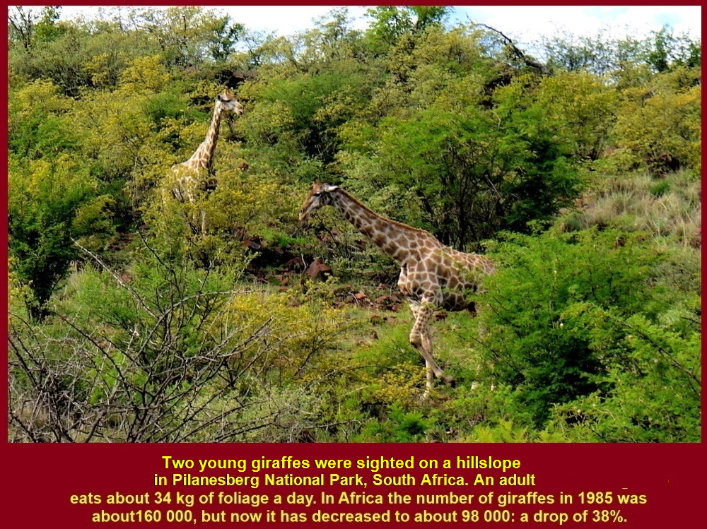
Two young giraffes eating leaves on a hillslope. About 98000 giraffes live in Africa and 170 in Pilanesberg National Park
Kudus
There are about 600 kudus living in Pilanesberg National Park. The males have long, spiral horns whereas the females have no horns.
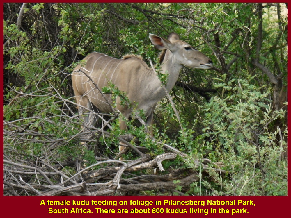
A female kudu eating leaves.
Sable Antelope
A sable antelope was a rare sight in Pilanesberg National Park. It had two long. curved horns and could weigh as much as 250 kg.
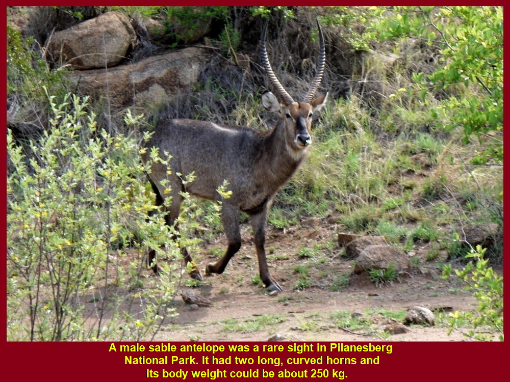
A sable antelope was a rare sight in Pilanesberg National Park. It had two long, curved horns and its body weight could be about 250 kg.
Rest-Place
Each game-drive lasted for 3-4 hours and had a short break at a rest-place where the game-rangers would offer us drinks and snacks. Then the game-drive resumed.

A rest-place for tourists to take a break during a 3-4 hour game-drive(safari)
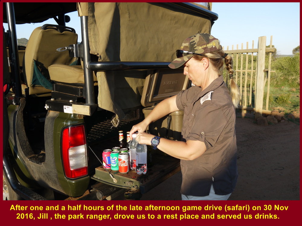
Jill. a park ranger, preparing drinks and snacks for Choo Chaw and fellow-Malaysians at a rest-place
Time for Photographing
Malaysians took an opportunity for photographing at the rest-place.
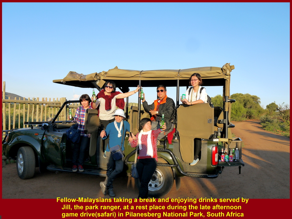
Fellow-Malaysians enjoying drinks and snack at a rest-place in Pilanesberg Park
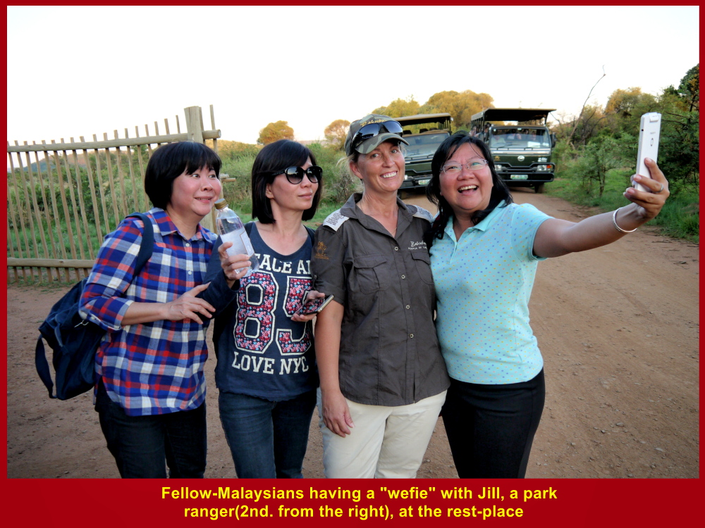
Fellow-Malaysians having “wefie” with Jill, a park-ranger, at a rest-place
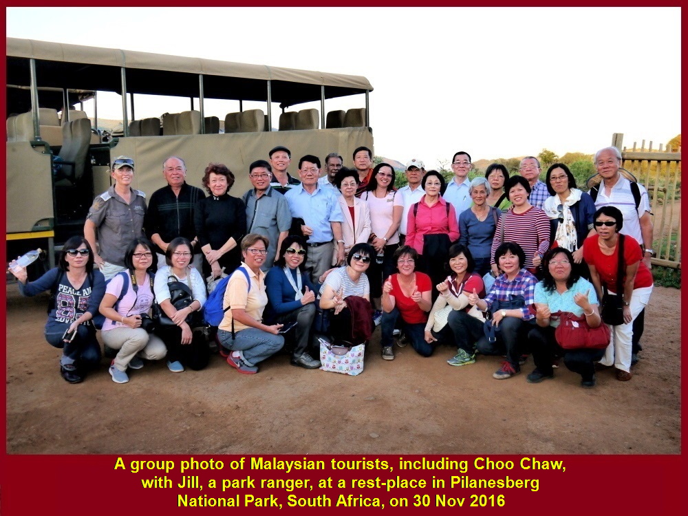
Group photo of Malaysians with at a rest-place in Pilanesberg National Park, South Africa
“Big 5”
When the morning game-drive ended at 8.40 a.m. we felt disappointed for not being able to spot all the five animals in the “Big 5”. We failed to see leopards and buffaloes in the two game-drives(safaris) in Pilanesberg National Park. But we were happy to have seen many kinds of animals not listed in the “Big 5”.
Departure for Sun City
At 10 a.m. we left Pilanesberg National Park for Sun City which was nearby, and then to more places.
(continue in South Africa Travel Part VI)
Written by Choo Chaw
South Africa Travel Part I: Air Flight from KLIA to Cape Town, Cape Town Shantytowns
South Africa Travel Part II: Table Mountain, Malay Quarter, Castle of Good Hope. A & V Waterfront
South Africa Travel Part III: Hermanus, Cheetah Outreach, Stellenbosch, Jewel Africa
South Africa Travel Part V: Pilanesberg National Park(Game Drives)
South Africa Travel Part VI: Sun City, Union Buildings, Vootrekker Monument
South Africa Travel Part VII Kruger Museum, Church Square, Melrose Museum, Carnivore Restaurant
South Africa Travel Final Part Gold Reef City: Gold Mine Museum
South Africa Travel Part IV: Maiden’s Cove, Hout Bay, Duiker Island(Seals), Boulders, Cape Point, Cape of Good Hope
Filed under: Boulders, Cape of Good Hope, Cape Point, Duiker Island(Seals), Hout Bay, South Africa Travel Part IV: Maiden's Cove
South Africa Travel Part IV: Maiden’s Cove, Hout Bay, Duiker Island(Seals), Boulders, Cape Point, Cape of Good Hope
(continue from South Africa Travel Part III)
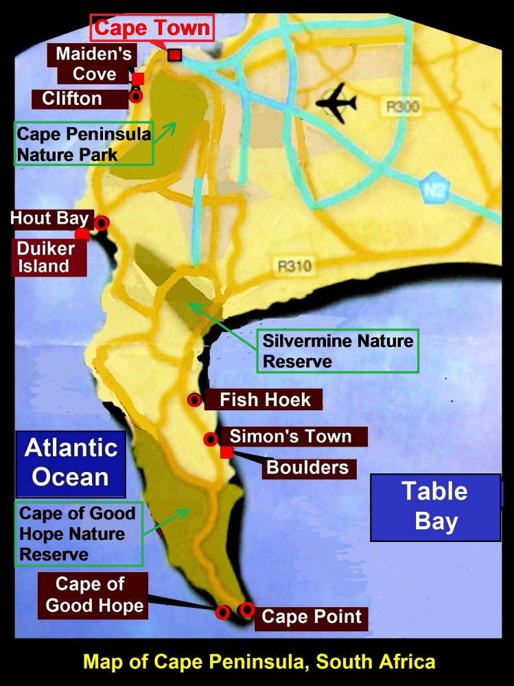
Map showing Maiden’ Cove, Hout Bay, Fish Hoek, Boulders, Cape Point and Cape of Good Hope
Day 4 Tuesday, 29 Nov 2016
Today we were going to several places on Cape Peninsula.
Maiden’s Cove
At 8 a.m. we left Southern Sun Hotel in Cape Town City for Hout Bay where we would see Cape Fur seals on a small island, Duiker Island.
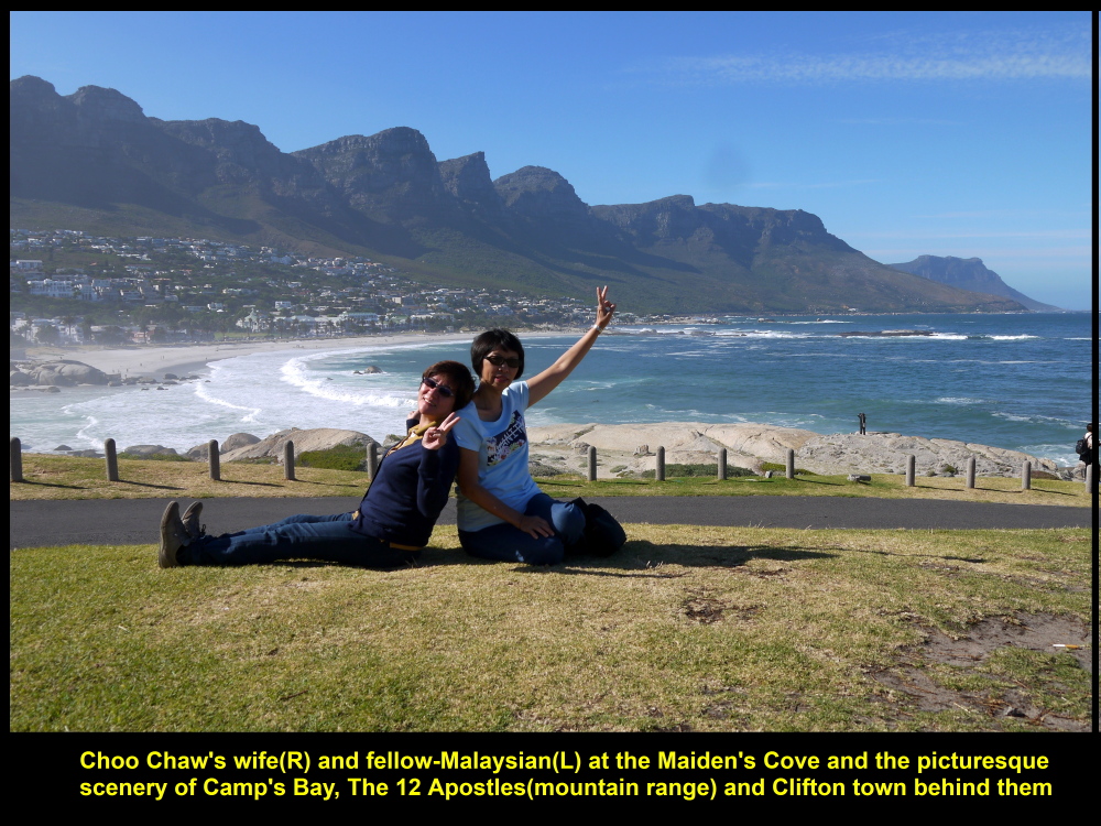
On the way, after 30 minutes on the road, we stopped for awhile at a place known as Maiden’s Cove. It was a place where we could see Table Mountain and 12 peaks known as “The 12 Apostles” in the distance. Besides, we could see Clifton, a town where wealthy people lived, and Camp’s Bay Beach that was considered as the best beach in the world. The whole scenery was stunning.
Beautiful scenery of “12 Apostles”, Camp’s Bay and Clifton Town
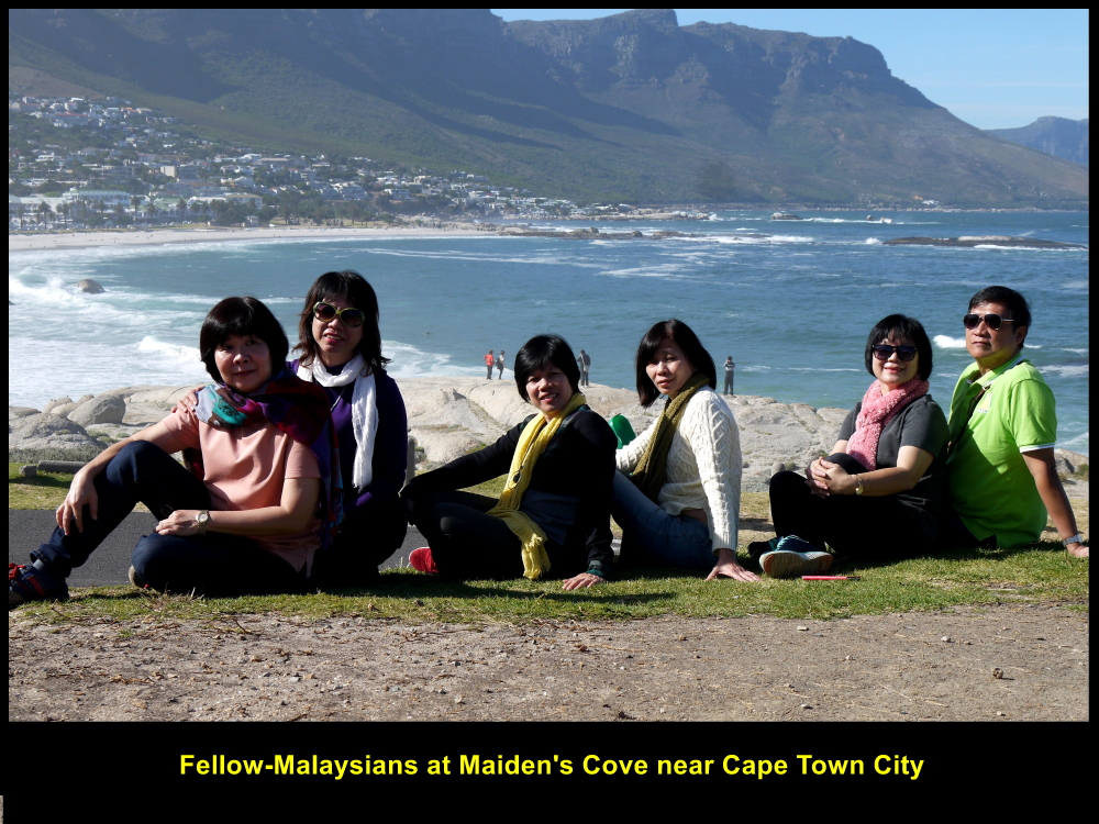
Fellow-Malaysians at Maiden’s Cove enjoying sunshine and sea-breeze
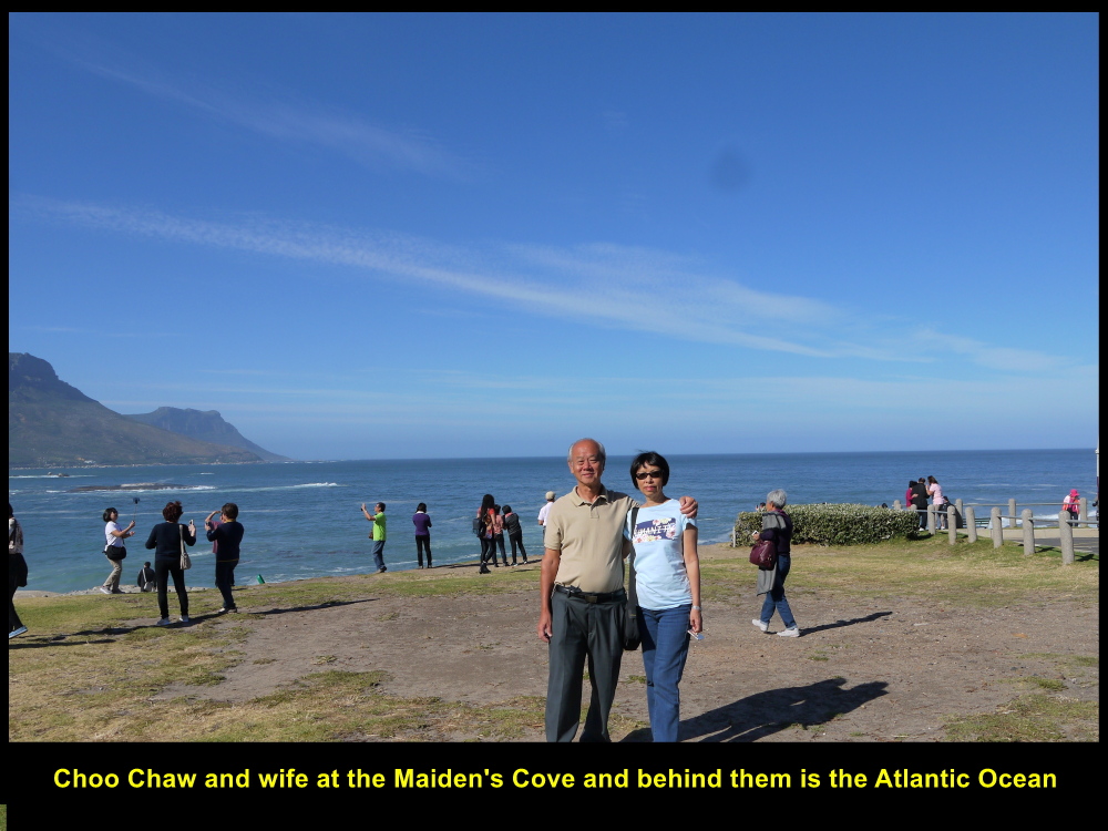
Choo Chaw and wife at Maiden’s Cove on 29 Nov 2016
High Unemployment Rate of the Black
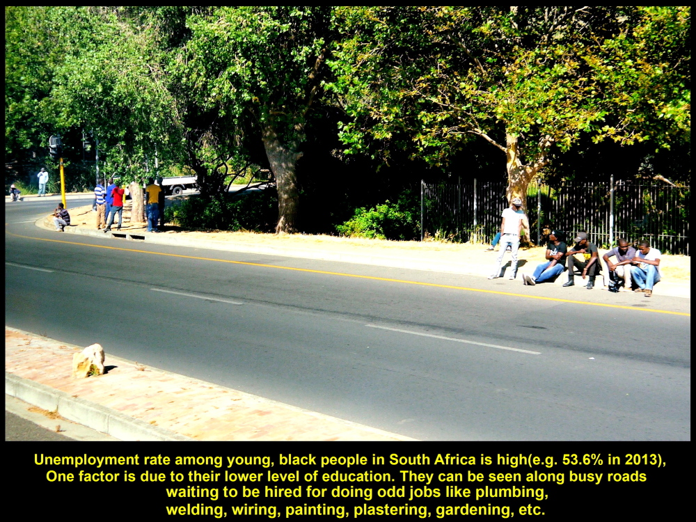
Then we continued our journey to Hout Bay. Not long, we saw some young Black people along a busy road. The tour guide told us that they were waiting for motorists to stop by and offer them odd jobs, like plumbing, painting, gardening, plastering, welding, etc.
Unemployment rate among young Black people in South Africa is high, e.g. 53.6 % in 2013. One factor is due to their lower level of education.
Young people waiting for jobs
Hout Bay, Duiker Island
Soon we reached Hout Bay Town. While walking to Hout Bay Wharf, we saw a row of stalls selling souvenirs with local themes.

Souvenir stalls at Hout Bay Wharf
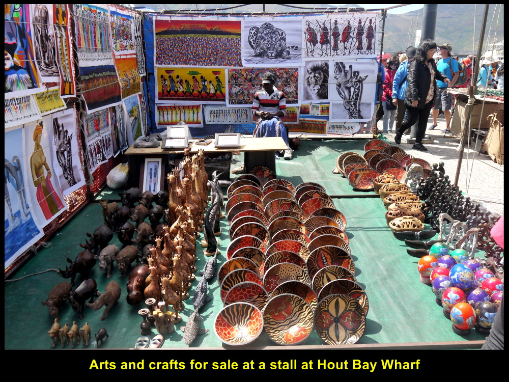
Arts and crafts for sale
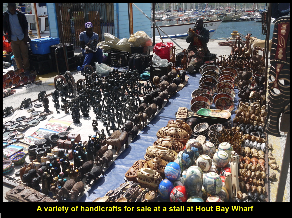
Souvenirs with local themes for sale
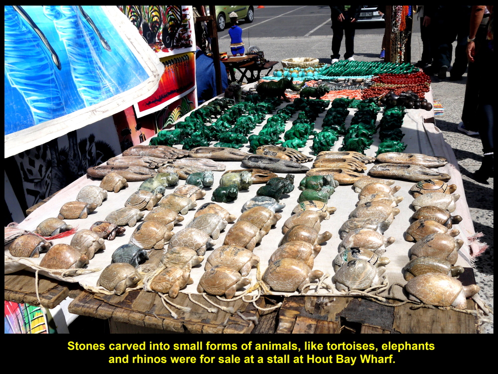
Sculptures of animals for sale
Hout Bay, a Picturesque Place
As we were waiting for a boat at Hout Wharf to take us to a small island, Duiker Island, to see seals, we looked around us. We saw the bay, harbour, marina, the landscape around the bay and tourist boats that went and returned from the seal island. It was a quaint and picturesque place.
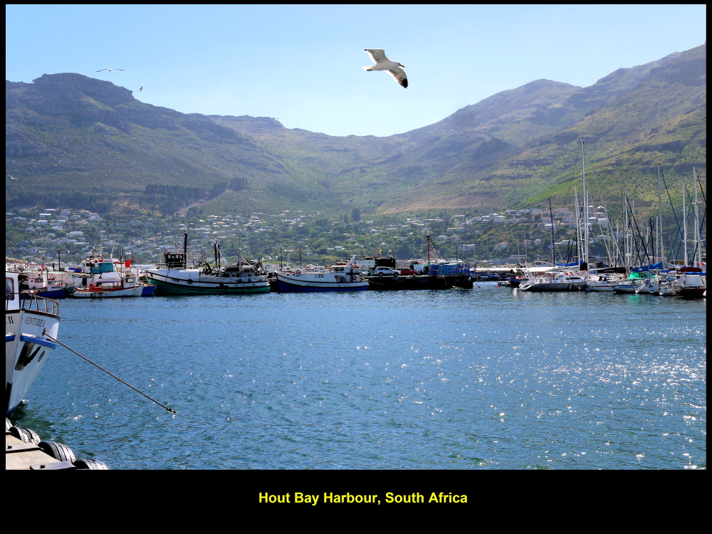
Hout Bay Harbour
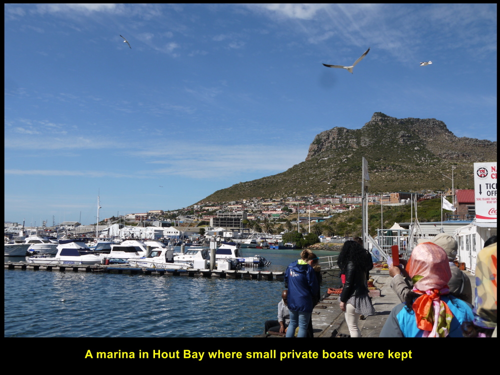
Hout Bay Marina
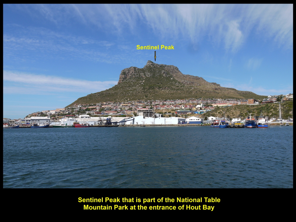
Sentinel at the entrance of Hout Bay
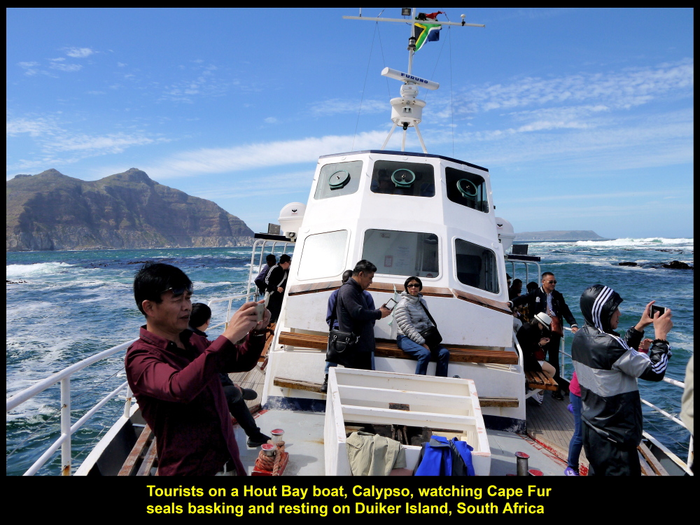
Calypso
At 9.30 a.m.we boarded a boat that could carry 100 passengers, Calypso, at the wharf and sailed to a small island nearby, Duiker Island in Atlantic Ocean, where a few hundred seals live. As the boat was sailing to the island, we saw the beautiful scenery of Hout Bay and its surroundings, slowly, moving away from us.

Calypso, a boat that would bring passengers to Duiker Island to see seals
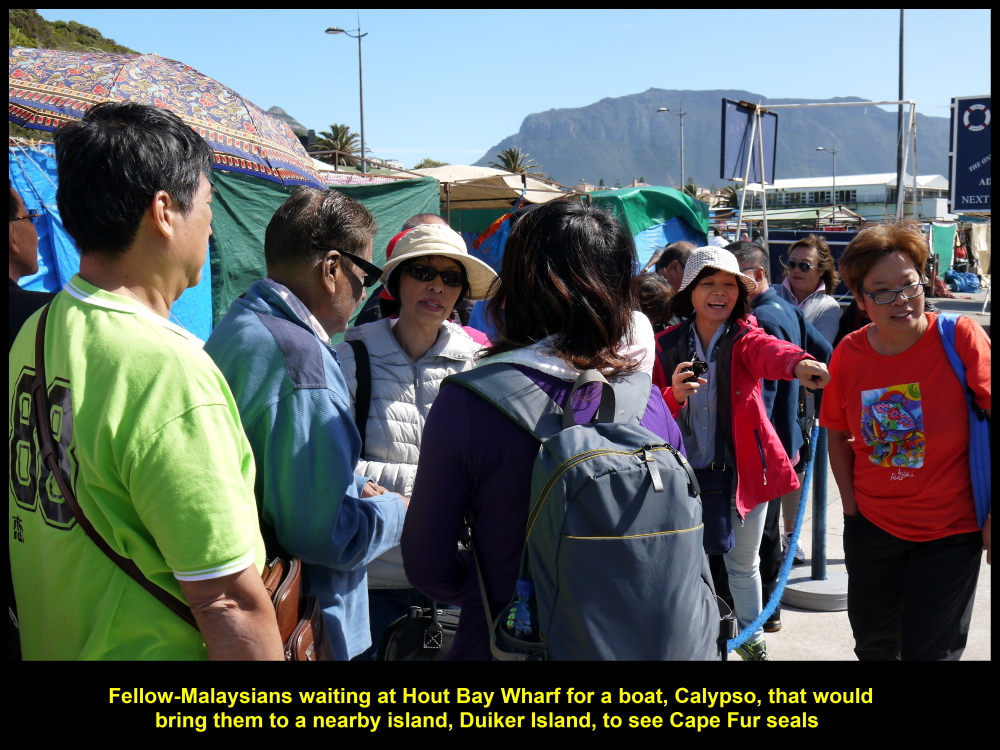
Fellow-Malaysians waiting for a boat. Calypso, to take them to Duiker Island to see seals

Pituresque Hout Bay as seen from boat, Calypso
“Titanic”
On the boat my wife who stood in front, surprisingly, re-enacted the iconic action of an actress, Kate Winslet, on a ship in a well-known movie, “Titanic” produced in 1997.

My wife, seemingly, on a ship, “Titanic”, re-enacted the iconic action of Kate Winslet in a 1997 movie, “Titanic”.
Duiker Island of Seals
Twenty minutes later after leaving the wharf, we came to the dirty-looking island, Duiker Island. A few hundreds of Cape Fur seals were seen basking in the sun.
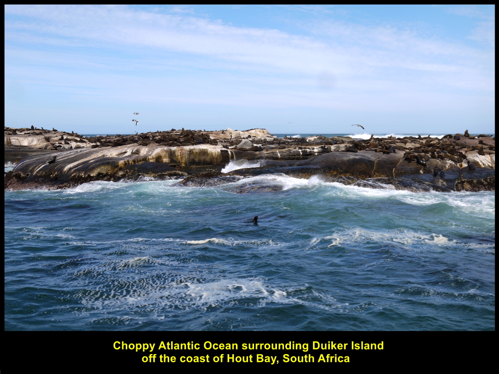
Duiker Island, a dirty-looking island full of Cape Fur Seals
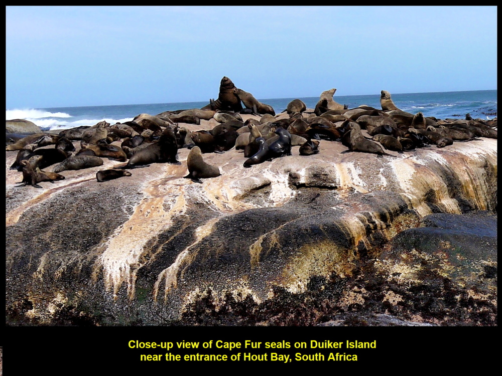
Cape Fur Seals basking in the sun
Choppy Atlantic Ocean
As our boat could not go near the island we saw the mammals about 100 metres away. There were a few boats with tourists near the island, too. But all the boats tried to stay between the island and the mainland as the Atlantic Ocean on the other side of the island was choppy.
Tourists watching seals on Duiker Island
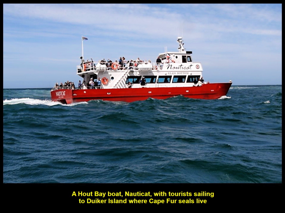
Nauticat, a boat carrying tourists to Duiker Island
Having watched the seals for about 20 minutes, we returned to Hout Bay and went to another destination known as Boulders to see African Penguins
Fish Hoek
On the way to Boulders, we stopped at a spot on a high ground, Chapman’ View Point, to have a last look of Hout Bay, a picturesque place. Then we moved on to Fish Hoek to have sea-food for lunch.
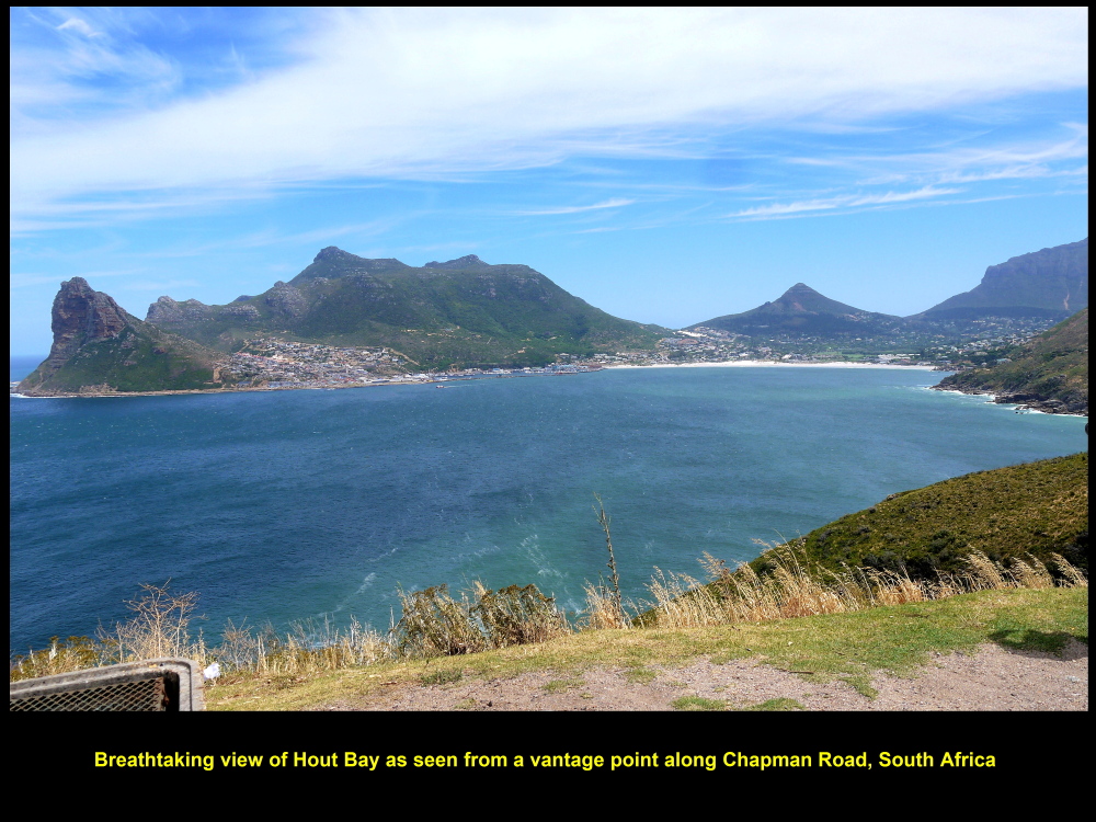
Spectacular view of Hout Bay as seen from a distance on a high ground of Chapman’s Peak
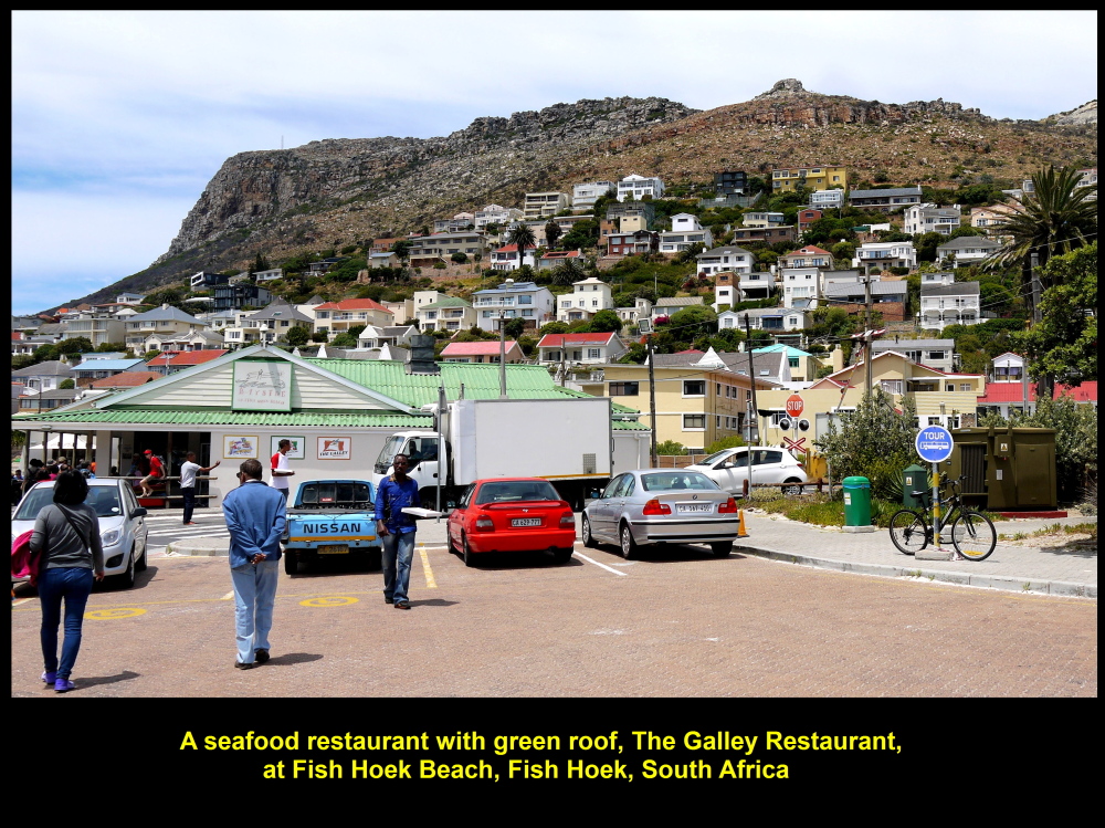
The Galley Restaurant
At 12.30 p.m. we arrived at a restaurant, The Galley Restaurant, at Fish Hoek Beach. We had a delicious sea-food of fried crayfish and prawns for lunch and tasty ice-cream at the end of the meal. The staff was friendly and helpful. In fact, the owner of the restaurant went round greeting us and was willing to take a photo with my wife and I.
The Galley Restaurant at Fish Hoek Beach
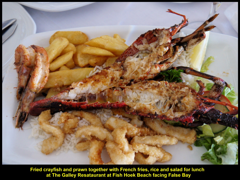
The Galley Restaurant served many kinds of dishes, e.g. fried crayfish and prawn as shown in photo
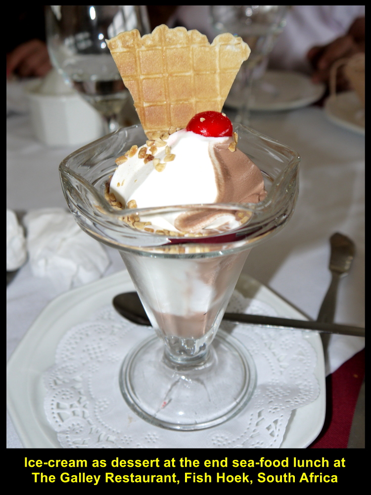
Ice-Cream at the end of lunch
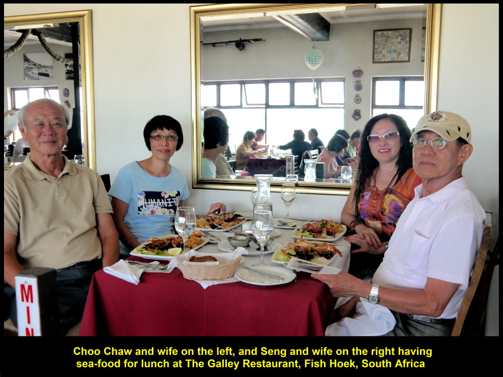
Choo Chaw and wife having lunch together with Seng and wife at The Galley Restaurant

The friendly owner of The Galley Restaurant, Fish Hoek, South Africa
Board of Foreign Currencies
After lunch, as we went out of the restaurant, we were attracted by a board on a wall near the exit door. It was full of foreign currencies put up by its former customers. Out of curiosity, I looked for the currency of my country, Malaysia, and was surprised to see two Malaysian banknotes of denominations, RM 1 and RM 10, pinned onto the board. It was a testimony that other Malaysians did visit Fish Hoek Beach in South Africa.
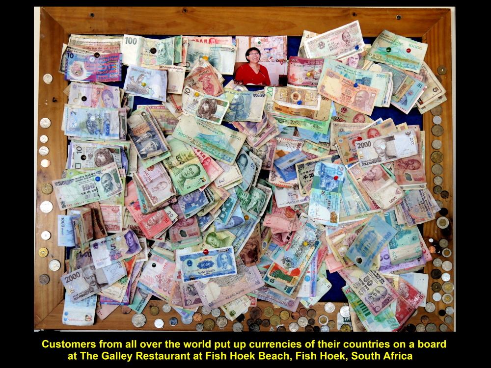
Foreign currencies pinned on a board by foreign customers of The Galley Restaurant
Seagulls
Outside the restaurant, we spent a few minutes at the white, sandy beach, Fish Hoek Beach, enjoying the sunshine and sea-breeze, and the scenery, too. At the same time some of our fellow-Malaysians were playing with the active seagulls without fear of receiving a “gift” from them.
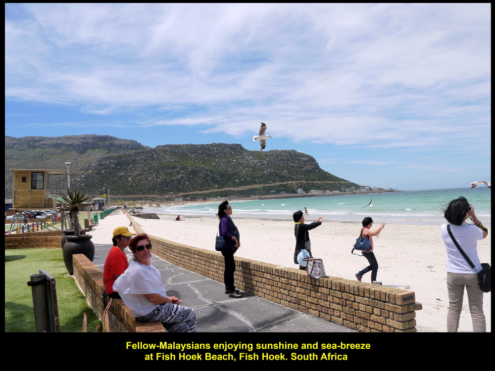
Sunshine and sea-breeze at Fish Hoek Beach
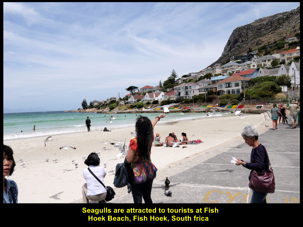
Fellow-Malaysians playing with seagulls
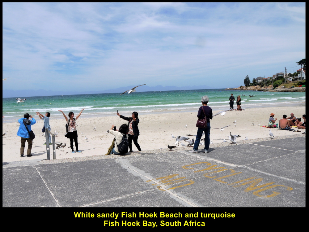
Sandy Fish Hoek Beach and turquoise Fish Hoek Bay
Simon’s Town
Boulders was our next destination. We travelled south of Fish Hoek, passed through Simon’s Town and arrived at Boulders.
Simon’s Town had been an important harbour and naval base for more than 200 years.
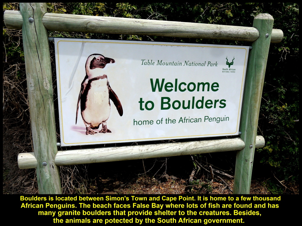
A signboard welcoming visitors to Boulders to see Africa Penguins
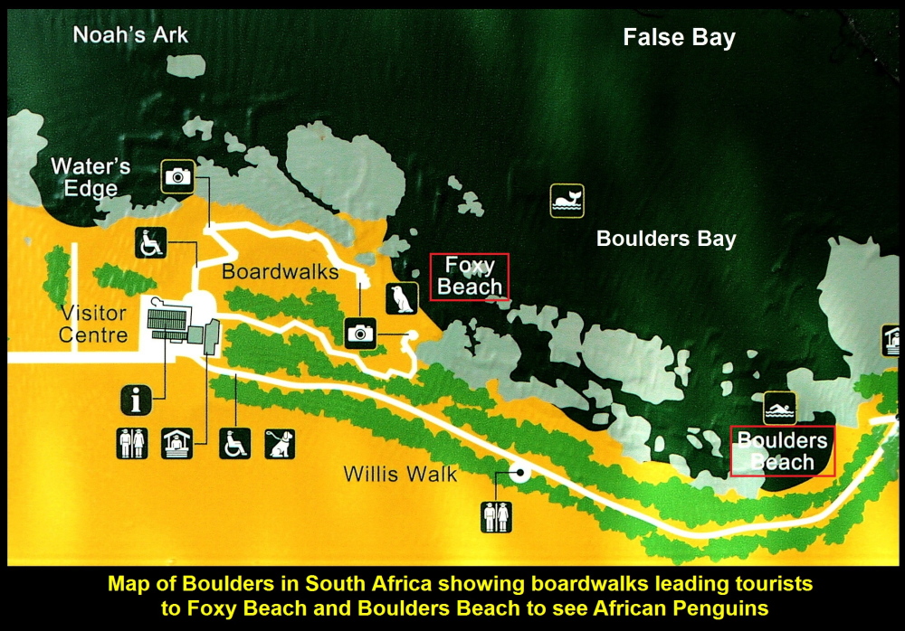
Map showing the location of Foxy Beach and Boulders Beach at Boulders
Haven for African Penguins
Boulders is located along the coast between Simon’s Town and Cape Point. As there are many granite boulders there hence the place is called Boulders. These boulders in water and at beaches provide good shelter to penguins from rough sea and their enemies, like sharks, seals and whales. So Boulders is a haven for African Penguins.
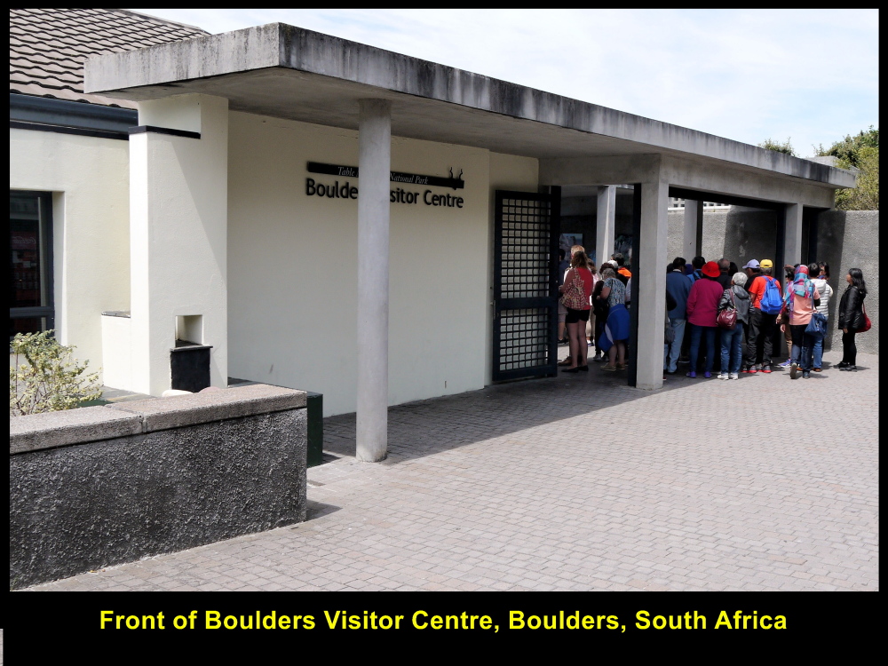
Boulders Visitor Centre, entrance to African Penguins’ home
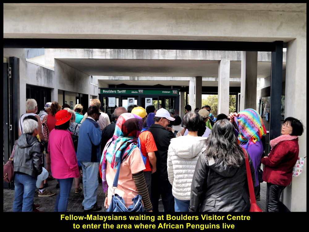
Fellow-Malaysians visiting Boulders to see African Penguins
Foxy Beach and Boulders Beach
To see African Penguins at the beaches of Boulders, we had to enter Boulders Visitor Centre with tickets. Then we walked along boardwalks from the centre to two beaches, Foxy Beach and Boulders Beach, where penguins lived.

A boardwalk to Foxy Beach where penguins live
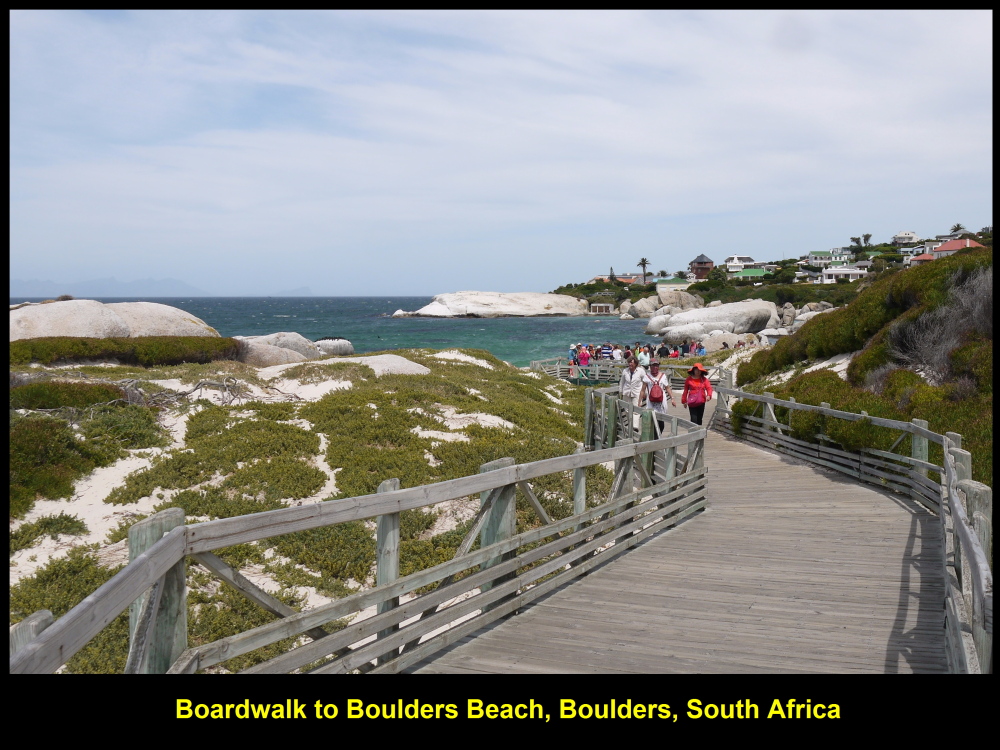
Boardwalk to Boulders Beach which is home to many penguins

Tourists looking at penguins that were moulting
Moulting Penguins and Chicks
As we were walking to Boulders Beach we saw among the boulders and bushes at the sandy beach some penguins that were moulting and some chicks waiting for their parents to come back from the sea with food.
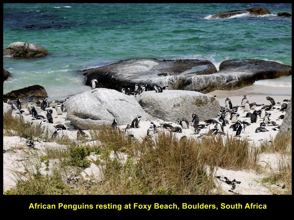
Foxy Beach is the best place to watch penguins as it is very close to the the boardwalks
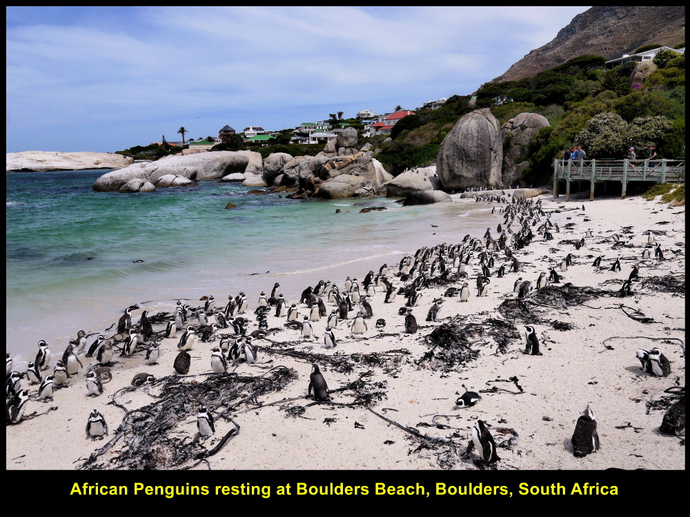
Boulders Beach with lots of African Penguins basking in the sun
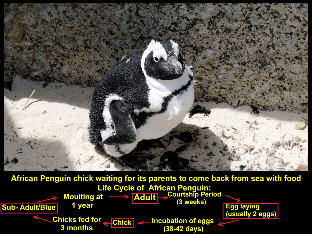
Young penguin chick waiting for its parents to come back from sea with food
Penguin Life Cycle
Below is a diagram of the life cycle of an African Penguin:
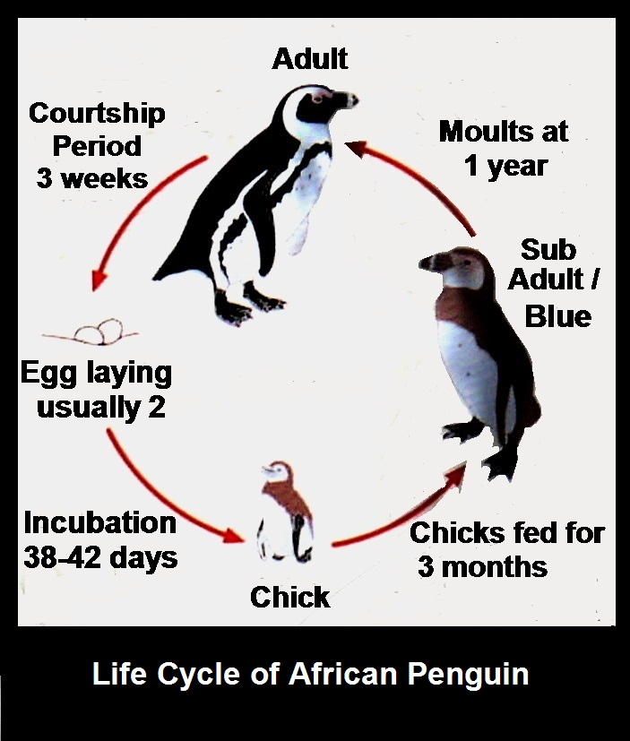
Life Cycle of African Penguin
South of Cape Peninsula
We spent half an hour at Boulders to see the African Penguins. At 2.30 p.m. we left the place and went further south to the end of Cape Peninsula which splits into two promontories. The southeastern promontory is called Cape Point whereas the southwestern one is known as Cape of Good Hope which is the most southwestern point of the continent of Africa.

Map showing Cape Point and Cape of Good Hope
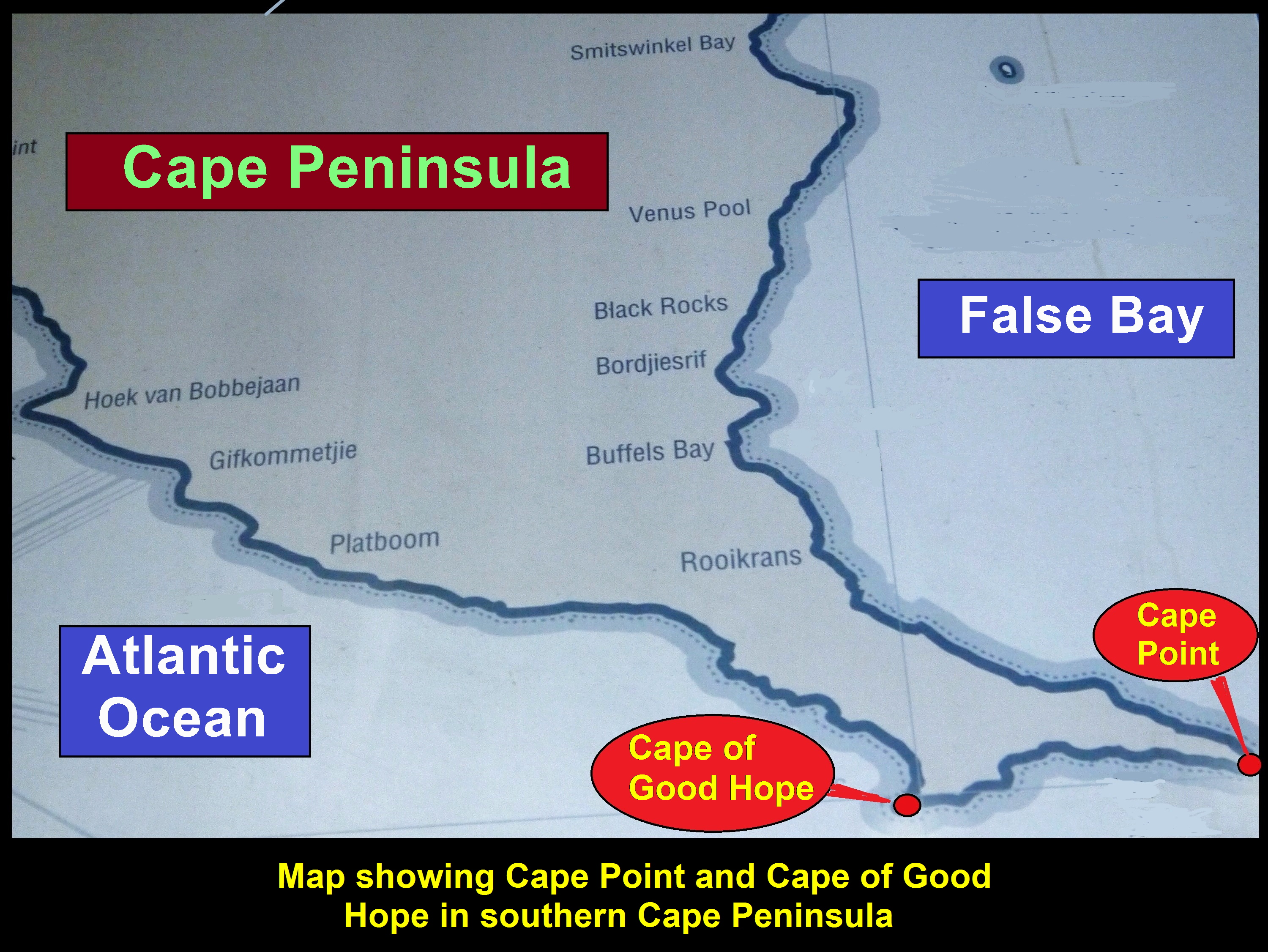
Map showing Cape Peninsula splits into two promontories in the south, Cape Point and Cape of Good Hope
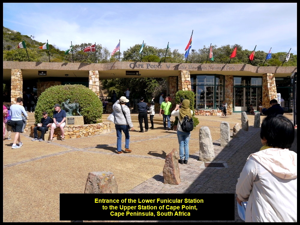
Funicular at Cape Point
At 3.30 p.m. we reached Cape Point first. We stopped at a coach-park and entered the Lower Funicular Station(127 m high). Then we took the Funicular, a train, to the Upper Funicular Station(214 m high). On arrival at the station, we walked up a few flights of steps to an old lighthouse on top of Cape Point Peak.
Funicular lower station to Cape Point Peak
Funicular Track
The Funicular track is 585 metres long and the train that is pulled by a strong cable takes 3 minutes to reach the upper station. It replaced the buses in 1995.

Cape Point Funicular replaced the “Flying Dutchman” bus services in 1995.
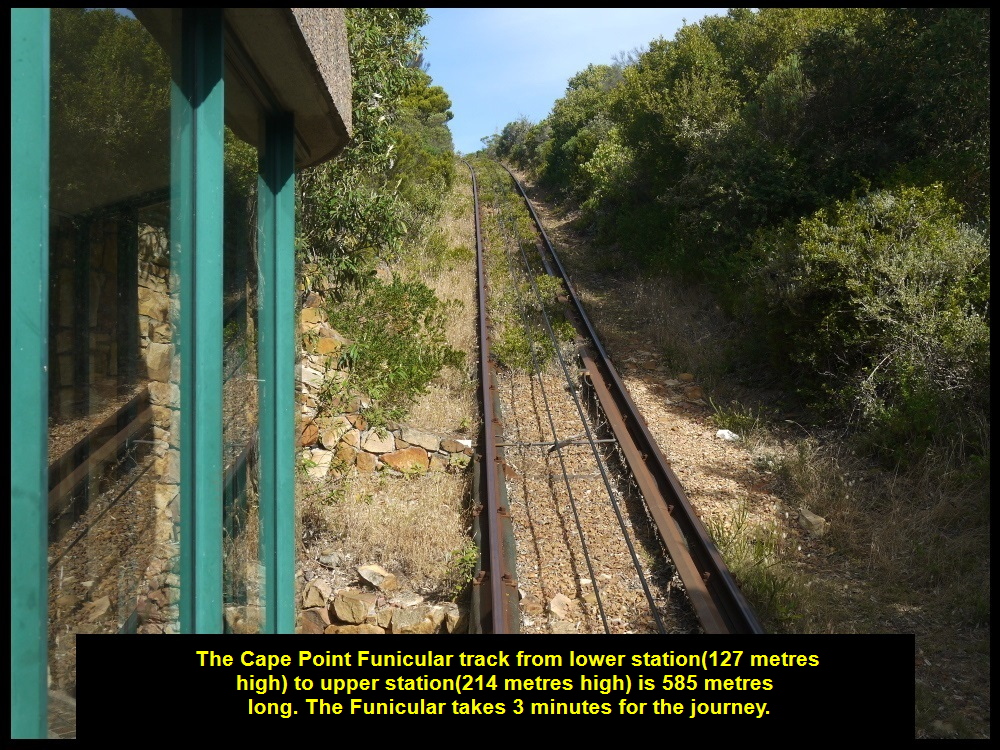
Funicular track is 585 metres long and the train takes about three minutes to make the journey.
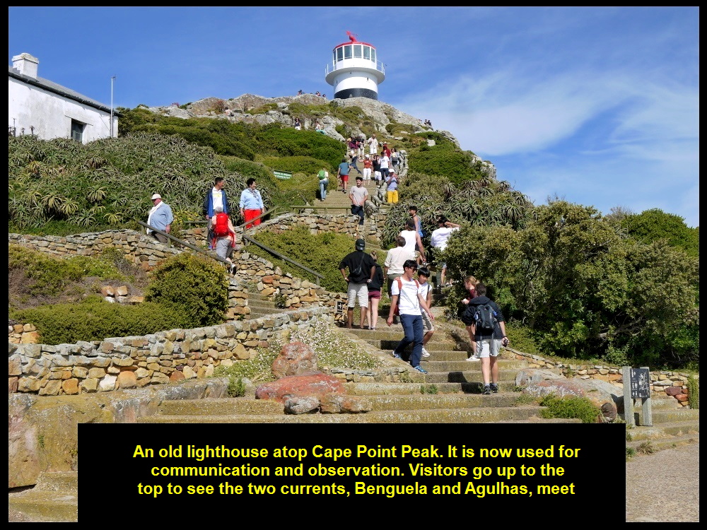
Tourists climbing up the steps to the olf lighthouse
Old Lighthouse of Cape Point
The old lighthouse was built in 1860 but decommissioned in 1919 when the most powerful one in South Africa was built nearby. The old one was then used for observation and communication.
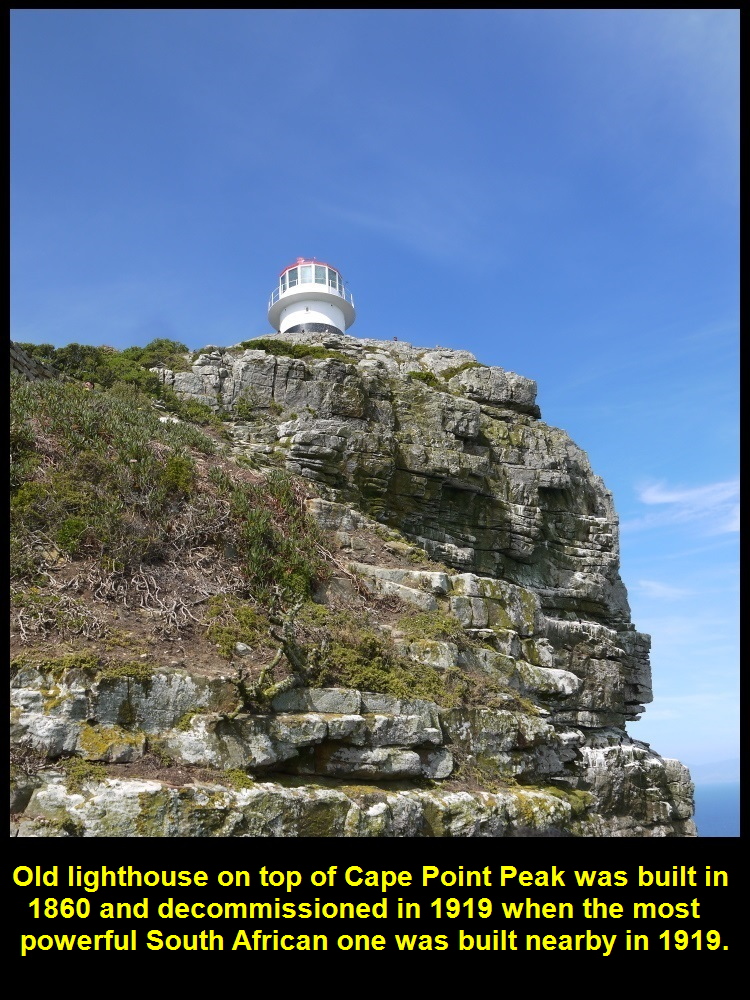
Old lighthouse was built in 1860 and decommissioned in 1919. It is now used for observation and communication.
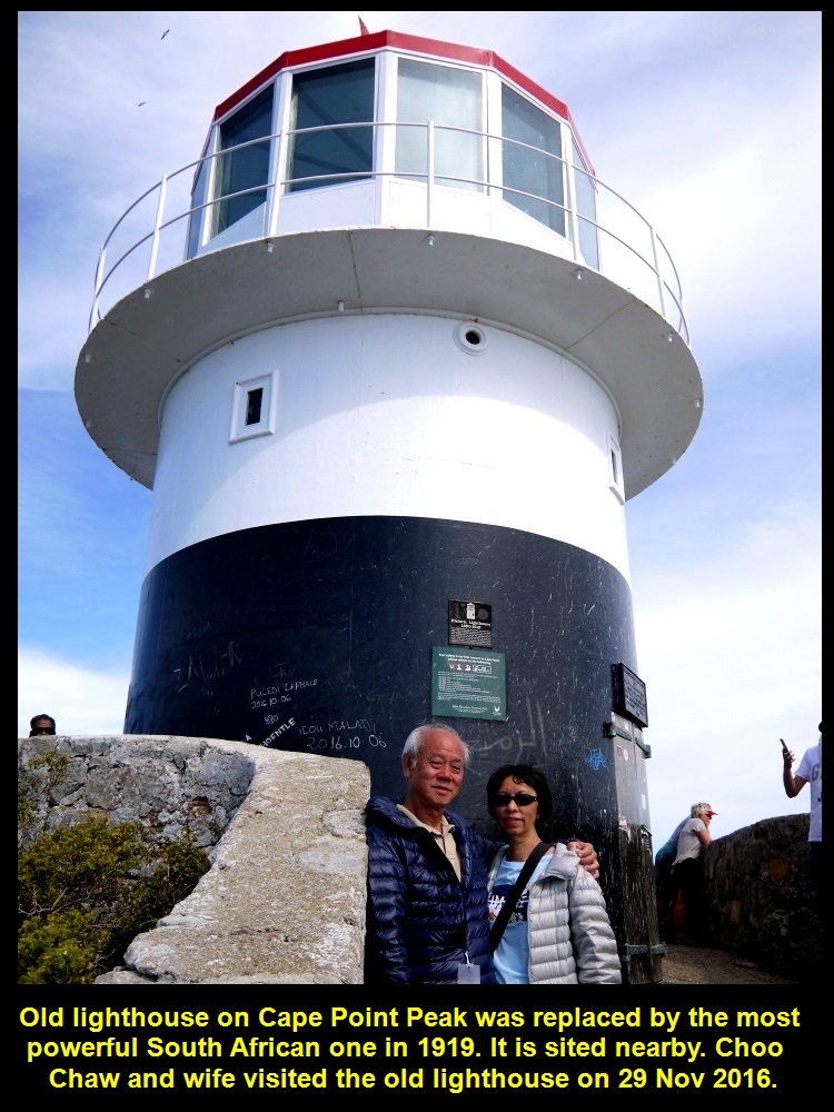
Choo Chaw and wife visited the old lighthouse which was replaced by a more powerful one nearby in 1919.
Spectacular, Panoramic View
From the lighthouse we could see a spectacular panoramic view of Cape Peninsula, Atlantic Ocean, Cape of Good Hope, Indian Ocean and False Bay. Besides, there was a post at its base that showed distances of foreign cities from it.

A spectacular panoramic view of the Cape Peninsula landscapes from the old lighthouse
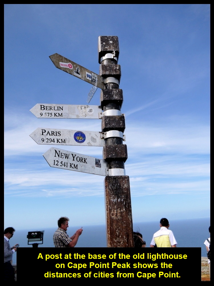
A post at the old lighthouse showing the distances of foreign cities from the lighthouse
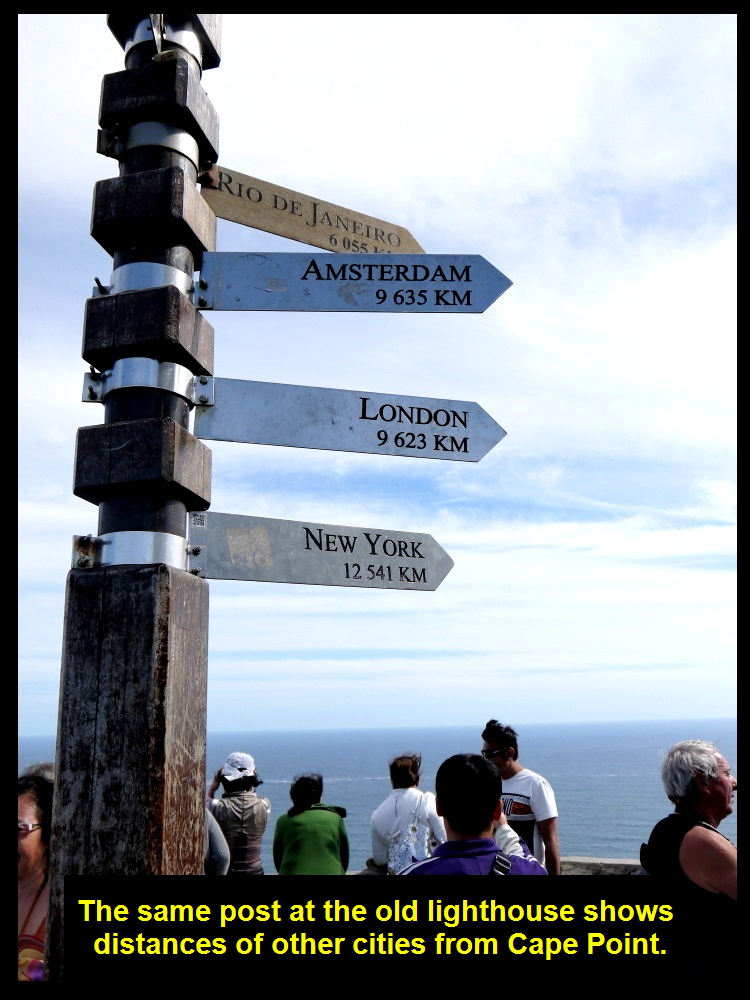
The same post showing the distances of other foreign cities from the lighthouse
Wonderful Feeling at Cape Point Old Lighthouse
All my fellow-Malaysians, my wife and I were having a wonderful feeling at the Cape Point old lighthouse. We were 9600 km away from our home and enjoying the sights and sounds of the two oceans which were next to each other, and the spectacular view of Cape Peninsula.
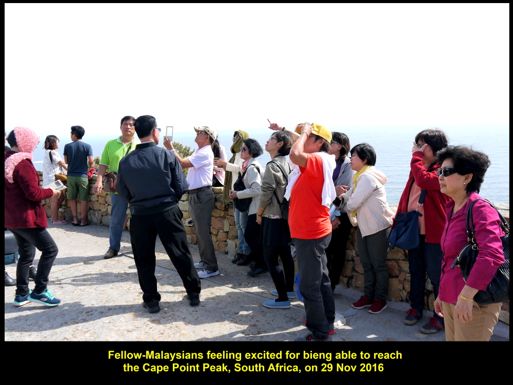
Fellow-Malaysians at old lighthouse on 29 Nov 2016
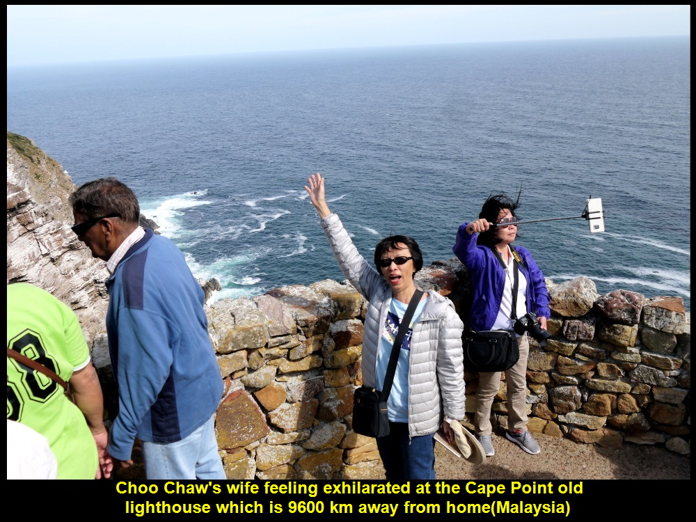
Choo Chaw’s wife feeling exhilarated at the Cape Point old lighthouse that is 9600 km from home(Malaysia)
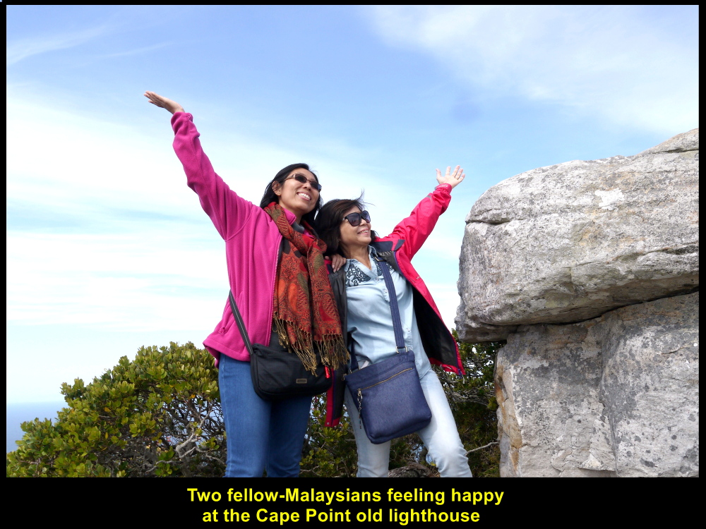
Two fellow-Malaysians feeling happy to be at the Cape Point old lighthouse
Meeting of Two Currents
Right in front of Cape Point in the south, two currents meet each other. They are the cold Benguela Current from Atlantic Ocean that flows eastwards and the warm Agulhas Current from Indian Ocean that flows westwards. It seems that the actual place where they meet is between Cape Point and Cape Agulhas.
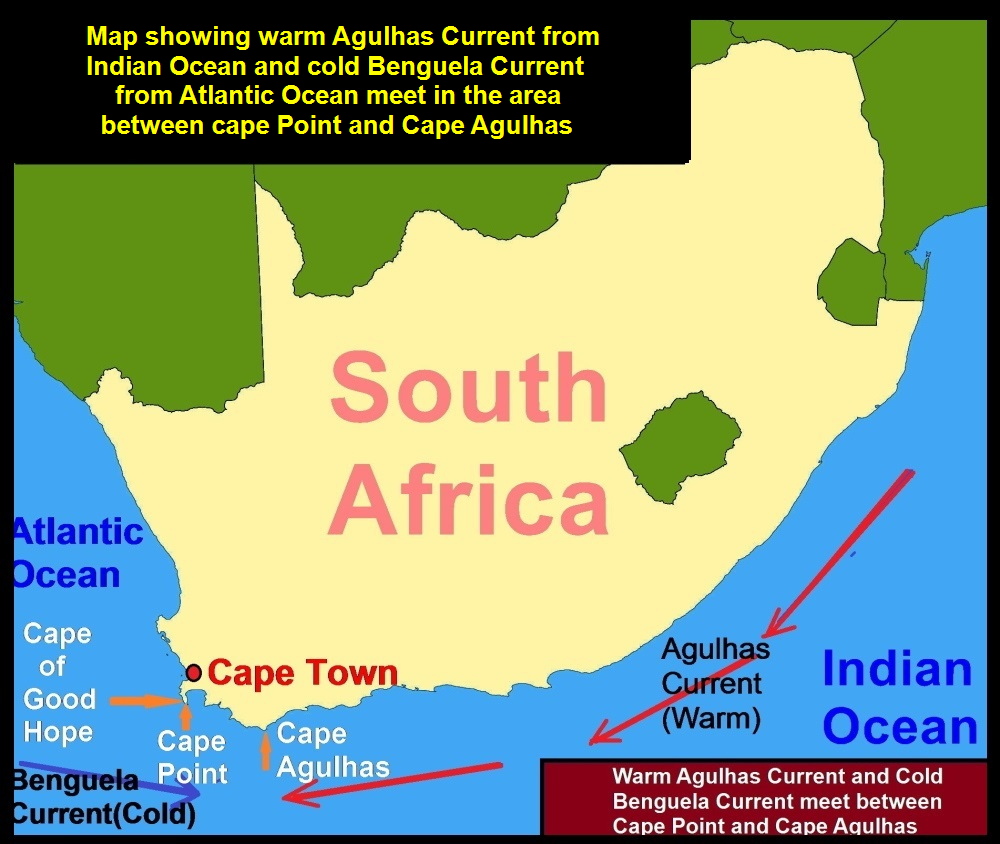
Map showing the meeting of two currents, cold Benguela Current and warm Agulhas Current
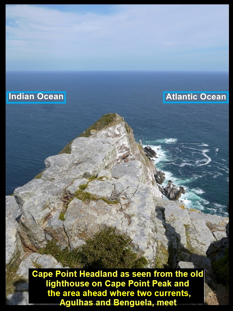
Two oceans, Atlantic Ocean and Indian Ocean next to each other in front of Cape Point Headland

Fellow-Malaysians watching the meeting of two currents, Benguela and Agulhas
Cape of Good Hope
After spending a short time at Cape Point we went to Cape of Good Hope which was a few kilometres away. It is located at the most south-western point of the continent of Africa and faces Atlantic Ocean.
Cape Agulhas which is 150 km south-east of Cape of Good Hope is considered to be the most southern point of the African continent.
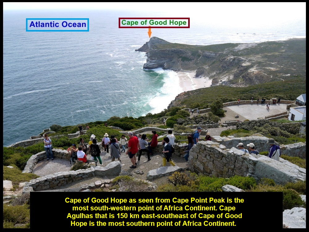
Cape of Good Hope as seen from Cape Point Peak
The Most South-Western Point of African Continent
When we reached Cape of Good Hope we saw a low, rocky headland with little grass on the coast of Atlantic Ocean. Owing to weathering and erosion, layers of sandstone were exposed. We made a beeline to a large, long and red signboard that declared that Cape of Good Hope was the most south-western point of the continent of Africa.
There were other tourists visiting the well-known place. Nobody left the place without taking a photo with the prominent signboard.
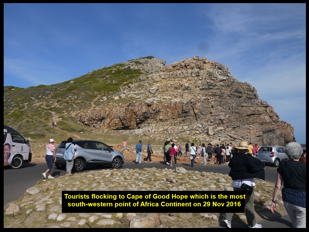
Tourists making a beeline to the most south-western point of the continent of Africa, Cape of Good Hope
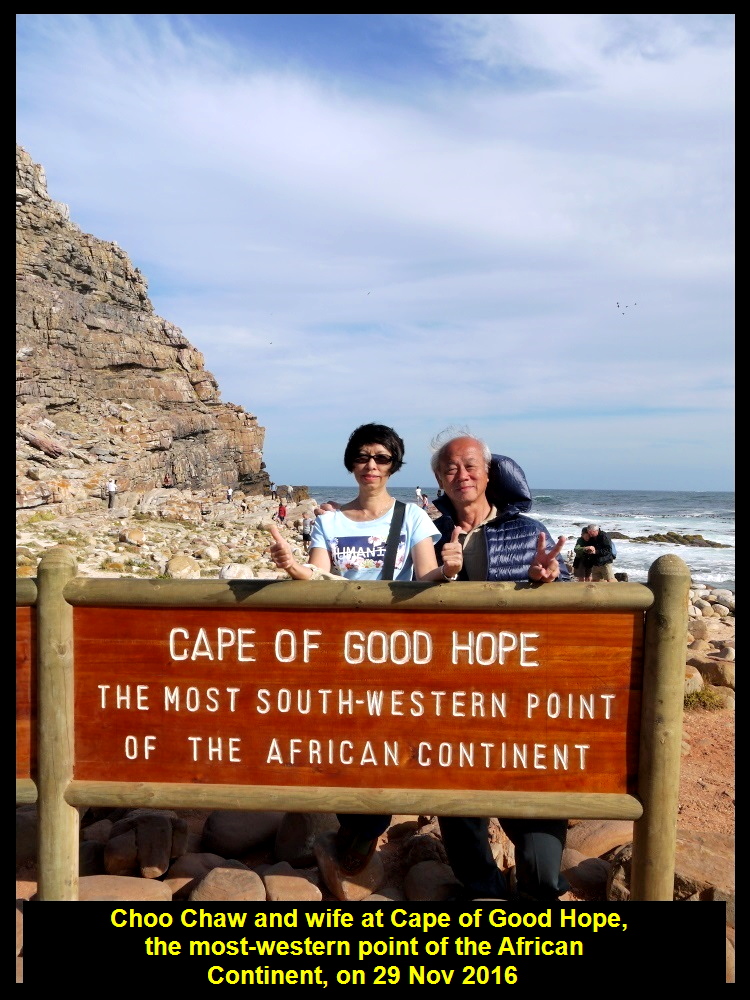
Choo Chaw and wife at the most south-western point of the continent of Africa
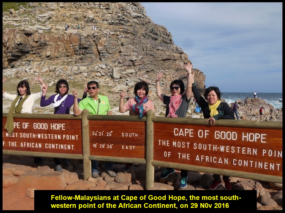
Fellow-Malaysians at Cape of Good Hope

Mr. & Mrs. Lee at Cape of Good Hope
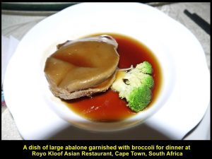
At 6 p.m. we left Cape of Good Hope leaving behind our foot-prints. We travelled back to Cape Town City where we had dinner at a Chinese restaurant known as Royo Kloof Asian Restaurant. Everyone was happy to have a dish of large abalone for dinner.
A dish of large abalone garnished with broccoli at Royo Kloof Asian Restaurant, Cape Town
Then we returned to our hotel, Southern Sun Hotel, to stay for the last night in the city. On the following day, we would fly north-east o Johannesburg from Cape Town, a distance of 1262 km between them, to visit more places of interest in the north of South Africa.
(continue in South Africa Travel Part V)
Written by Choo Chaw
South Africa Travel Part I: Air Flight from KLIA to Cape Town, Cape Town Shantytowns
South Africa Travel Part II: Table Mountain, Malay Quarter, Castle of Good Hope. A & V Waterfront
South Africa Travel Part III: Hermanus, Cheetah Outreach, Stellenbosch, Jewel Africa
South Africa Travel Part IV: Maiden’s Cove, Hout Bay, Duiker Island(Seals), Boulders, Cape Point, Cape of Good Hope
South Africa Travel Part V: Cape Town to Johannesburg, Pilanesberg National Park(Game Drive)
South Africa Travel Part VI: Sun City, Union Buildings, Vootrekker Monument
South Africa Travel Part VII Kruger Museum, Church Square, Melrose Museum, Carnivore Restaurant
South Africa Travel Final Part Gold Reef City: Gold Mine Museum
South Africa Travel Part III: Hermanus, Cheetah Outreach, Stellenbosch, Jewel Africa
South Africa Travel Part III: Hermanus, Cheetah Outreach, Stellenbosch, Jewel Africa
(continue from South Africa Part II)
Day 3 Monday, 28 November 2016
Journey from Cape Town to Hermanus(115 km)

Map showing the location of Hermanus, and Cheetah Outreach Sanctuary
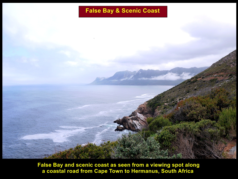
Scenic False Bay
In the morning, we left Cape Town City for Hermanus that is 115 km south-east of the city. After travelling half-way, we stopped for a short while at a spot off the coastal road where we could see the scenic False Bay, headlands and the rocky coasts. The view was stunning and we took some photos of the scenery and ourselves, too.
Stunning scenery of False Bay and coast
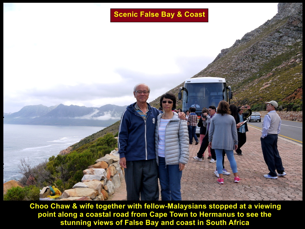
Choo Chaw and wife together with others at a lookout point to see scenic False Bay and coasts

Fellow=Malaysians at False Bay lookout point
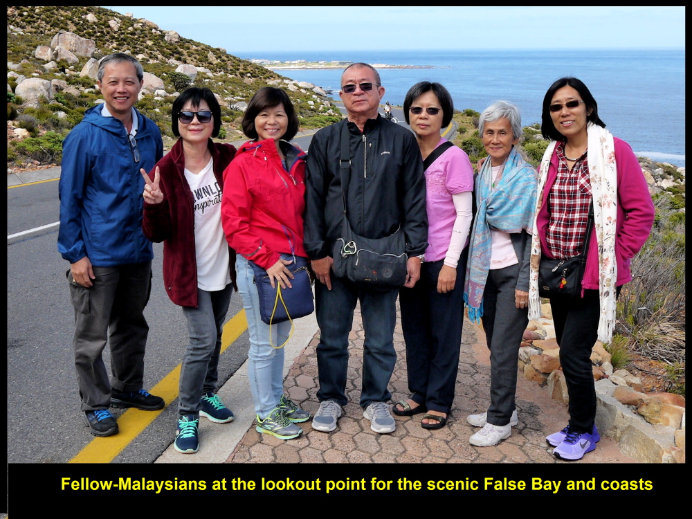
Fellow-Malaysians at lookout point for False Bay and coasts
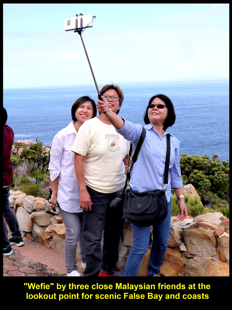
Three close Malaysian friends doing “wefie” at lookout point fpr False Bay and coasts
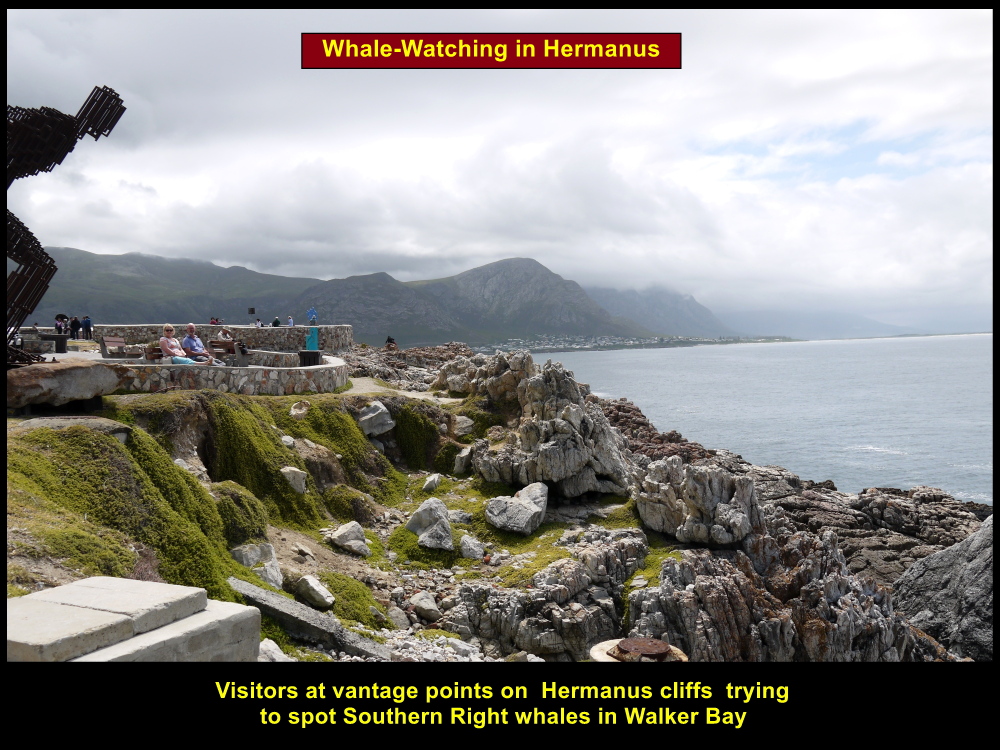
Hermanus
Then we continued our journey to Hermanus. At 10.30 a.m. we arrived at the town of Hermanus. It was a fishing town in the olden days and its old harbour was declared as a national monument in 1970.
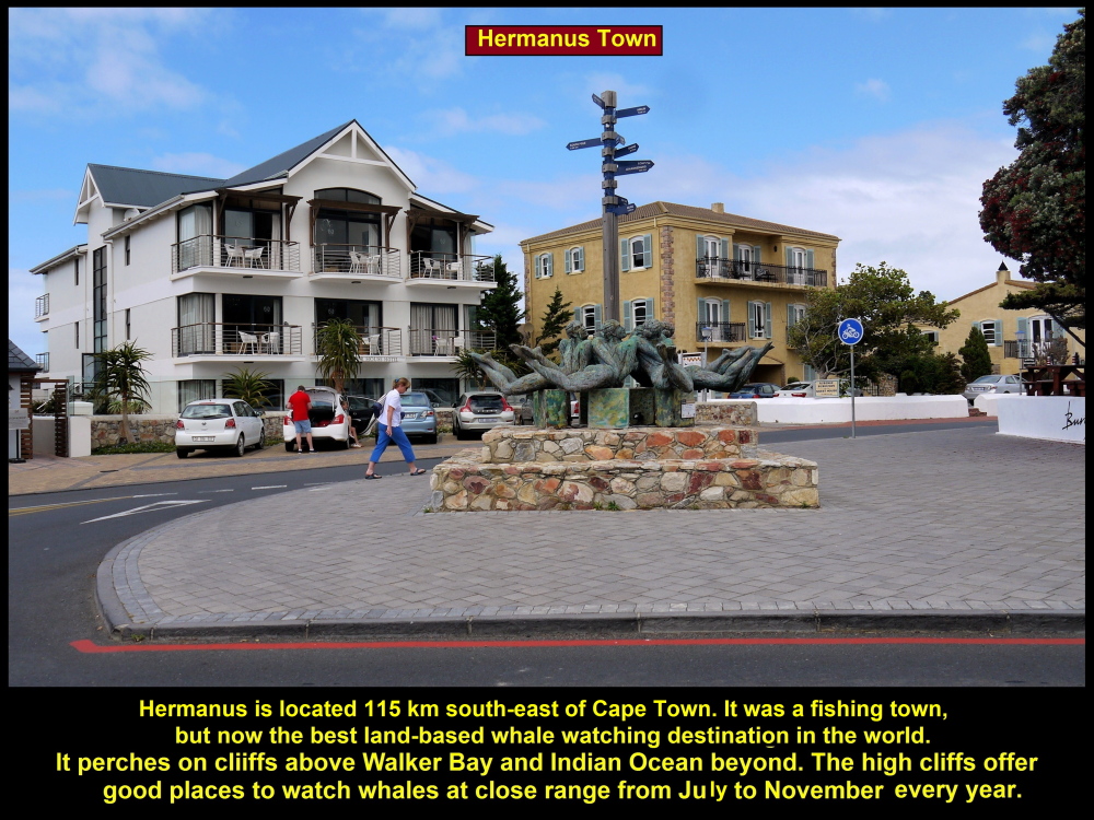
Hermanus Town was a fishing town. Now it is the best land-based whale watching destination in the world.
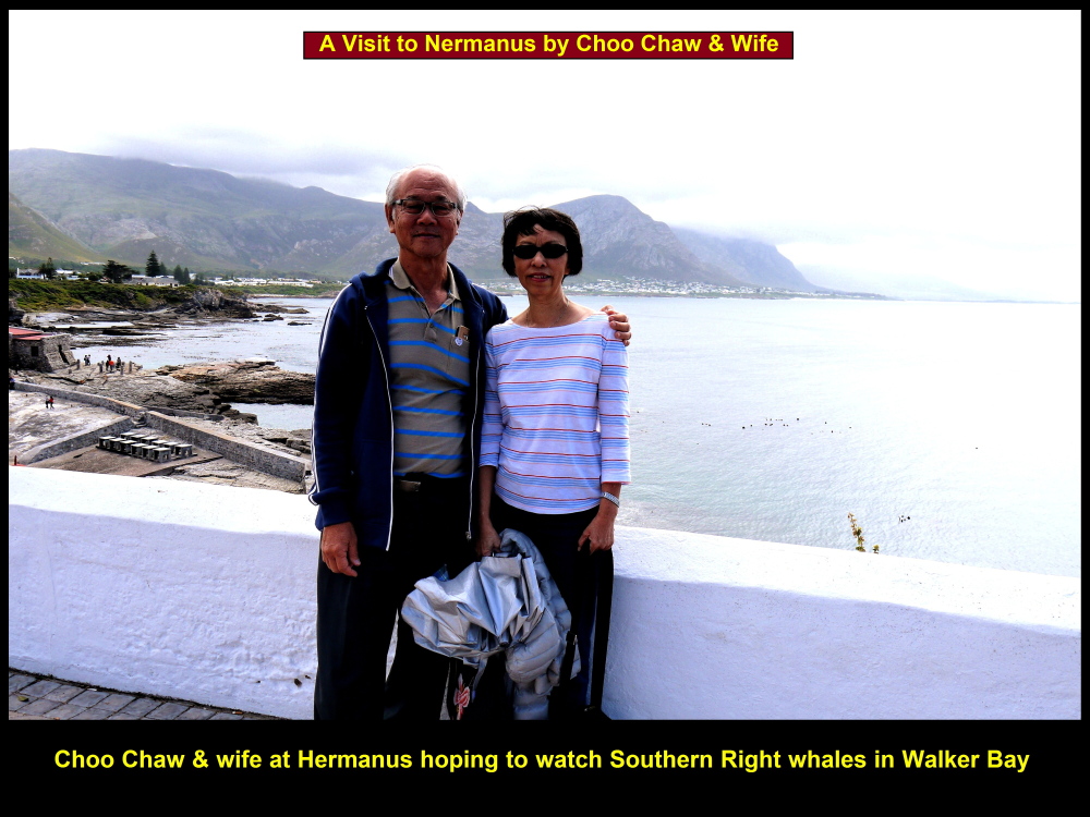
Choo Chaw & wife together with fellow-Malaysians visiting Hermanus to watch whales in Walker Bay
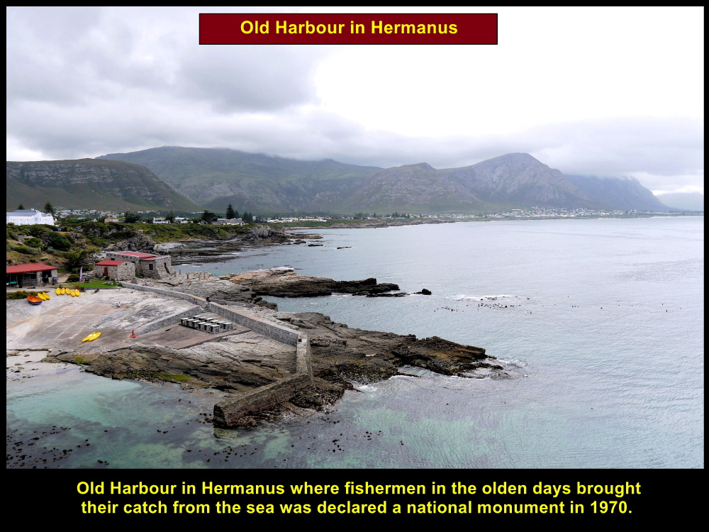
Hermanus was a fishing town in the olden days and was declared as a national monument in 1970.
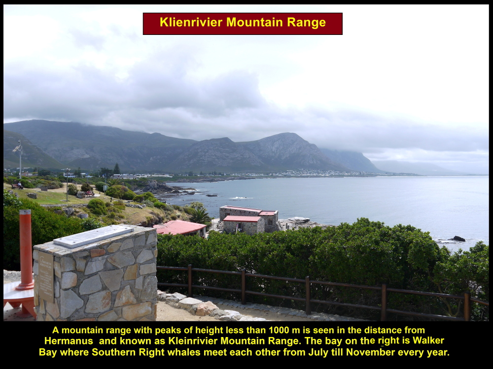
Walker Bay
Located in the distance is a mountainous range known as Klienrivier Mountain Range with peaks of height less than 1000 m. Walker Bay is Southern Right whales’ favourite place to meet each other from July to November. In the water they spend their time playing, mating, giving birth and nursing their calves.
Klienrivier Mountain Range with peaks of height less than 1000 m in Hermanus
Looking out for whales in Walker Bay, Hermanus
Gearing’s Point is the best place for watching whales in Walker Bay.
Several vantage points for whale-watching in Hermanus
Southern Right Whale
An adult Southern Right whale weighs about 40 tons and consume 1500 kg of food a day. Their food consists mostly of plankton where they forage in Indian Ocean and Atlantic Ocean. They can live up to 50 years and grow to a length of 17 m. These mammals are protected from commercial whaling by the South African government since 1935.
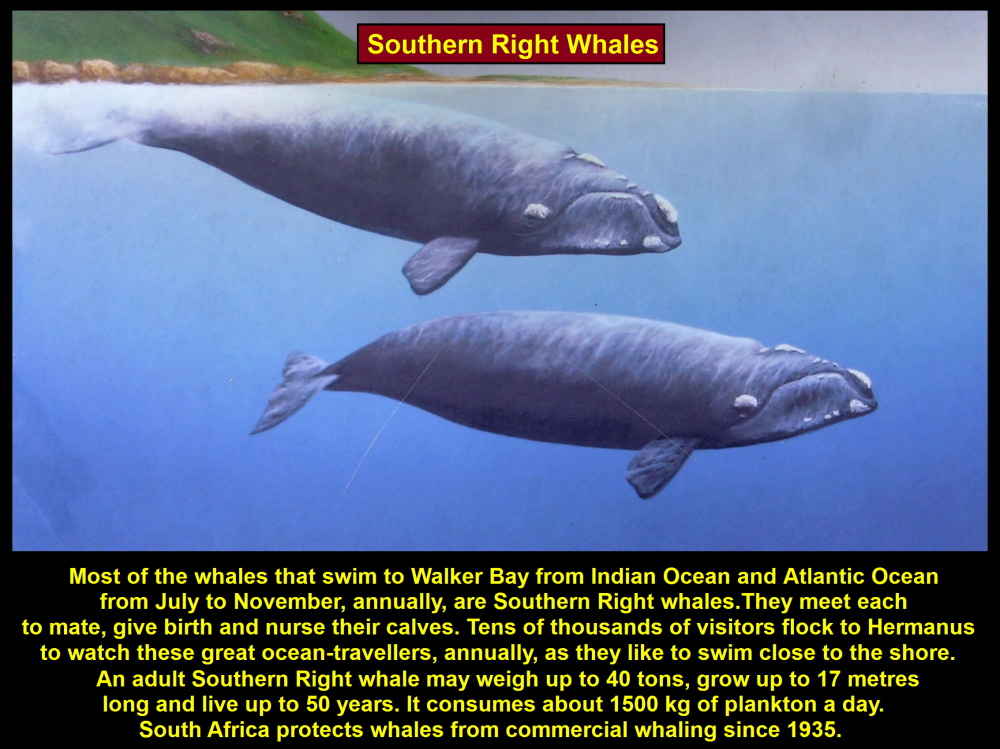
Southern Right whales can be sighted in Walker Bay in Hermanus from July till November every year.

Names of parts of Southern Right whales
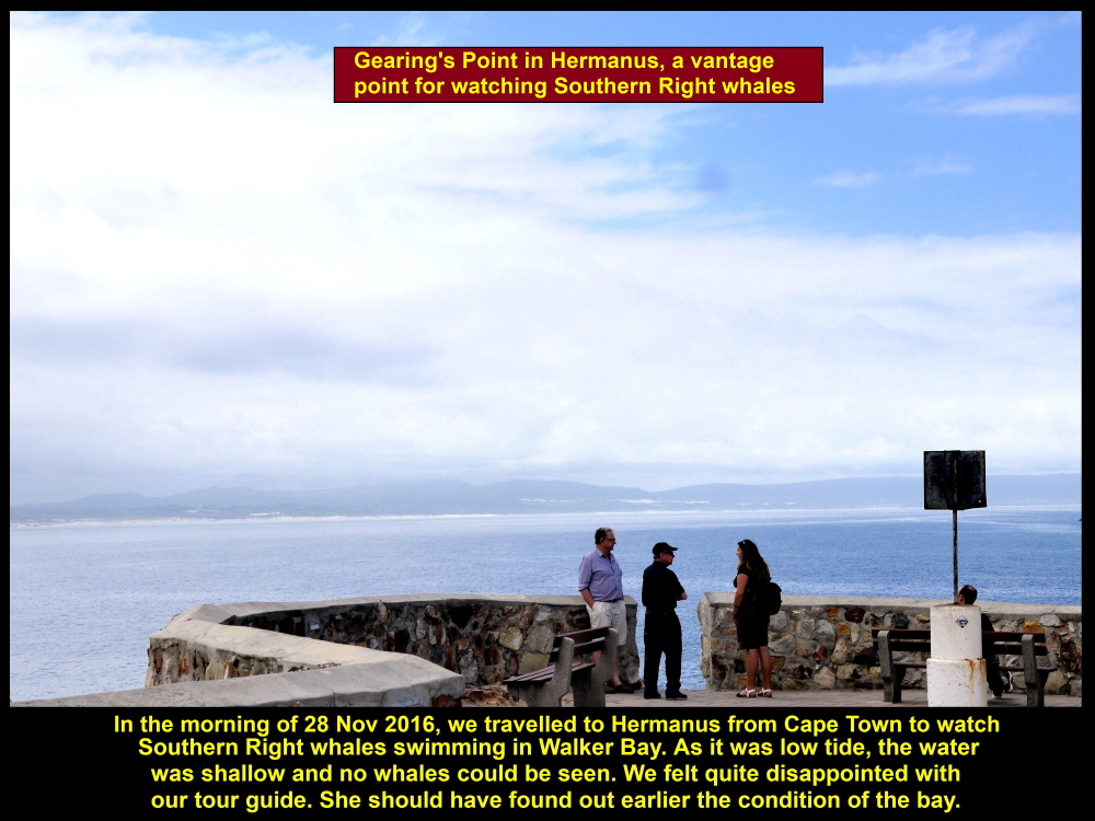
Gearing’s Point
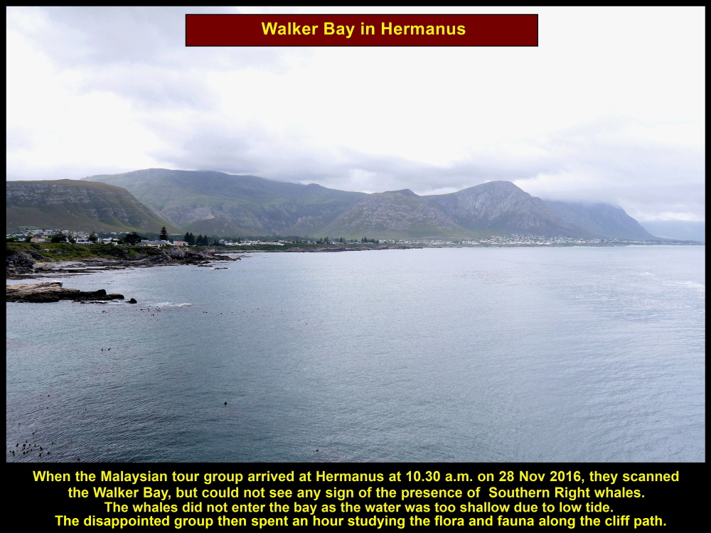
On arrival at Hermanus town, we walked to a place on a cliff, Gearing’s Point, to look out for Southern Right whales in a bay called Walker Bay.
Disappointment
After spending several minutes looking out for the whales, we realized that no whales would go to the bay at that moment due to low tide. Out trip there to watch whales was wasted. We felt quite disappointed with our tour-guide because she did not find out the condition of the bay earlier.
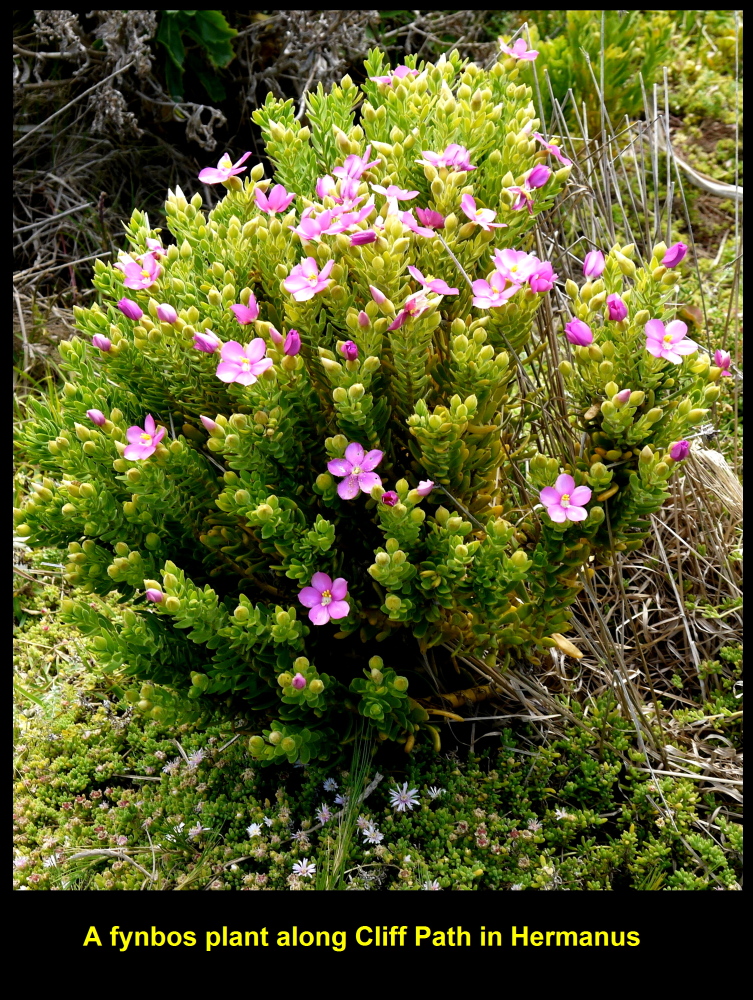
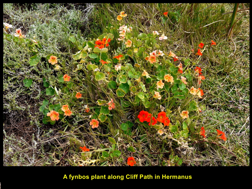
Flora and Fauna
Anyway, we spent the rest of our time walking along a path on the cliffs studying the flora and fauna. The area is covered with fynbos vegetation consisting of diverse, small plants that produce colourful flowers, like erica and protea plants. Below are some of the plants found along the cliff-path.
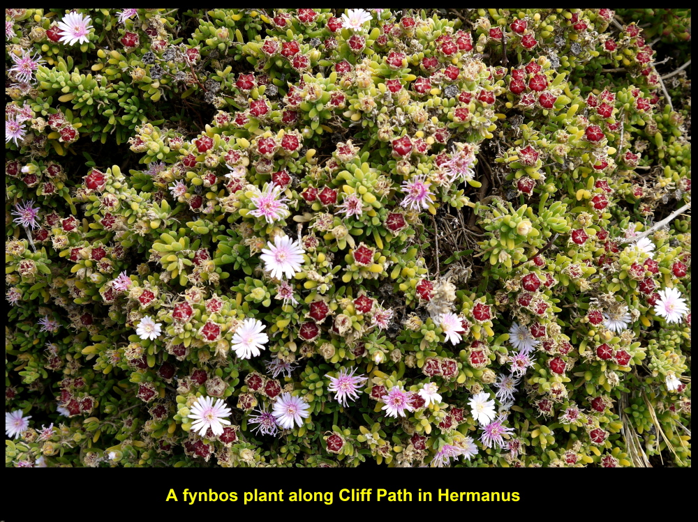
A fynbos plant along Cliff Path in Hermanus
A fynbos plant along Cliff Path in Hermanus
A fynbos plant along Cliff Path in Hermanus
Rock Hydraxes
Along the path we saw a few guinea-like mammals known as rock hydraxes basking on rocks. Some visitors felt excited and took photos of the animals. They were resting on the rocks oblivious of the presence of human beings.
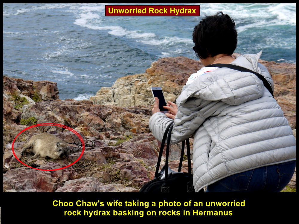
Choo Chaw’s wife taking photo of a rock hydrax

Rock Hydrax looks like a guinea pig basking in the sun.
Cormorants
We heard some birds chirping among the plants and saw several cormorants basking on a rock in Walker Bay several hundred metres away from the shore.
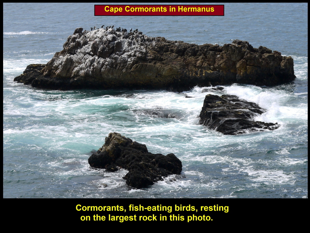
Cormorants resting on a large rock in Walker Bay, Hermanus
“Sculptures on the Cliffs”
Sculptures created by South African artists could be seen at a place known as “Sculpture on the Cliffs” at Gearing’s Point. Here are some sculptures I photographed at the place:
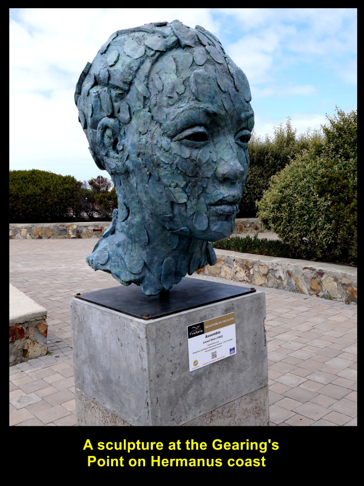
Sculpture of a head at Gearing’s Point
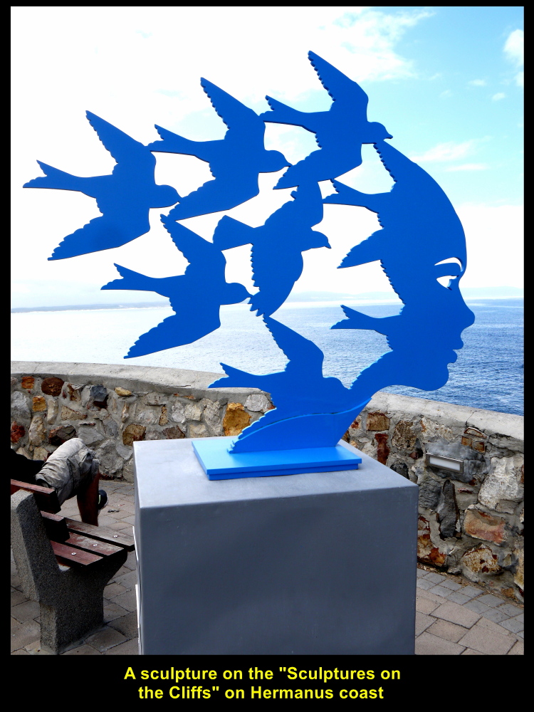
Sculpture of birds at Gearing’s Point in Hermanus

Sculpture of a tall steel man at Gearing’s Point in Hermanus
War Memorial Monument
Before we left Hermanus we came across a war memorial monument erected on a cliff in memory of those local soldiers who were killed in World War I(1914-1918) and World War II(1939-1945).
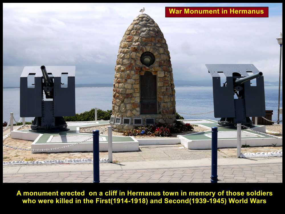
A monument erected in Hermanus Town in memory of the fallen soldiers in WWI(1914-1918) and WWII(1939-1945)
Having spent an hour exploring Hermanus Town and feeling disappointed for not being able to watch any whales swimming in Walker Bay, we left for another place known as Cheetah Outreach.
Cheetah Outreach
Located about 70 km north-west of Hermanus, Cheetah Outreach provides “an education and community-based programme created to raise awareness of the plight of the cheetah and to campaign for its survival”. It is in a region known as Somerset West.
Red Alert
The world population of cheetahs was 100,000 in 1900 and then plummeted to 10,000 in 1990. It dropped further to 7,500 in 2013. Soon these animals will disappear from earth if no drastic conservation efforts are taken.

World population of cheetahs plummeted from 100,000 in 1900 to 10,000 in 1990.
In South Africa, the number of cheetahs was 700 in 2007. But in 2016, it increased to 1,500 due to serious conservation efforts.
Annie Beckhelling
Cheetah Outreach was founded by Annie Beckhelling in 1997 with the purpose of “promoting the survival of the free ranging South African cheetah through environmental education and delivering conservation activities”.
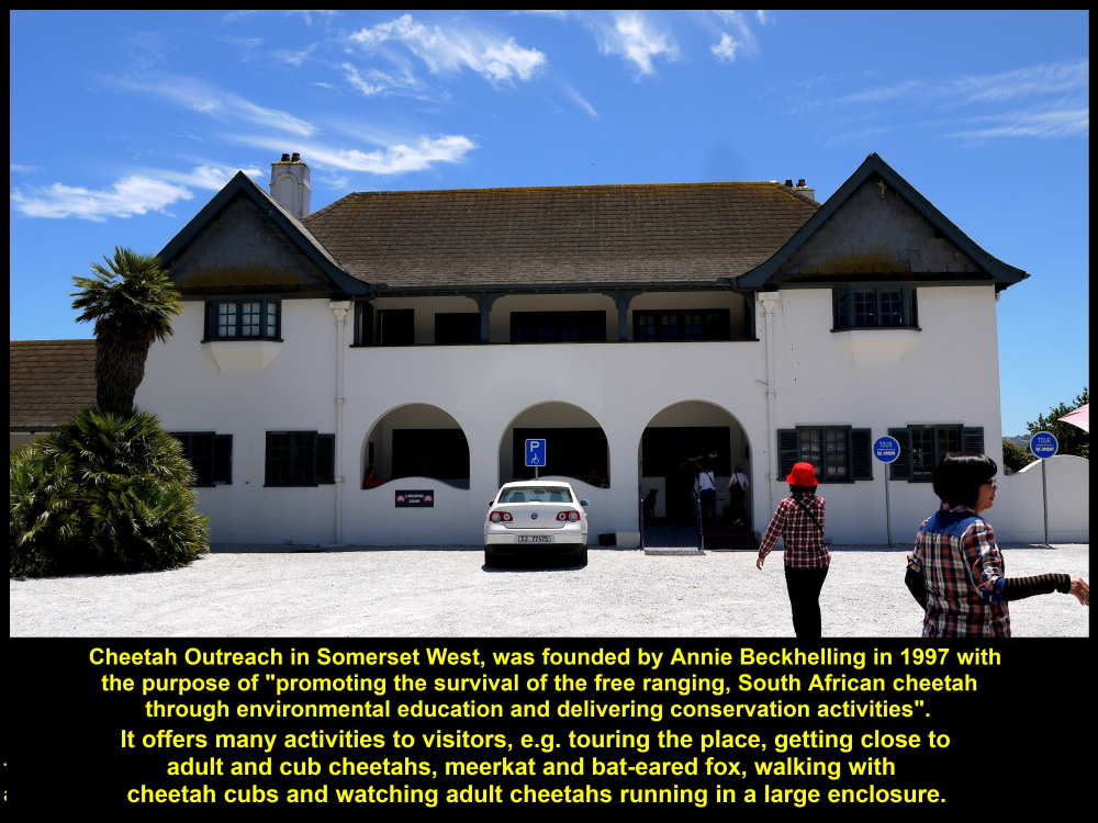
Cheetah Outreach was founded by Annie Beckhelling in 1997.
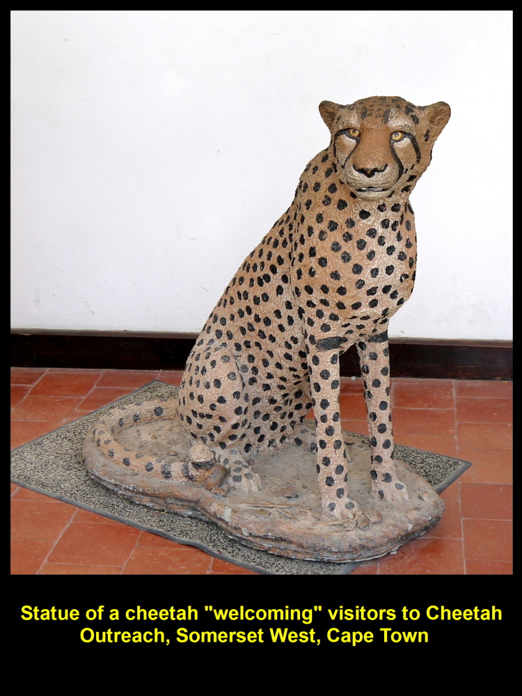
Statue of a Cheetah at the entrance of Cheetah Outreach welcoming visitors
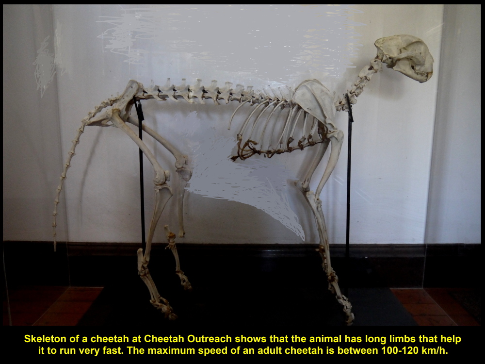
A cheetah skeleton shows that the animal has four long limbs that help it to run faster than other kinds of animals
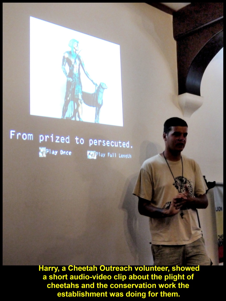
Harry, Cheetah Outreach Volunteer
On arrival at Cheetah Outreach, we were greeted by a volunteer Harry. He ushered us into a room and shown us a short audio-video clip about cheetahs, their plight, conservation programs to save and increase their population, etc.
A short show about cheetahs at Cheetah Outreach

Lethal predator control used by livestock farmers against cheetahs
Cheetah Outreach Activities
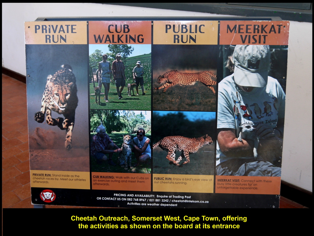
Cheetah Outreach offers many activities, such as guided tour of the place, getting close to cheetahs, meerkat and bat-eared fox, and watching cheetahs run in a large enclosed, open field, to name a few.
Cheetah Outreach’s activities for visitors
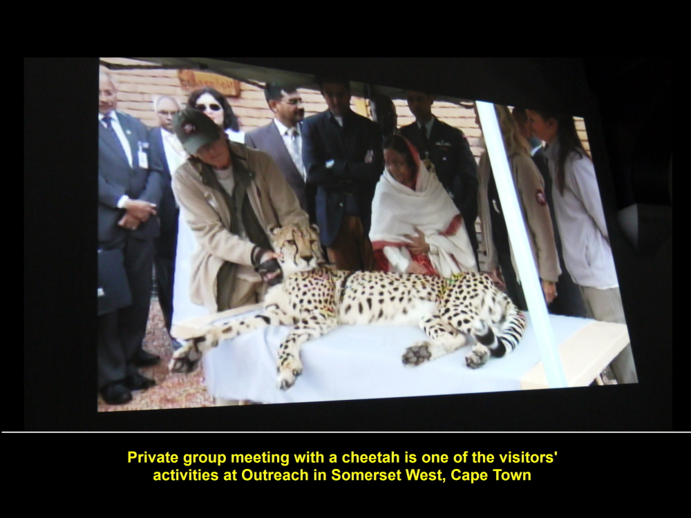
Private group meeting with cheetah
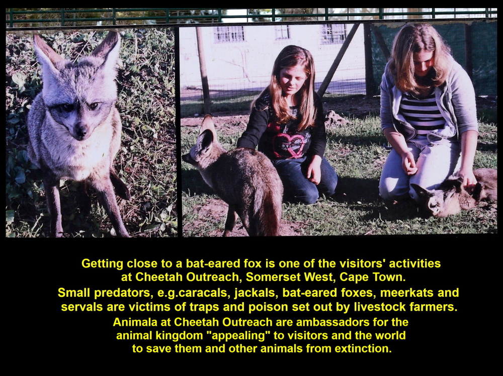
Getting close to small predators, e.g. bat-eared fox, meerkat and caracal
Animal Kingdom Ambassadors
After the show, Harry brought us round outside to see some animals, such as dogs, bat-eared fox and cheetahs. He told us that those animals were “ambassadors” for animal kingdom “appealing” to visitors and the whole world to save their kinds and other animals from extinction.
Lethal Predator Control
Livestock farmers in Southern Africa used lethal predator control against cheetahs to protect their livestock(cattle and goats). Examples of the control were using traps and poison. This lethal control had diminished the number of cheetahs, greatly. Besides, many victims of this control, like bat-eared foxes, caracals, meerkats, and other wild animals were killed.
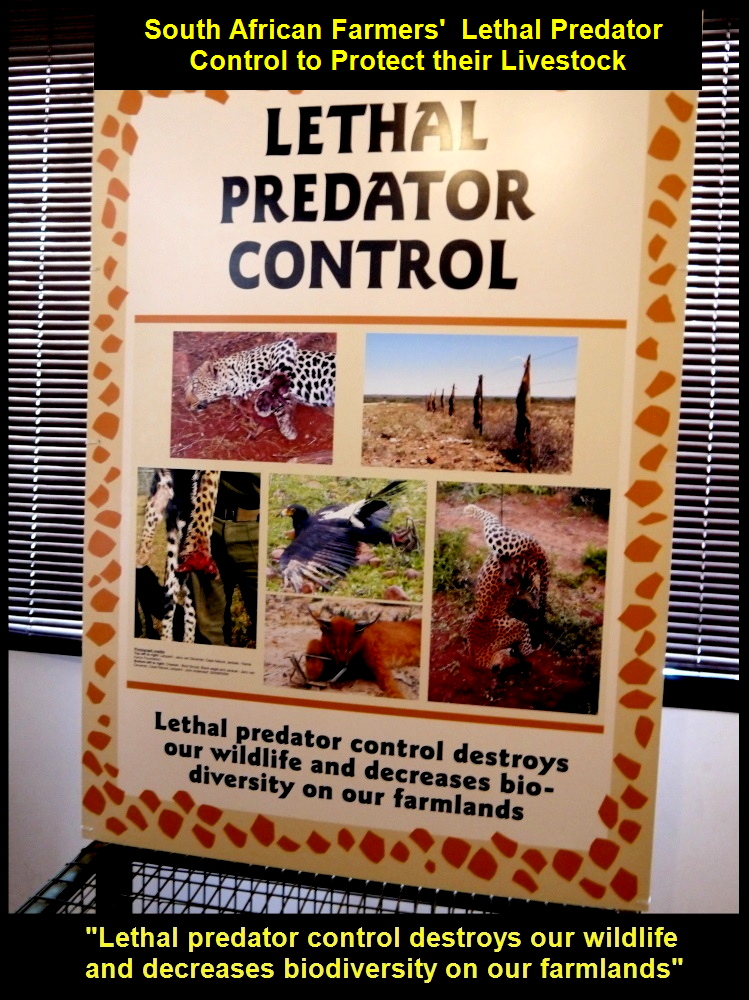
South African farmers’ used lethal predator control to protest their livestock.
Livestock Guarding Dog Program
In 2005 Cheetah Outreach carried out a program called “Livestock Guarding Dog Program”. They bred Anatolian Shepherd dogs and gave them away to the farmers to guard their livestock against the predators. As the dogs are good protectors of livestock, farmers continue to use them. Consequently, more wild cheetahs and other animals were saved.

Farmers are encouraged to use dogs to guard their livestock against predators
Cheetah Run
The last place Harry brought us to was a large enclosure, a large fenced-up field, where cheetahs would run for visitors on a high platform to watch. As it was animals’ feeding time while we were there, all animals’ activities were stopped.
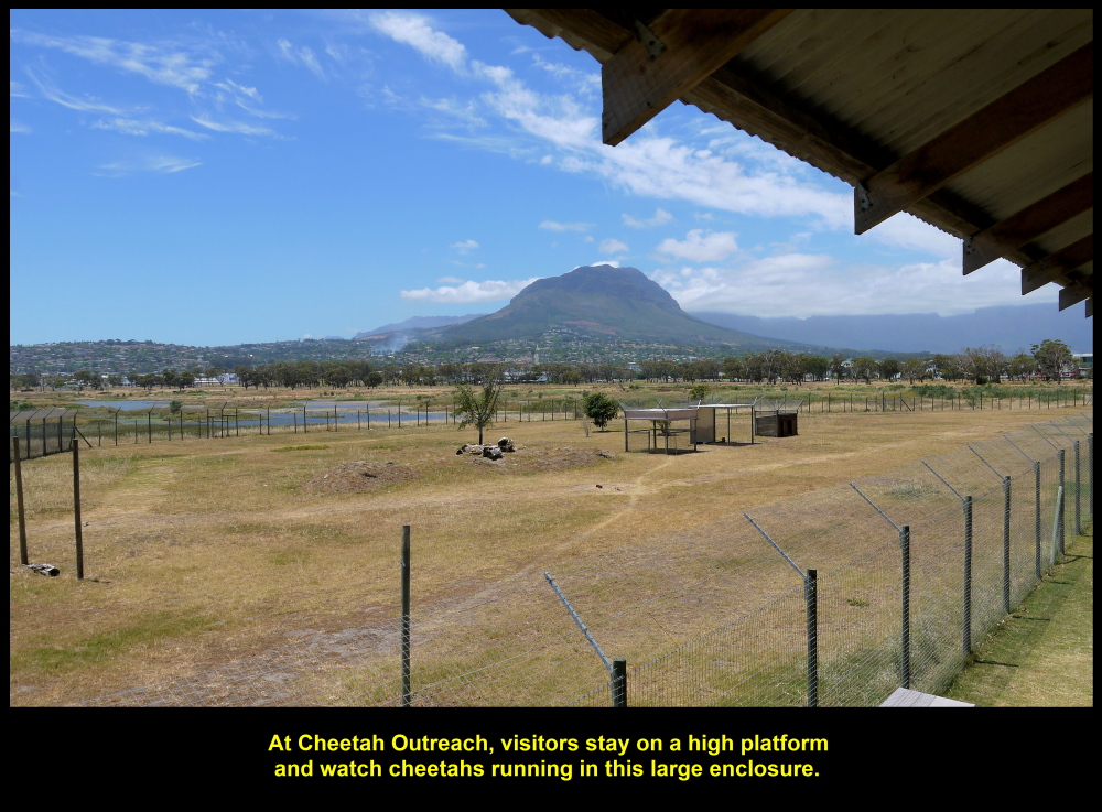
Visitors can watch cheetahs running in this large fenced-up field from a high platform.
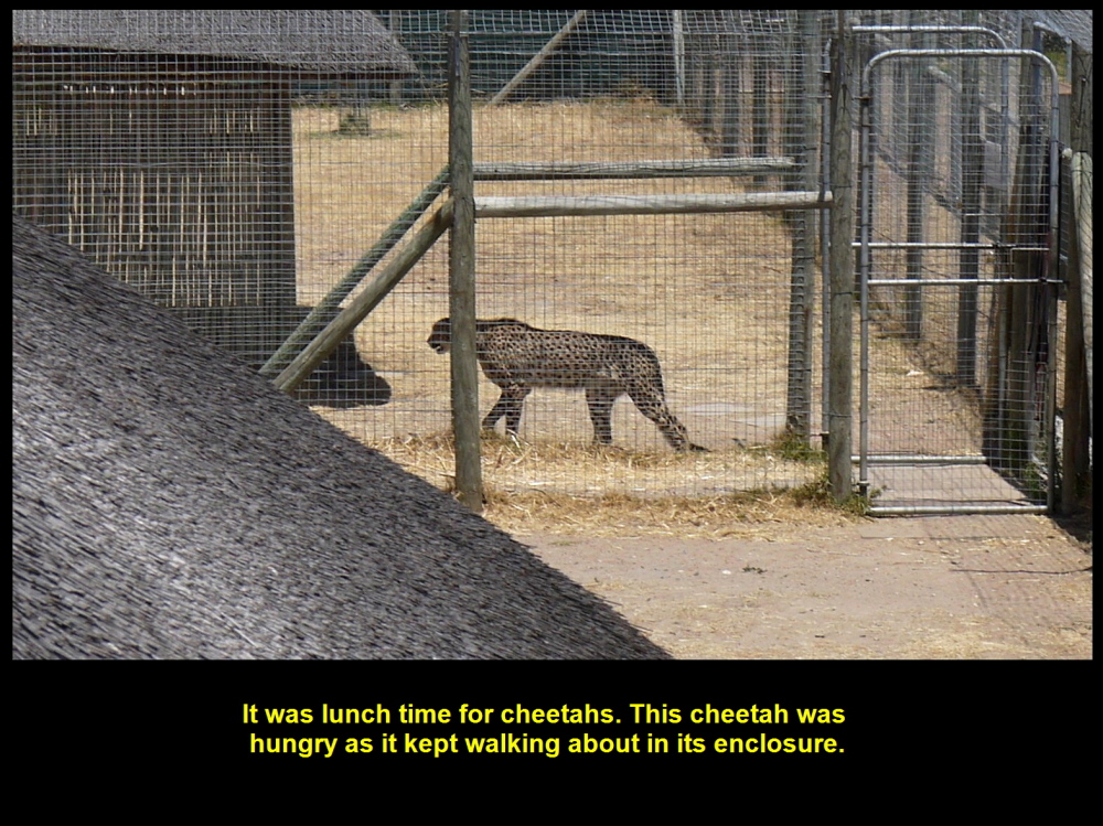
A hungry cheetah walking about and waiting for its food in an enclosed area.
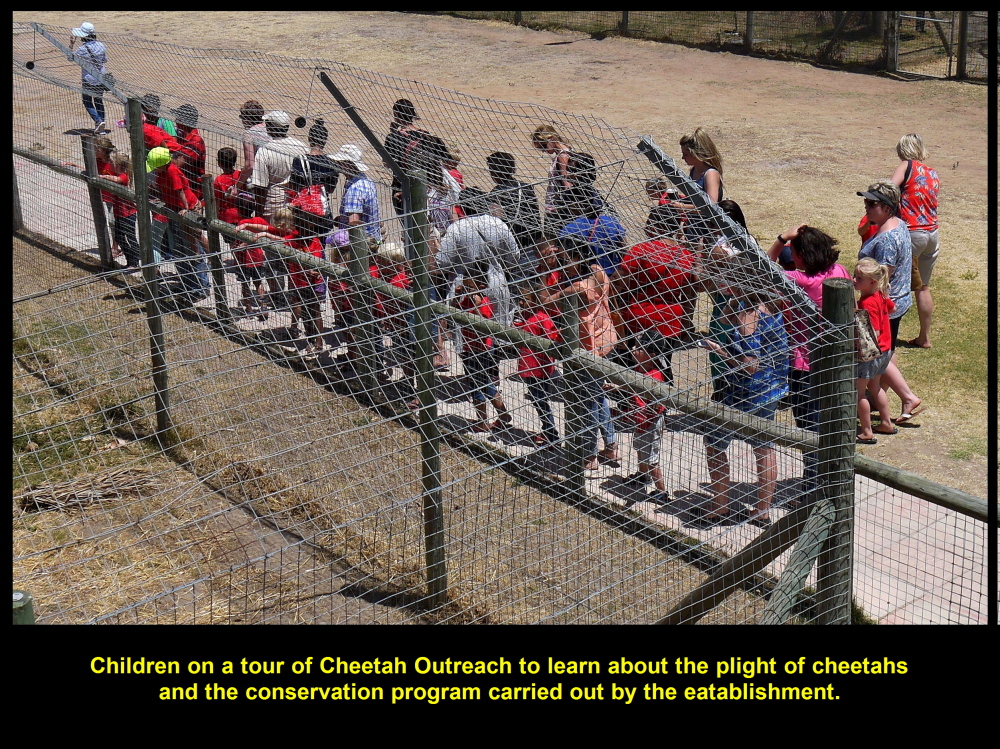
Children visiting Cheetah Outreach `to learn about the endangered species

Choo Chaw and Harry on a high platform where visitors can watch cheetahs running in a large enclosed field
Thanking Harry
Finally, we thanked Harry for the Cheetah Outreach tour. It has made us realize that the existence of wild animals is under constant threat by poaching, deforestation, lethal predator control and other unfavourable factors. Thanks to Cheetah Outreach for making the public aware of the plight of wild animals.
Neethlingshof Wine Estate
Our next destination was a grape-growing area known as Neethlingshof Wine Estate. It is in a large grape-growing region, Stellenbosch, which is about 15 km north of Cheetah Outreach and 42 km east of Cape Town.
Stellenbosch
Stellenbosch is a well-known grape-growing region in South Africa as its climatic and soil conditions are suitable for grape-growing. Grapes have been grown in the region since 1690. Now more than 200 grape-growers and wine-makers are found there. They produce one trillion litres of wine, annually.
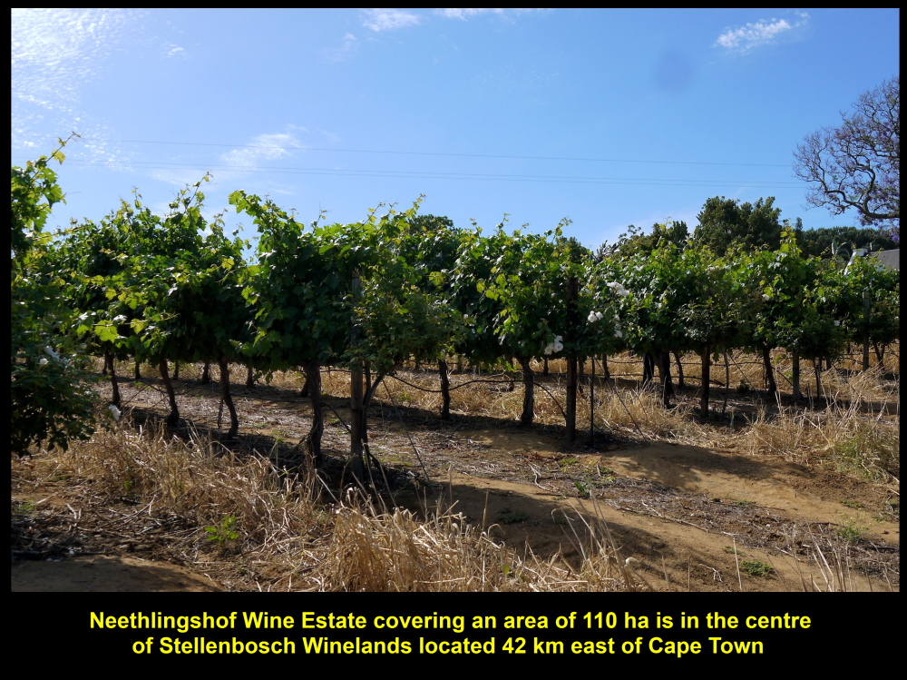
Neethlingshof Wine Estate has 110 ha of vineyard in Stellenbosch, South Africa
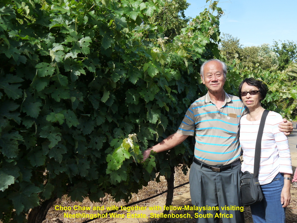
Choo Chaw and wife together with fellow-Malaysians visiting Neethlingshof Wine Estate
Winery
When we arrived at Neethlingshof Wine Estate we headed straight to its winery. It has been producing wine since 1788. At the winery, a young, pretty lady, Tami, greeted us and conducted a tour of the winery for us.
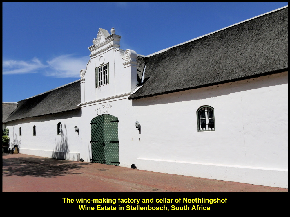
Winery of Neethlingshof Wine Estate, Stellenbosch, South Africa
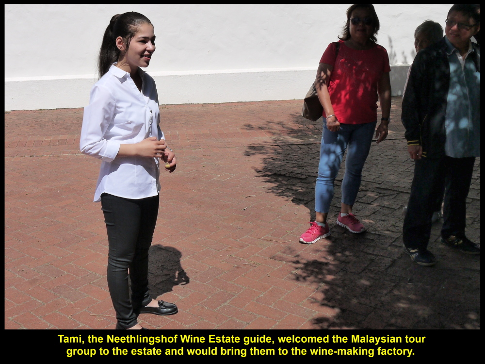
Tami greeted the Malaysian tour group and would talk about wine-making inside the factory or winery.
Tami, the Winery Guide
We went into a building where wine-making machines were kept. Tami told us the processes of wine-making, namely harvesting, crushing, pressing, fermentation, clarification(filtration), aging and bottling.
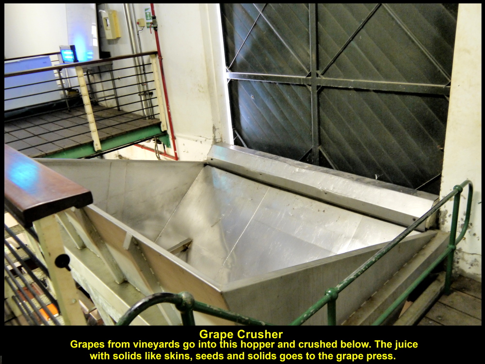
Grapes are crushed in this machine
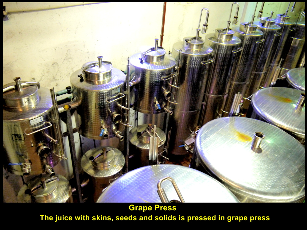
Juice with skins, seeds and solids are pressed in these machines
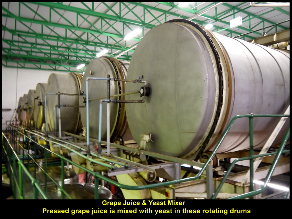
Grape juice and yeast are mixed in these machines
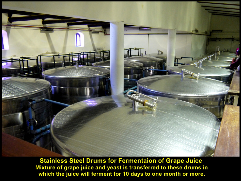
Grape juice with yeast fermenting in these stainless steel drums
Wine-Aging
In the cellar there were large and small oak-drums for wine-aging. The purpose of aging is to create flavours and textures of the wines. Each large drum has a volume of about 5,000 litres and small one 30 litres.
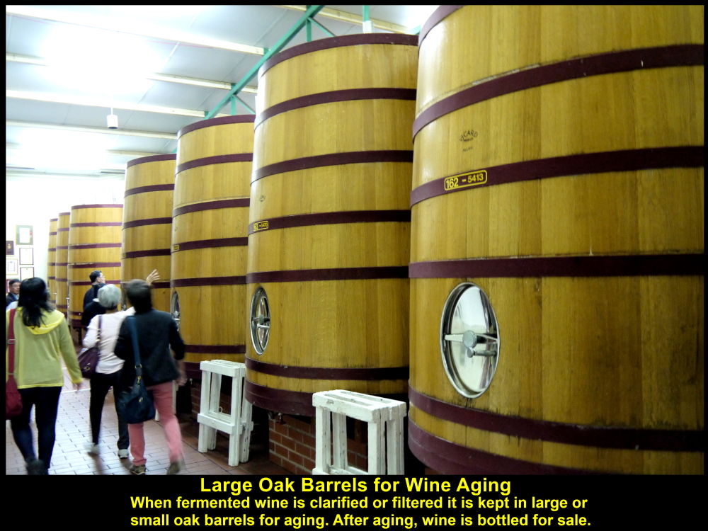
Large oak drums for wine aging so that the wine has flavours and textures.
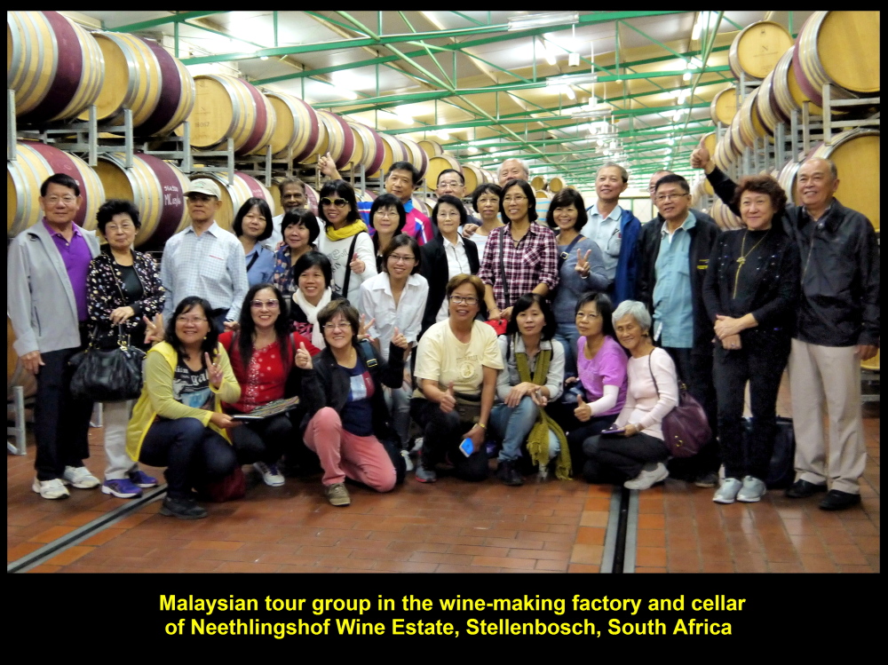
Malaysian tour group visiting the winery and the small oak barrels for wine aging
Young Grapes
As the grapes in the vineyards were young and growing the wine-making was stopped. Those grapes would ripen three months later.
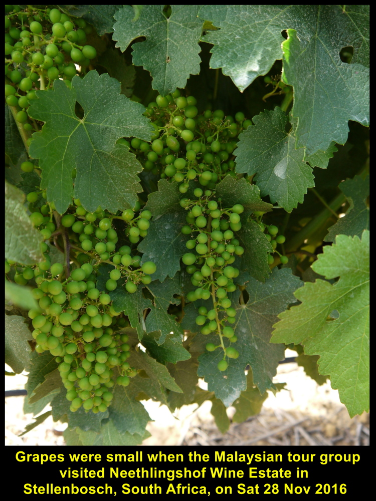
Grapes were young when Malaysian tour group visited Neethlingshof Wine Estate
Wine-Tasting
After the tour Tami offered us five kinds of wine to taste and we enjoyed drinking them.

Tami offering different kinds of wine for tasting
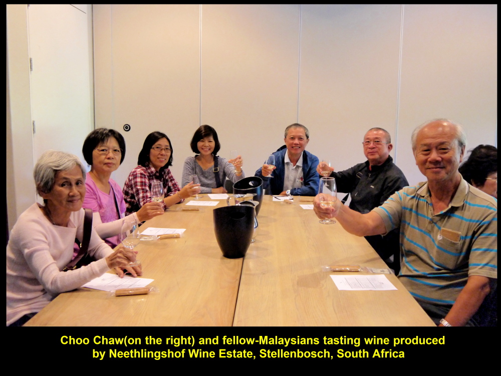
Choo Chaw(right) and fellow-Malaysians tasting wine
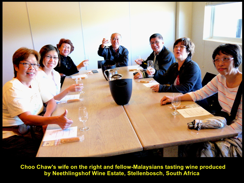
Choo Chaw’s wife and others tasting wine

Fellow-Malaysians tasting wine
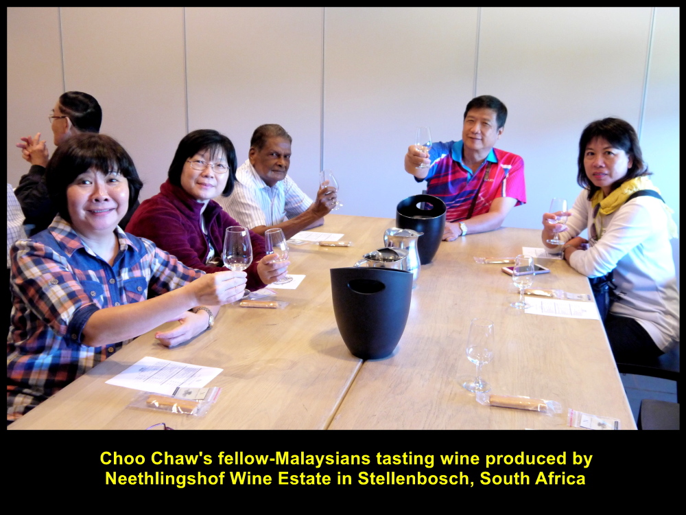
Fellow-Malaysians tasting wine
A few fellow-Malaysians bought some bottles of wine before we left Neethlingshof Wine Estate.
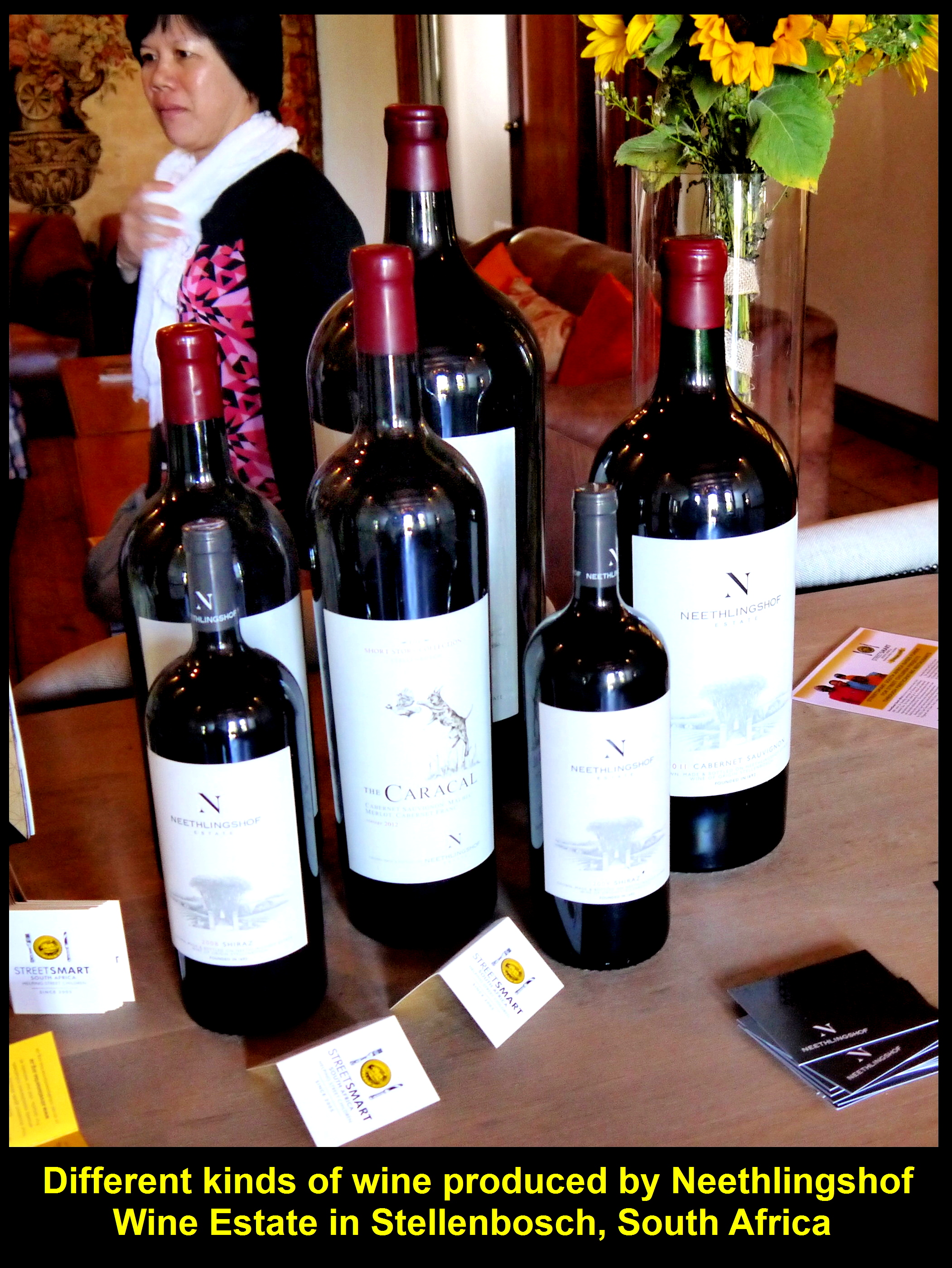
Different kinds of wine produced by Neethlingshof Wine Estate in Stellenbosch, South Africa
Jewel Africa, Diamond Shop
The next place we went to was a diamond and tanzanite shop, Jewel Africa, in the city of Cape Town. South Africa is the largest producer of diamond in the world. The largest diamond weighing 605 grams in the world was found in South Africa. It was found in a mine near Pretoria in 1905. They called it “The Cullinan”, named after the Chairman of the mine, Thomas Cullinan.
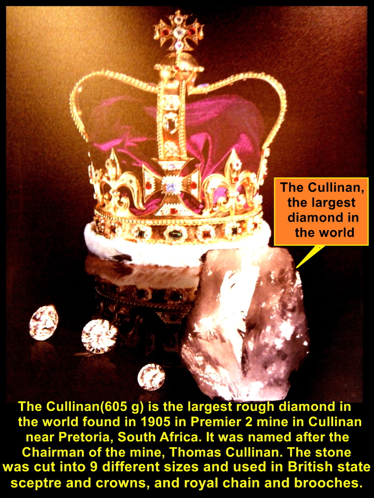
The largest diamond, The Cullinan, weighed 605 grams and used in British crowns and spectre, and royal members’ jewellery.
Cullinan I-IX
It was then cut into 9 pieces calling them Cullinan I to IX. The heaviest one is Cullinan I that weighed 106 grams and the lightest, Cullinan IX is 0.9 gram. They were used for the British crowns and spectre, and royal members’ brooches, ring and chain, too.
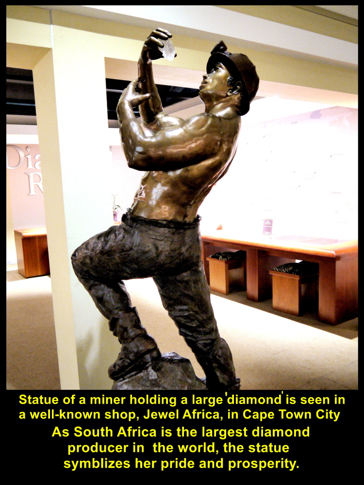
Statue of Diamond miner
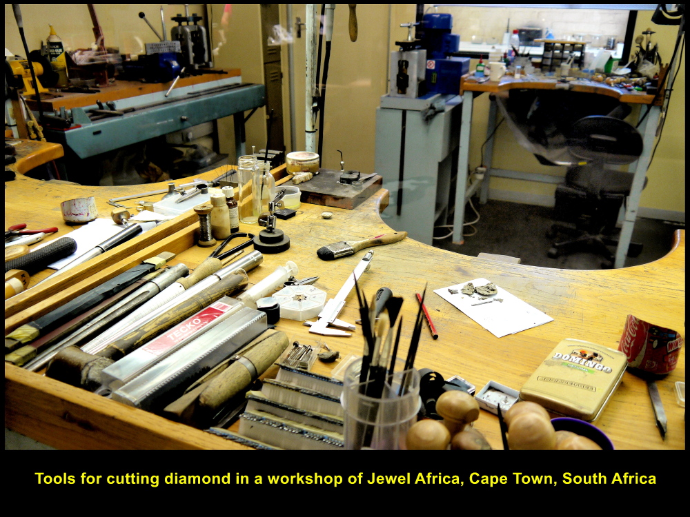
Diamond cutting tools in Jewel Africa workshop
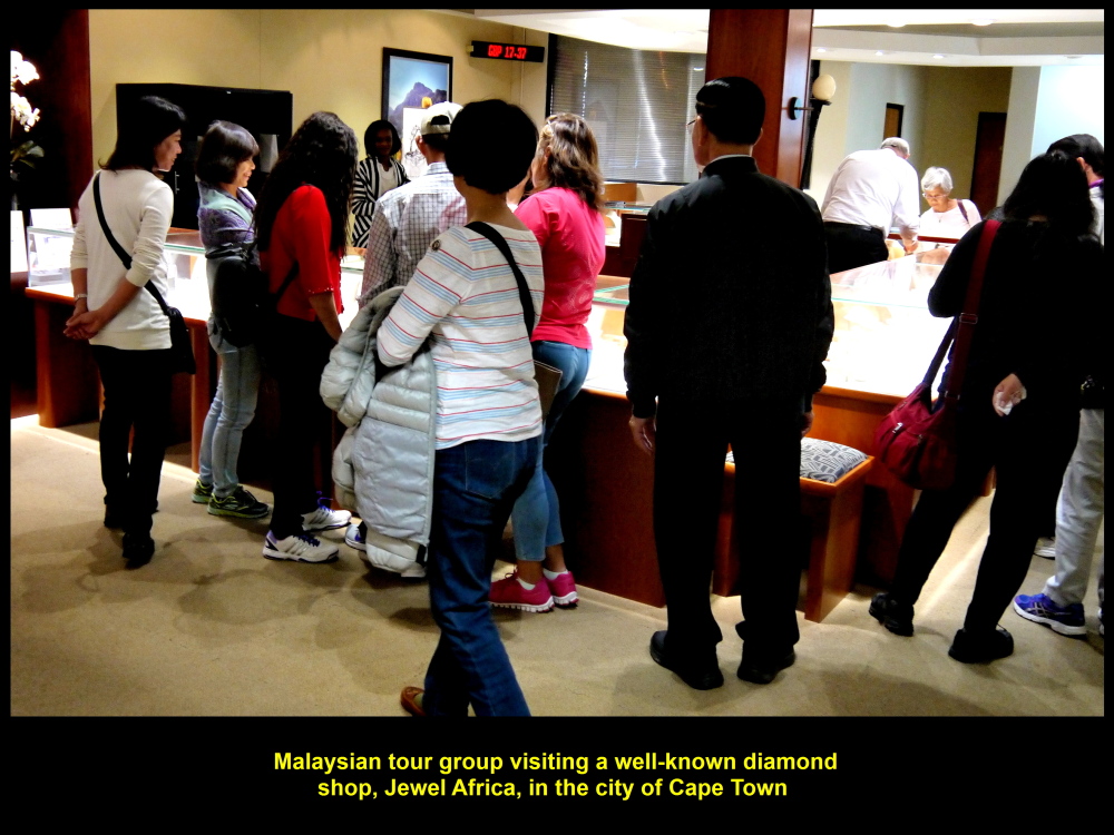
Malaysian tour group visiting Jewel Africa, a famous diamond jewellery shop in Cape Town
Expensive Jewellery
Jewel Africa had quite a variety of jewellery studded with diamond and tanzanite. As they were quite expensive, nobody bought any. So we left the place to the disappointment of the staff and went to a hotel for dinner, Rockwell Hotel.
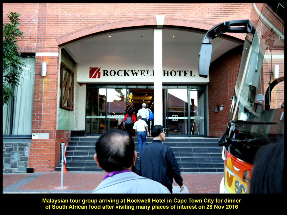
South African food dinner at Rockwell Hotel in Cape Town City
Yellow Man
On arrival at the hotel, we were greeted by a tall, yellow man at the entrance. Some of us were fascinated by him and took photo with him.
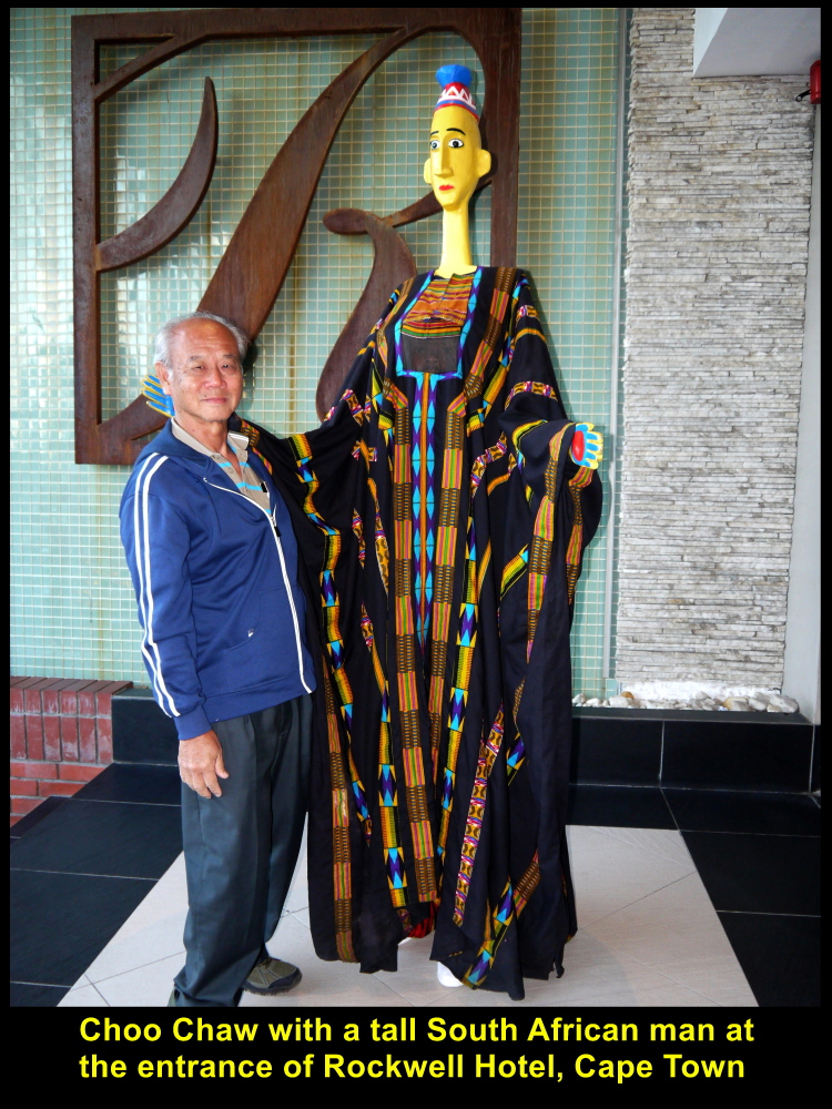
Choo Chaw taking photo with a tall, yellow man

Some fellow-Malaysians taking photo with the tall, yellow man
Exotic South African Food
Then we were ushered into a small theatre-hall where we had exotic South African food for dinner. It consisted of many kinds of dishes that we could not finish.
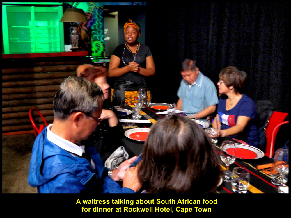
A waitress talking about South African food before it was served
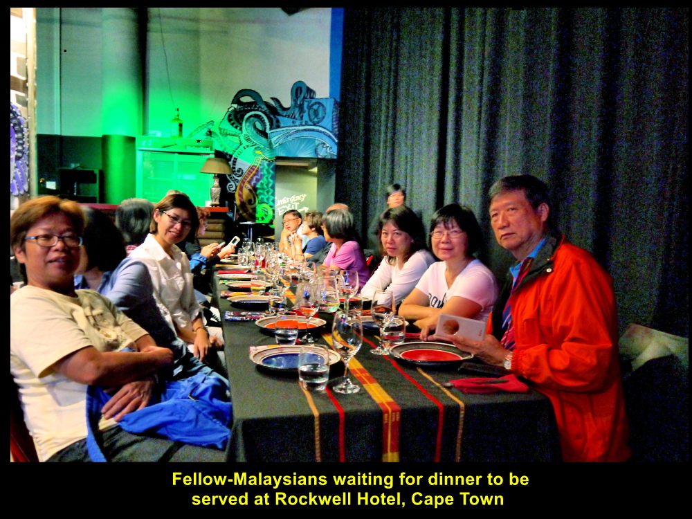
Malaysians waiting, patiently, for dinner to be served
South African Dance
In the midst of the meal, we were entertained by musicians and dancers. Three of our friends let their hair down as they danced with them, happily.

Musicians and dancers entertaining the Malaysian diners
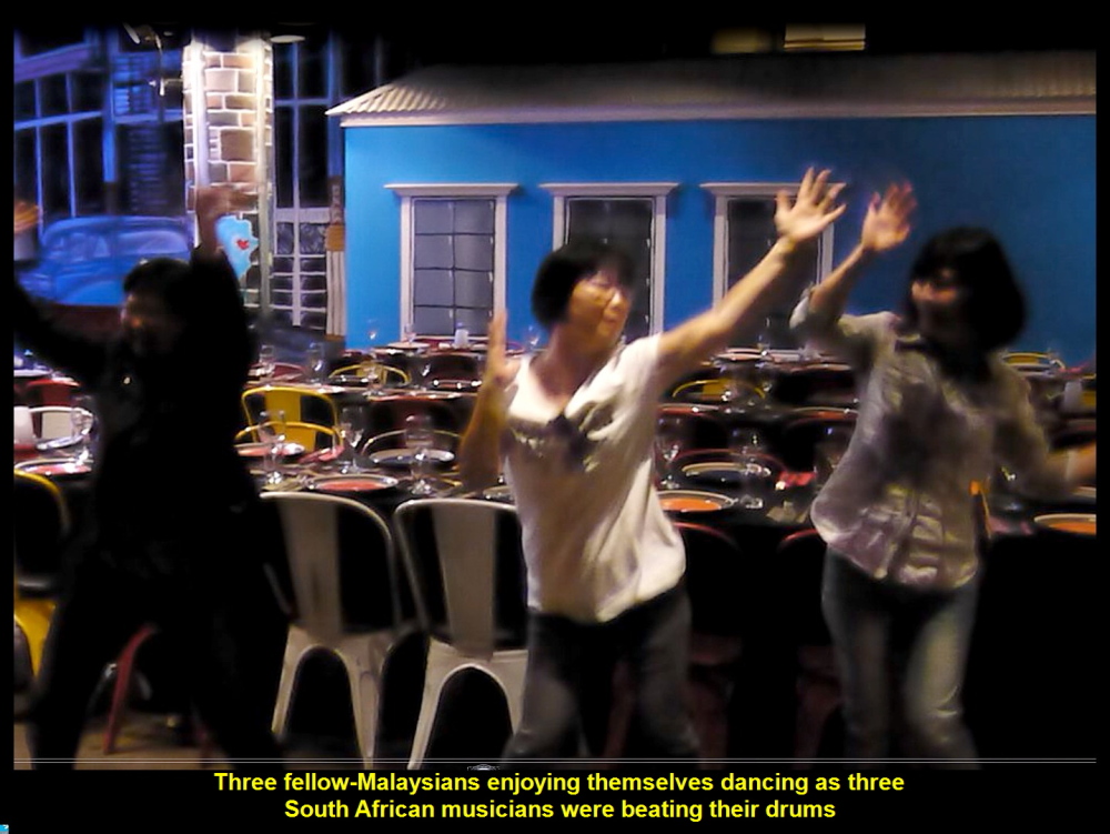
Malaysian dancing, happily
Here are some of the South African dishes we had for the dinner.
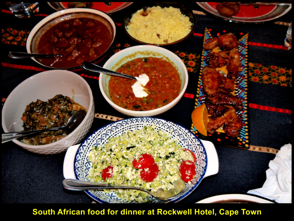
South African food for dinner
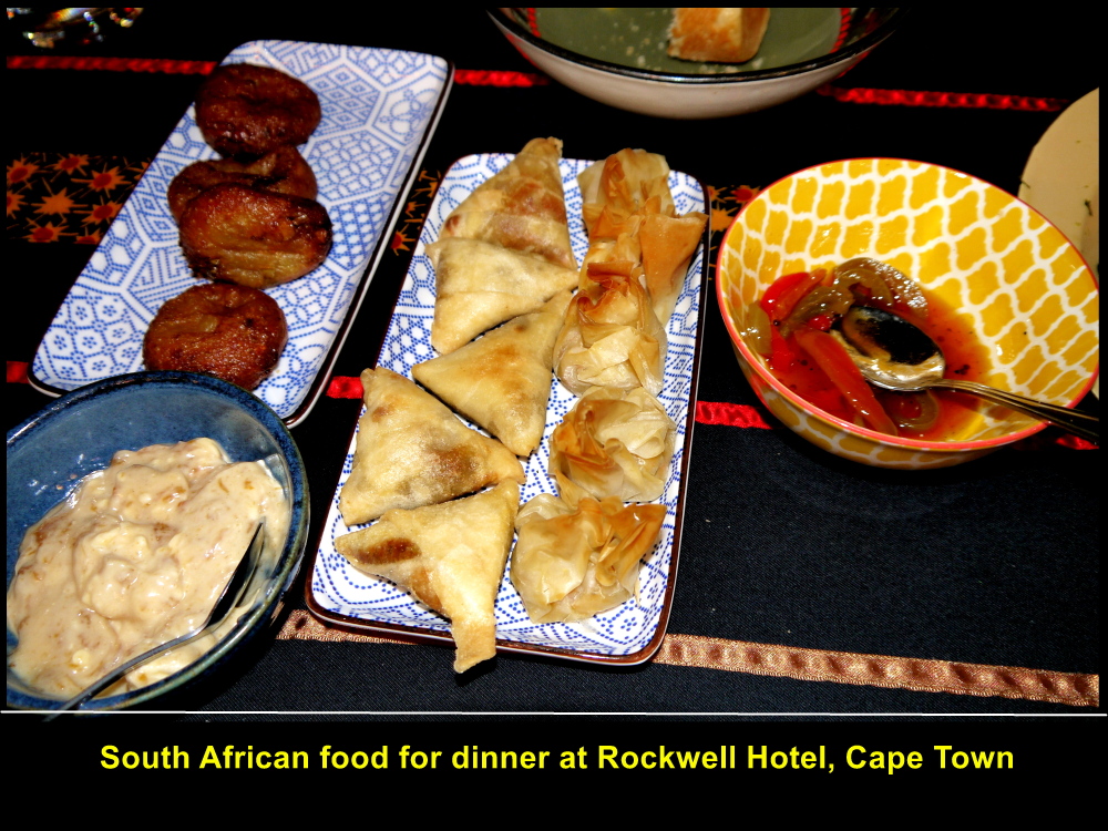
More South African food for dinner
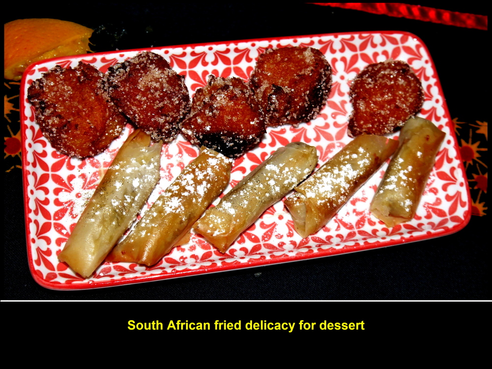
South African dessert after dinner
Photo Session
After dinner, some of us took photos with the waiters and waitresses for remembrance.
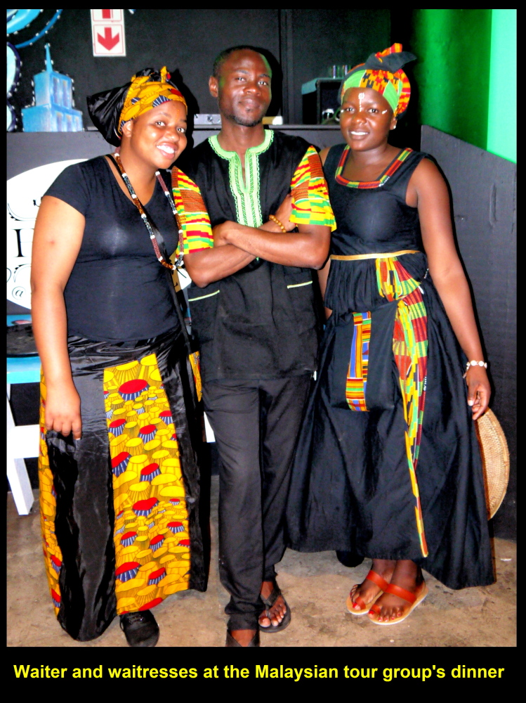
Waiter and waitresses
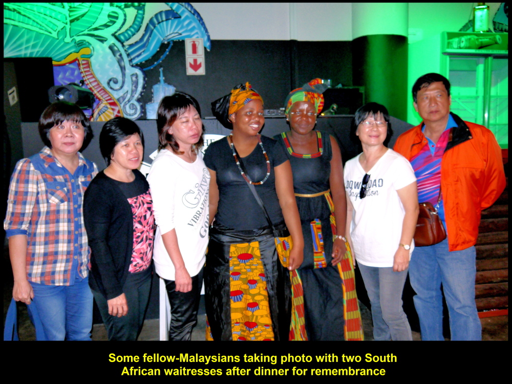
Fellow-Malaysians taking photo with two waitresses
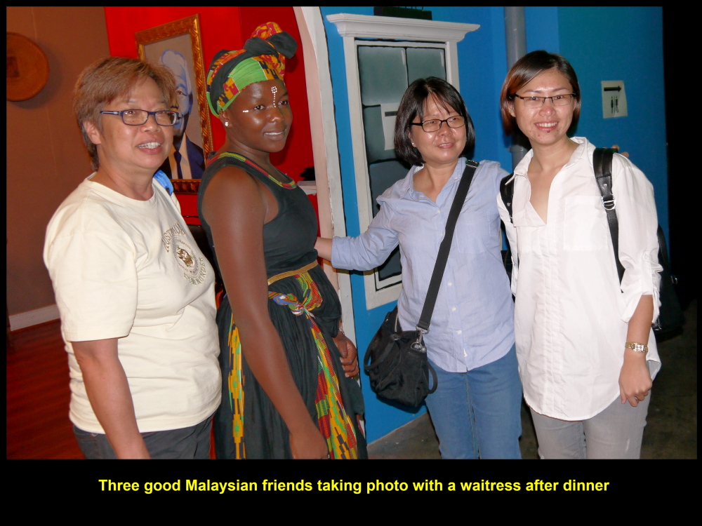
Fellow-Malaysians taking photo with a waitress for remembrance
Back to Hotel
Finally, we went back to our hotel, Southern Sun Hotel, which was nearby.
It was another busy but unforgettable day as we had visited a few interesting places, namely Hermanus, Cheetah Outreach, Neethlingshof Wine Estate and Jewel Africa.
The following day would be another busy one visiting a few significant spots on the Cape Peninsula that is south of Cape Town City.
(continue in South Africa Part IV)
Written by Choo Chaw
South Africa Travel Part I: Air Flight from KLIA to Cape Town, Cape Town Shantytowns
South Africa Travel Part II: Table Mountain, Malay Quarter, Castle of Good Hope. A & V Waterfront
South Africa Travel Part III: Hermanus, Cheetah Outreach, Stellenbosch, Jewel Africa
South Africa Travel Part IV: Duiker Island of Seals, Cape Point, Boulders
South Africa Travel Part V: Cape Town to Johannesburg, Pilanesberg National Park(Game Drives)
South Africa Travel Part VI: Sun City, Union Buildings, Vootrekker Monument
South Africa Travel Part VII Kruger Museum, Church Square, Melrose Museum, Carnivore Restaurant
South Africa Travel Final Part Gold Reef City: Gold Mine Museum
South Africa Travel Part I: KLIA to Cape Town Airport
South Africa Travel Part I: KLIA to Cape Town Airport
About South Africa
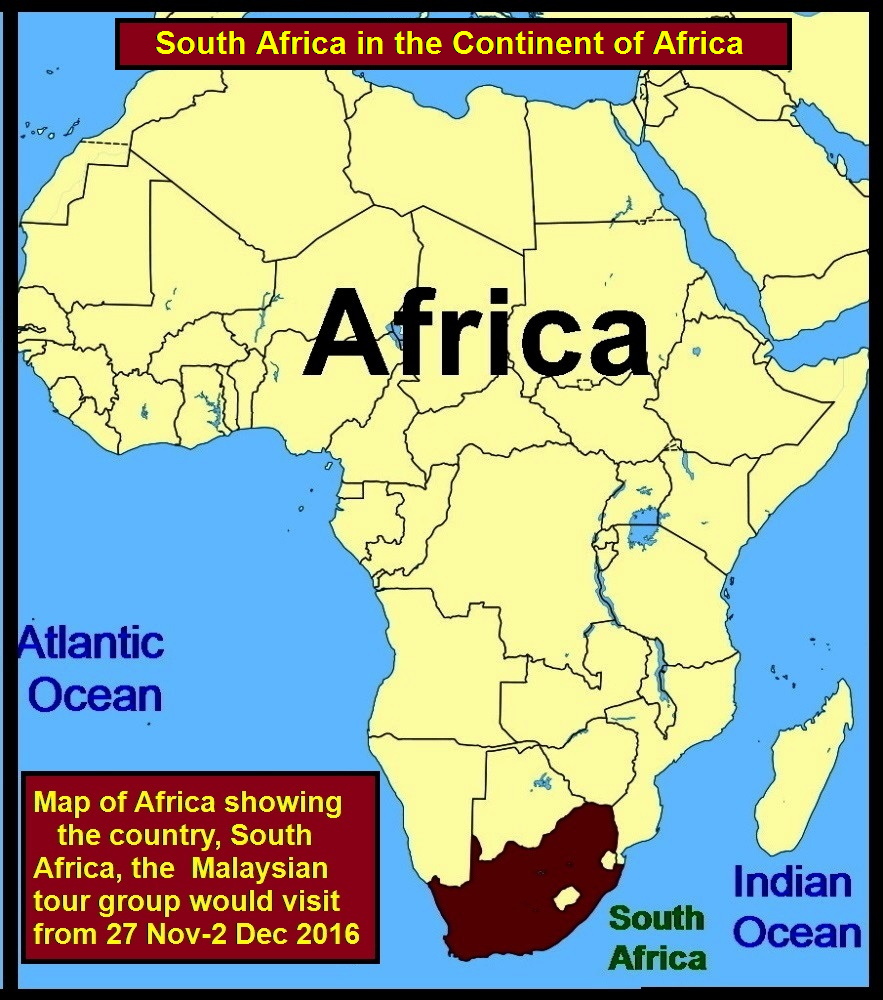
Map showing the location of South Africa
South Africa is in the southern part of the continent of Africa. She is a nation of 55 million people comprising 80.2% Black, 8.8% Coloured, 8.4% White and 2.5% Asians(2014) according to Wikipedia. The people are of diverse origins, races, cultures, languages and religions.
South Africa is now a well-known tourist country that attracts tens of millions of visitors from all over the world every year, as it has many interesting places.
Day 1 Saturday, 26 Nov 2016
Air Flight from Malaysia to Mauritius
Malaysian Tour Group
On Saturday, 26 Nov 2016 my wife and I joined a Malaysian tour group of 26 to go to South Africa for a tour of some of the places there. The trip was known as “8D6N South Africa Tour”.
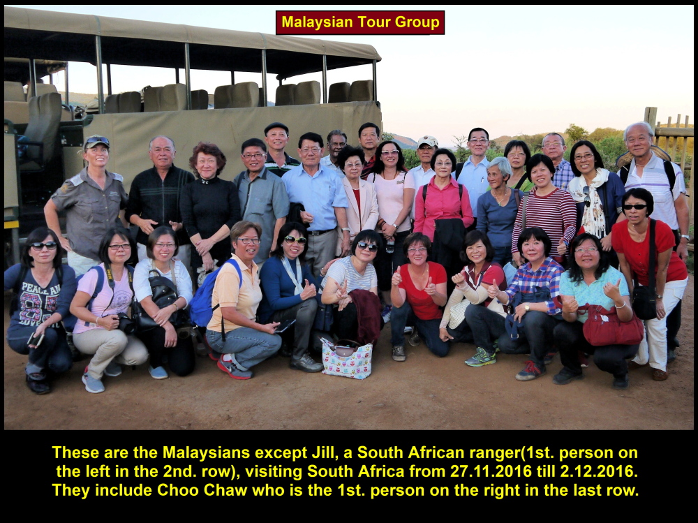
Malaysian tourists going for an 8D6N South Africa Tour
Golden Destinations Tour Leader, Pek Yee
The group was headed by a Malaysian tour leader of Golden Destinations Company in Kuala Lumpur, Pek Yee.
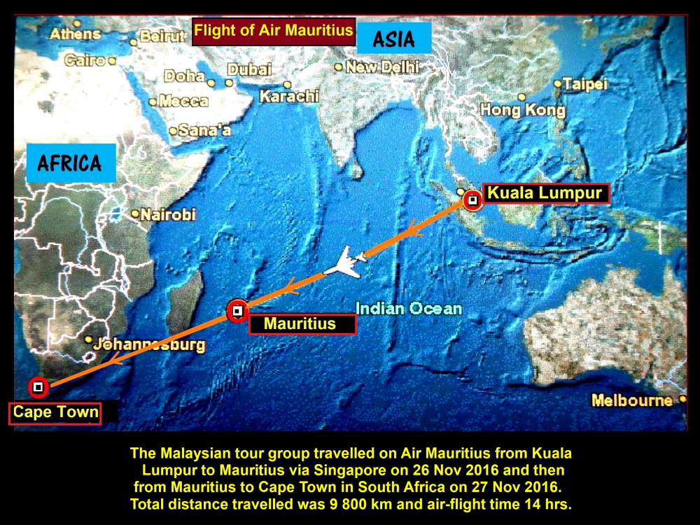
At 1.35 p.m.(Malaysian time) we boarded an Air Mauritius plane at Kuala Lumpur International Airport(KLIA) in Sepang and flew off to Mauritius in Indian Ocean via Singapore.
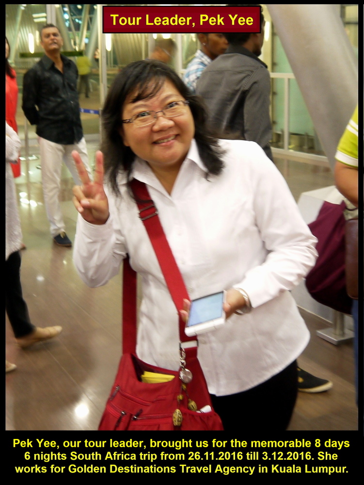
Pek Yee, the leader of the Malaysian Tour Group
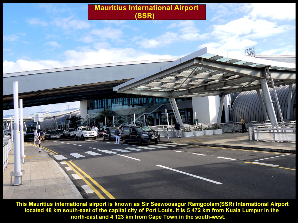
Mauritius International Airport
After travelling a long distance of 5 800 km in 9 hours including the stopover time in Singapore, we arrived at the Mauritius international airport which is known as Sir Seewoosagur Ramgoolam(SSR) International Airport. [SSR(1900-1985) was the first Chief Minister and Prime Minister of Mauritius.]
Air Mauritius bringing Malaysian tour group from KLIA to South Africa
SSR International Airport, Mauritius
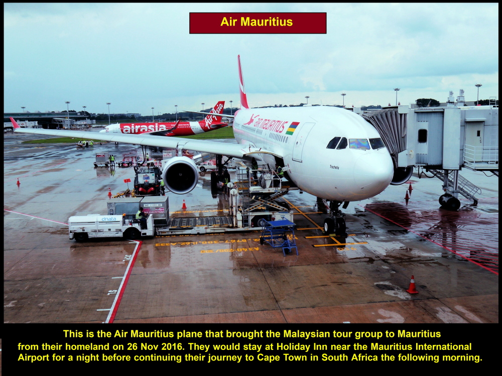
This Air Mauritius plane flew the tour group from KLIA to Mauritius via Singapore
Holiday Inn, Mauritius
We stayed at Holiday Inn which is near the airport for a night before we would fly off again to Cape Town the following morning. The hotel staff were helpful and friendly.
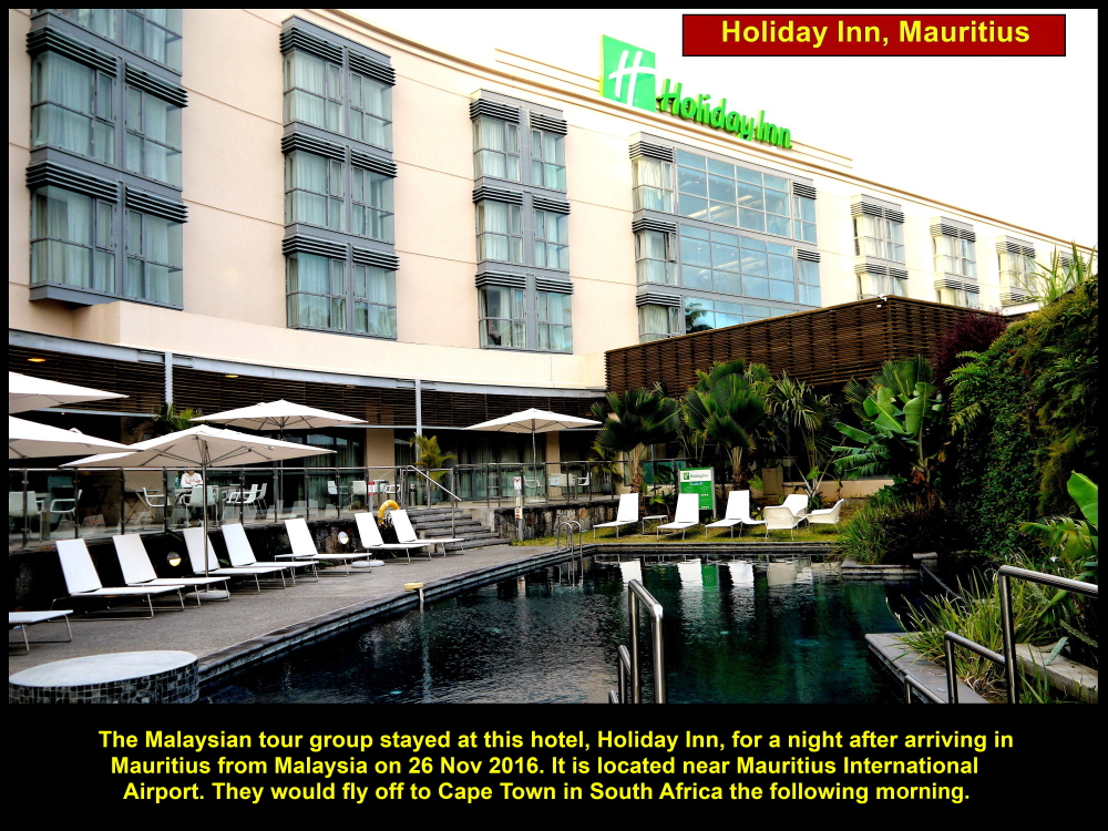
Malaysian Tour Group stayed here for a night in Mauritius before continuing their to South Africa in the morning
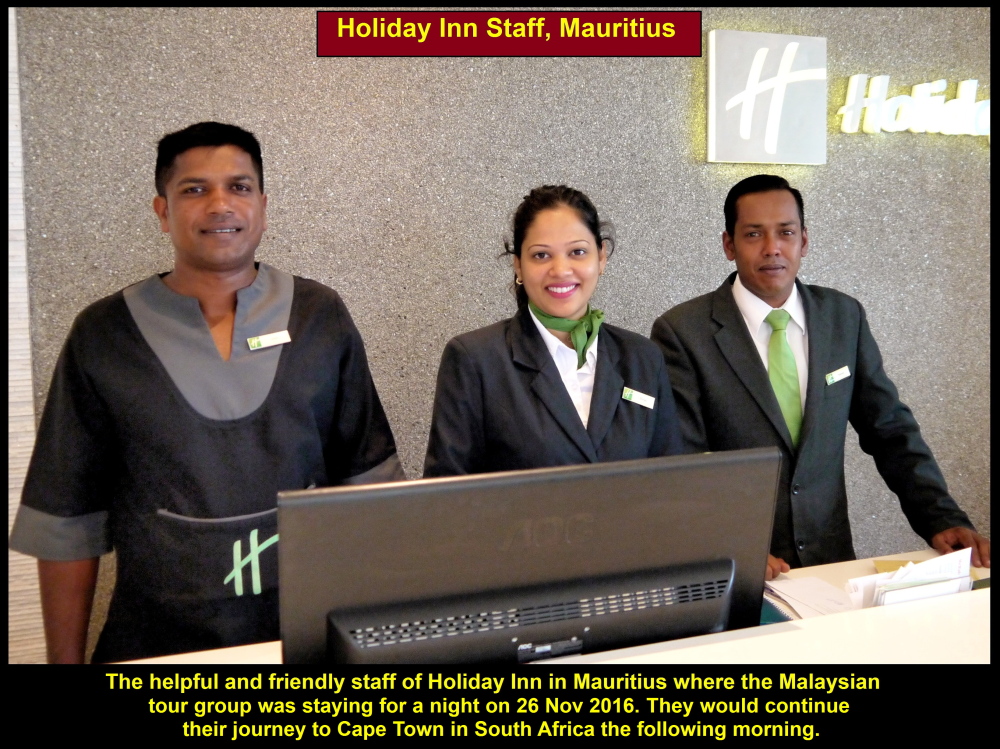
Friendly and helpful staff of Holiday Inn, Mauritius
Day 2 Sunday, 27 Nov 2016
Air Flight from Mauritius to Cape Town
The following early morning we left the hotel for the airport. At 8.45 a.m.(Mauritius time) we flew off again to continue our journey to South Africa.
Our plane, Air Mauritius, took 6 hours to fly from Mauritius to Cape Town International Airport in South Africa. The distance between them is 4 100 km.
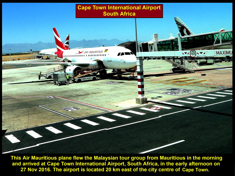
This Air Mauritius plane flew the tour group from Mauritius to South Africa
Cape Town International Airport
On arrival at the Cape Town International Airport, everybody was feeling tired but was ready for the exciting tour in South Africa.
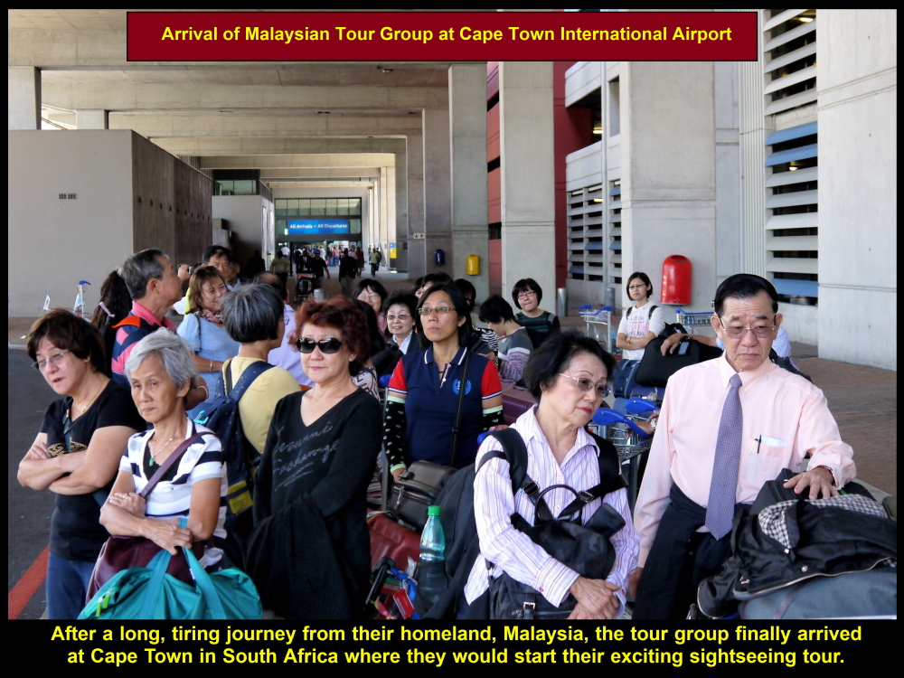
Tour group feeling tired after a long journey but ready for the South Africa tour
Pictures of Nelson Mandela
As we were waiting for our Cape Town tour guide, Cindy, in the arrival hall, we noticed a row of several large pictures of the first President of South Africa, Nelson Mandela(1918-2013), on a long wall. They were displayed there in memory of him as a great statesman, anti-apartheid activist, political prisoner for 27 years and the first President of South Africa(1994-1999).
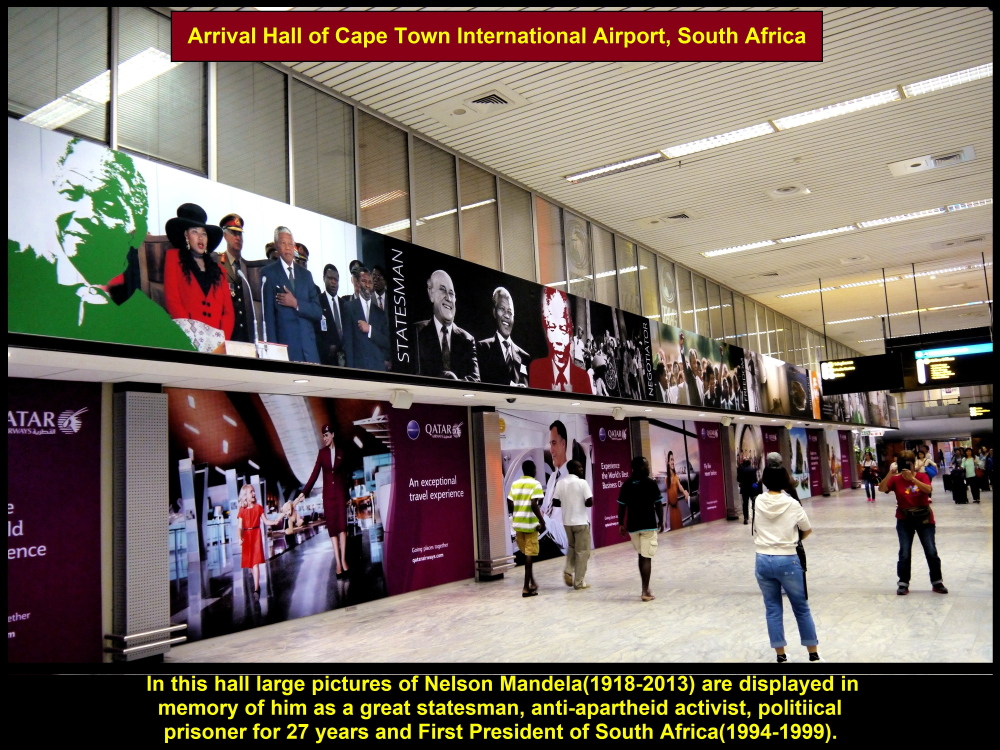
Pictures of Nelson Mandela in airport arrival hall

A picture of Nelson Mandela congratulating the S. Africa rugby team captain for winning the 1995 Rugby World Cup Final
Cape Town Tour Guide, Cindy
Soon the tour guide, Cindy, came and brought all of us to Cape Town’s well-known iconic landmark, Table Mountain.
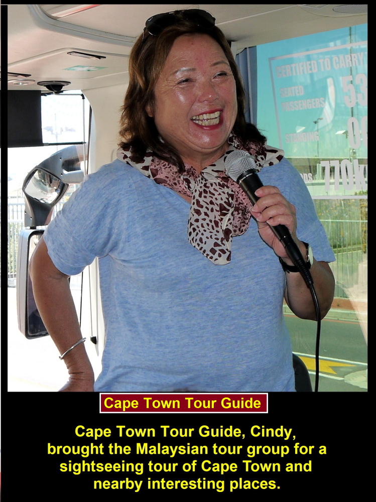
The tour guide of Cape Town is called Cindy.
Shantytowns
As we were travelling by coach from the airport to the city we saw some shantytowns. These places are inhabited by Black who are poverty-stricken and mostly unemployed. Some are involved in gang activities. As they are very poor, their houses are small and made of “tin”, wood and cardboard.
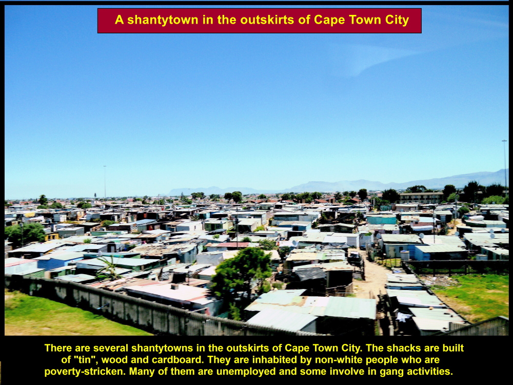
Shantytown where poor people who are mostly black stay
Apartheid Rule(1948-1994)
During the South Africa apartheid rule from 1948 till 1994, non-White living in White areas in the cities were forced to move out to the outskirts where they settled in shantytowns.
Houses for the Black
In 1994 when the first black President of South Africa, Nelson Mandela(1918-2013) was elected the apartheid law was abolished. The new government started to build new houses for the Black. Millions of Black people have benefited from the housing program. But those who are poor and unemployed have to continue living in these areas that have no basic amenities.
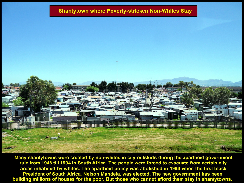
Poverty-stricken and unemployed non-whites live in shantytowns in South Africa
Soon we reached Table Mountain which forms the backdrop of the city of Cape Town. Besides, it is an iconic landmark of the city that beckons millions of tourist from all over the world to visit it, annually.
(continue reading in South Africa Part II)
Written by Choo Chaw
South Africa Travel Part I: Air Flight from KLIA to Cape Town, Cape Town Shantytowns
South Africa Travel Part II: Table Mountain, Malay Quarter, Castle of Good Hope. A & V Waterfront
South Africa Travel Part III: Hermanus, Cheetah Outreach, Stellenbosch, Jewel Africa
South Africa Travel Part IV: Duiker Island of Seals, Cape Point, Boulders
South Africa Travel Part V: Cape Town to Johannesburg, Pilanesberg National Park(Game Drives)
South Africa Travel Part VI: Sun City, Union Buildings, Vootrekker Monument
South Africa Travel Part VII: Kruger Museum, Church Square, Melrose Museum, Carnivore Restaurant
South Africa Travel Final Part: Gold Reef City: Gold Mine Museum