
South Africa Travel Part IV: Maiden’s Cove, Hout Bay, Duiker Island(Seals), Boulders, Cape Point, Cape of Good Hope
Filed under: Boulders, Cape of Good Hope, Cape Point, Duiker Island(Seals), Hout Bay, South Africa Travel Part IV: Maiden's Cove
South Africa Travel Part IV: Maiden’s Cove, Hout Bay, Duiker Island(Seals), Boulders, Cape Point, Cape of Good Hope
(continue from South Africa Travel Part III)
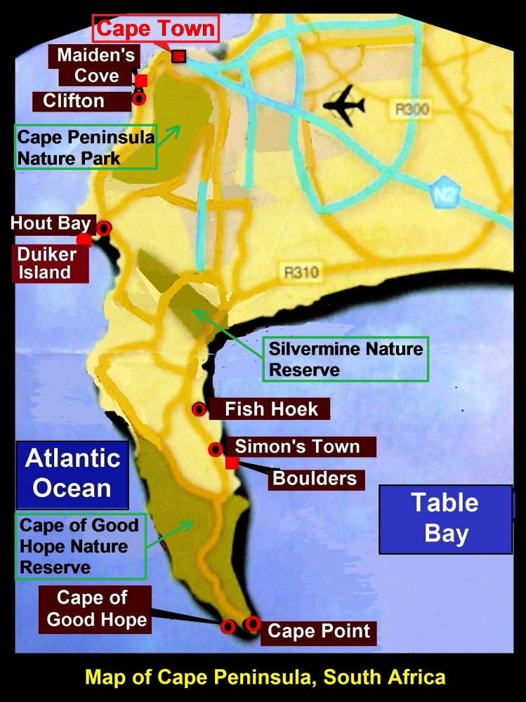
Map showing Maiden’ Cove, Hout Bay, Fish Hoek, Boulders, Cape Point and Cape of Good Hope
Day 4 Tuesday, 29 Nov 2016
Today we were going to several places on Cape Peninsula.
Maiden’s Cove
At 8 a.m. we left Southern Sun Hotel in Cape Town City for Hout Bay where we would see Cape Fur seals on a small island, Duiker Island.
On the way, after 30 minutes on the road, we stopped for awhile at a place known as Maiden’s Cove. It was a place where we could see Table Mountain and 12 peaks known as “The 12 Apostles” in the distance. Besides, we could see Clifton, a town where wealthy people lived, and Camp’s Bay Beach that was considered as the best beach in the world. The whole scenery was stunning.
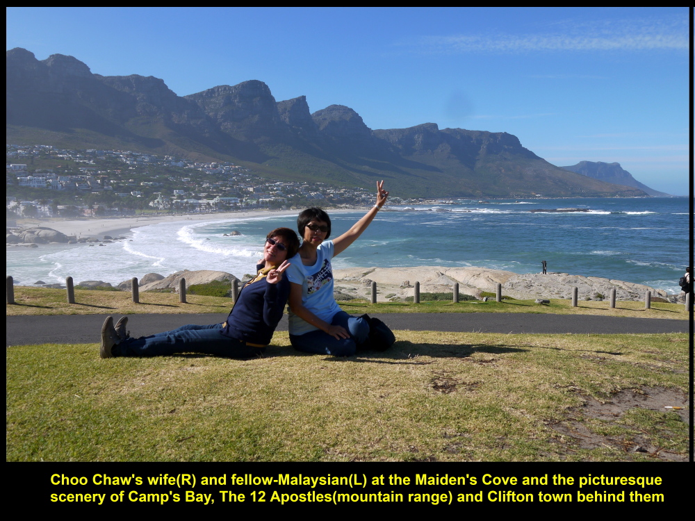
Beautiful scenery of “12 Apostles”, Camp’s Bay and Clifton Town
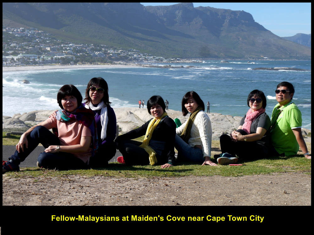
Fellow-Malaysians at Maiden’s Cove enjoying sunshine and sea-breeze
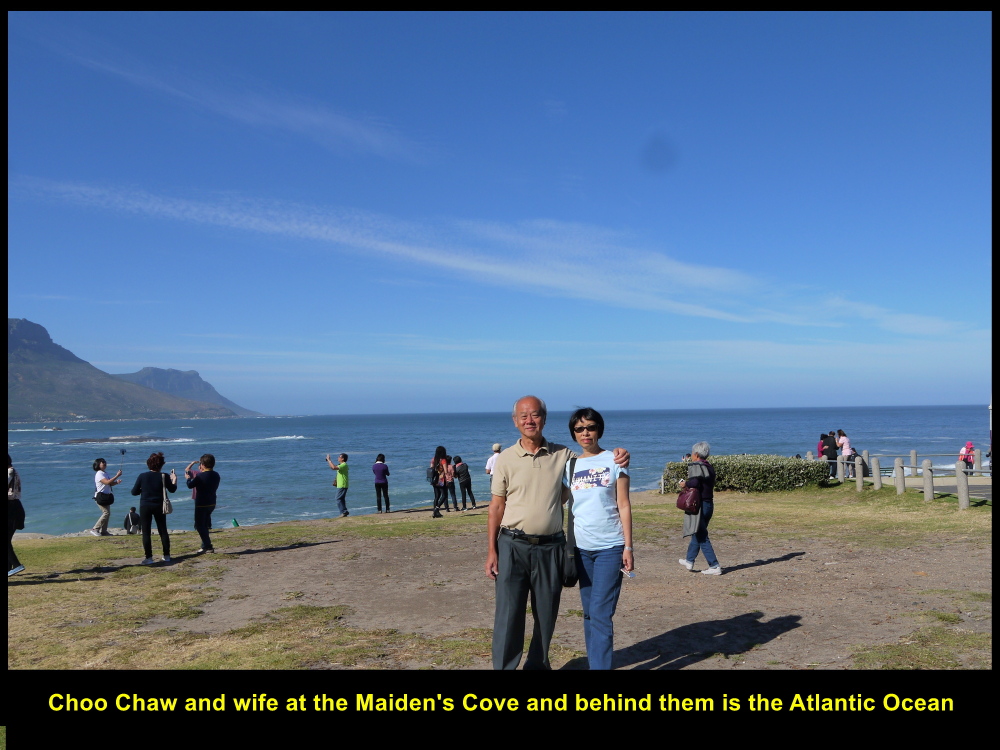
Choo Chaw and wife at Maiden’s Cove on 29 Nov 2016
High Unemployment Rate of the Black
Then we continued our journey to Hout Bay. Not long, we saw some young Black people along a busy road. The tour guide told us that they were waiting for motorists to stop by and offer them odd jobs, like plumbing, painting, gardening, plastering, welding, etc.
Unemployment rate among young Black people in South Africa is high, e.g. 53.6 % in 2013. One factor is due to their lower level of education.
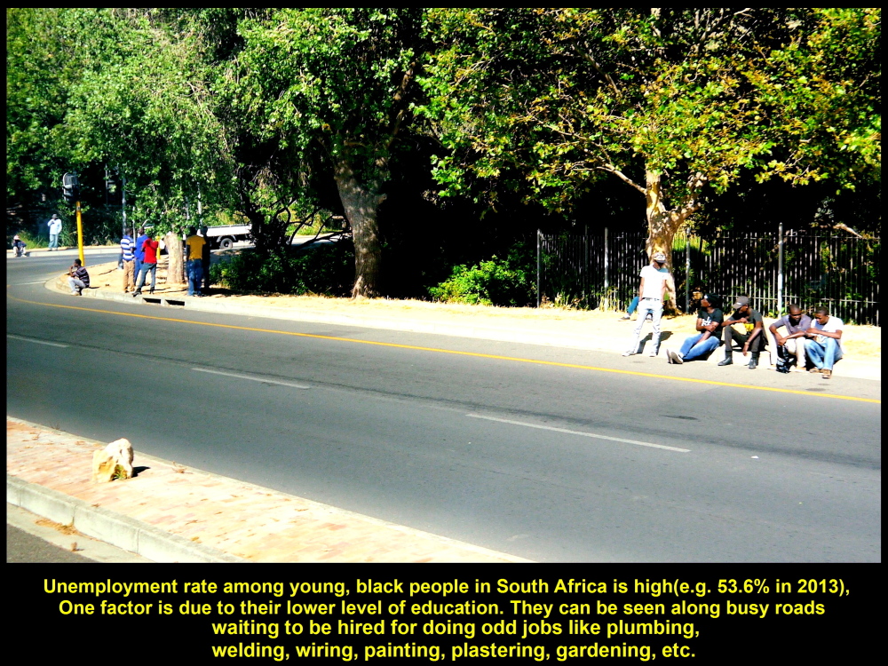
Young people waiting for jobs
Hout Bay, Duiker Island
Soon we reached Hout Bay Town. While walking to Hout Bay Wharf, we saw a row of stalls selling souvenirs with local themes.

Souvenir stalls at Hout Bay Wharf
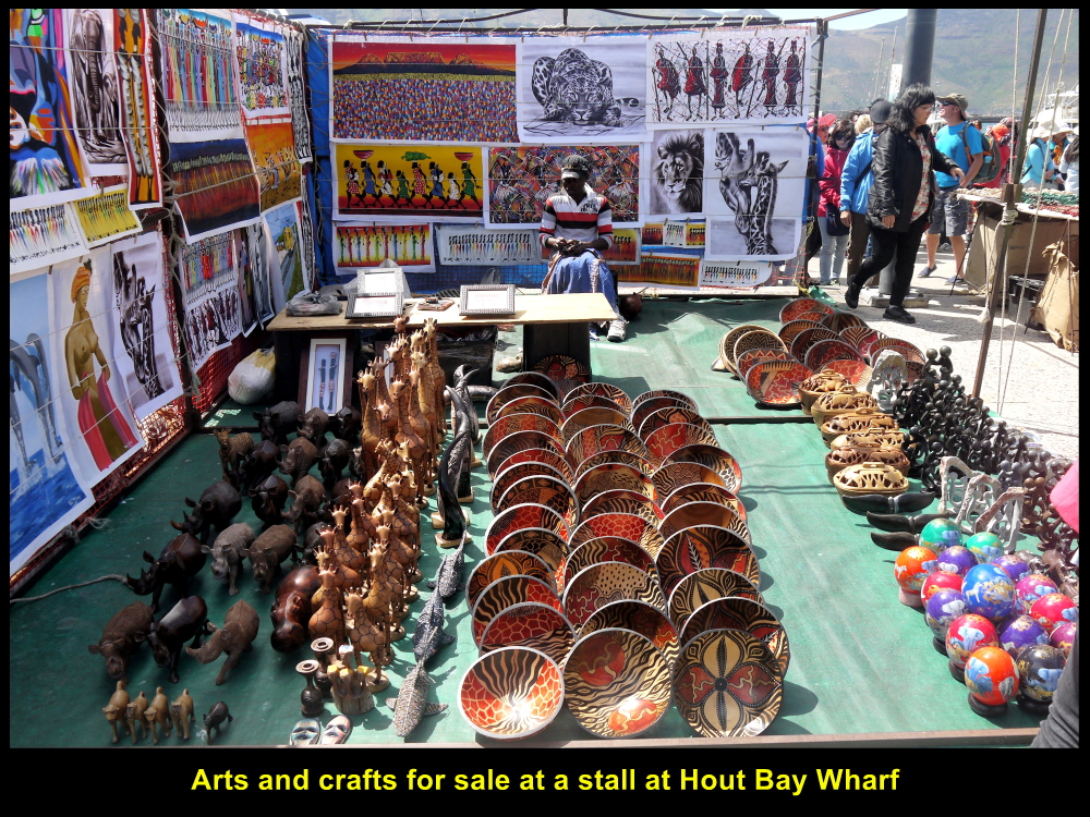
Arts and crafts for sale
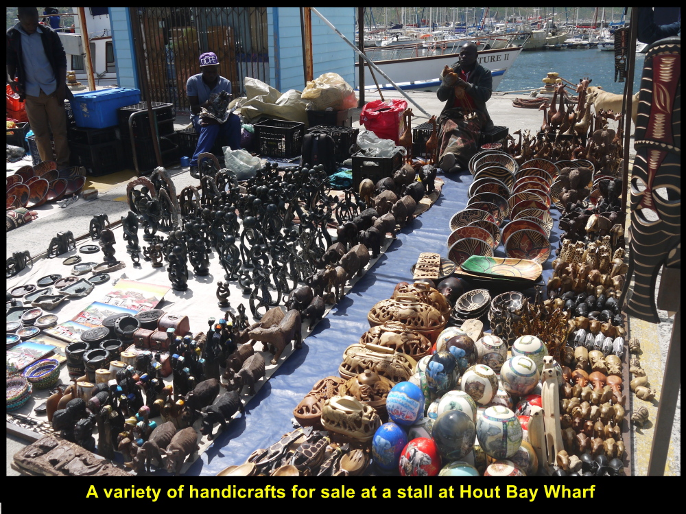
Souvenirs with local themes for sale
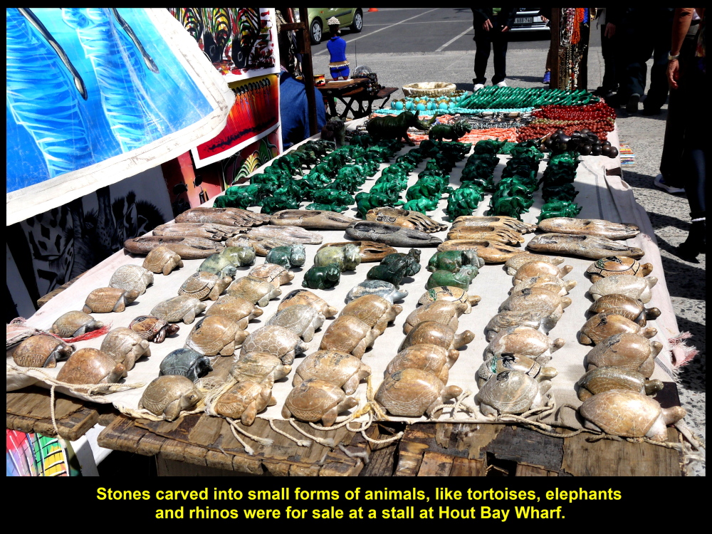
Sculptures of animals for sale
Hout Bay, a Picturesque Place
As we were waiting for a boat at Hout Wharf to take us to a small island, Duiker Island, to see seals, we looked around us. We saw the bay, harbour, marina, the landscape around the bay and tourist boats that went and returned from the seal island. It was a quaint and picturesque place.
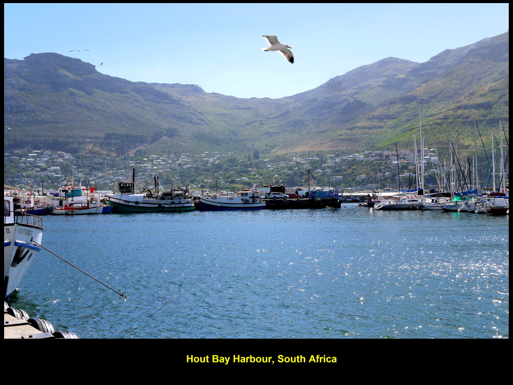
Hout Bay Harbour
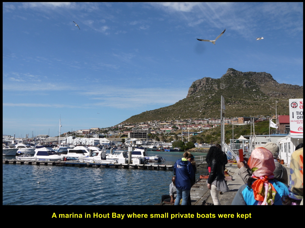
Hout Bay Marina
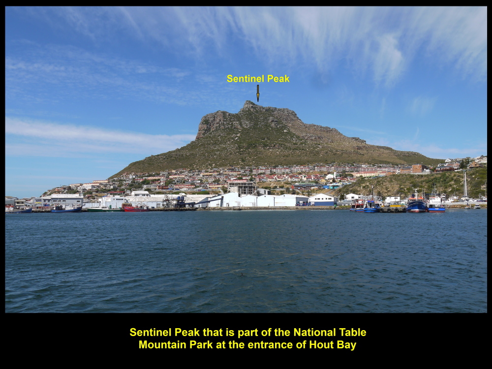
Sentinel at the entrance of Hout Bay
Calypso
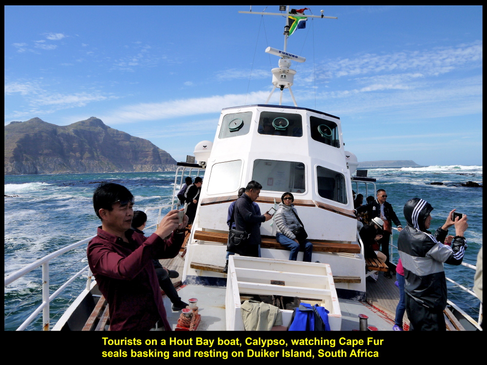
At 9.30 a.m.we boarded a boat that could carry 100 passengers, Calypso, at the wharf and sailed to a small island nearby, Duiker Island in Atlantic Ocean, where a few hundred seals live. As the boat was sailing to the island, we saw the beautiful scenery of Hout Bay and its surroundings, slowly, moving away from us.

Calypso, a boat that would bring passengers to Duiker Island to see seals
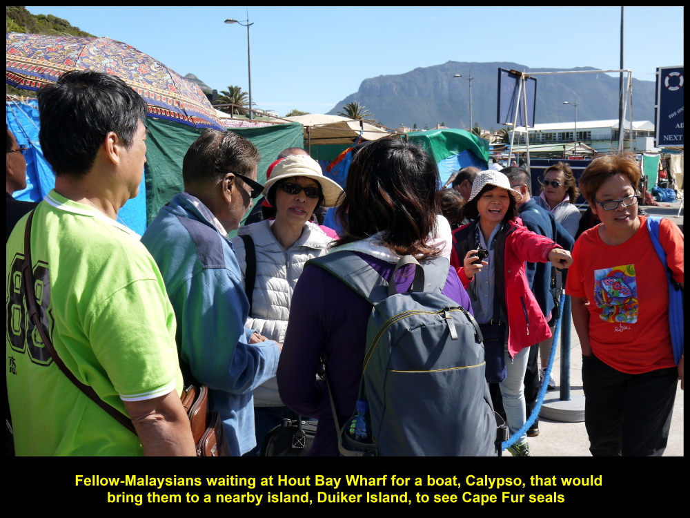
Fellow-Malaysians waiting for a boat. Calypso, to take them to Duiker Island to see seals

Pituresque Hout Bay as seen from boat, Calypso
“Titanic”
On the boat my wife who stood in front, surprisingly, re-enacted the iconic action of an actress, Kate Winslet, on a ship in a well-known movie, “Titanic” produced in 1997.

My wife, seemingly, on a ship, “Titanic”, re-enacted the iconic action of Kate Winslet in a 1997 movie, “Titanic”.
Duiker Island of Seals
Twenty minutes later after leaving the wharf, we came to the dirty-looking island, Duiker Island. A few hundreds of Cape Fur seals were seen basking in the sun.
Duiker Island, a dirty-looking island full of Cape Fur Seals
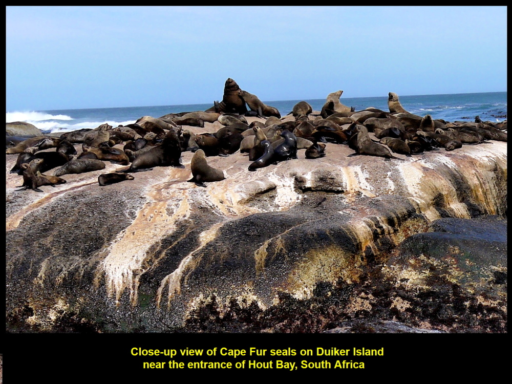
Cape Fur Seals basking in the sun
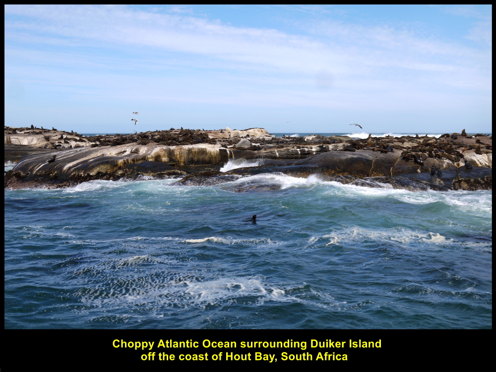
Choppy Atlantic Ocean
As our boat could not go near the island we saw the mammals about 100 metres away. There were a few boats with tourists near the island, too. But all the boats tried to stay between the island and the mainland as the Atlantic Ocean on the other side of the island was choppy.
Tourists watching seals on Duiker Island
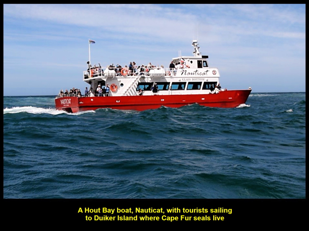
Nauticat, a boat carrying tourists to Duiker Island
Having watched the seals for about 20 minutes, we returned to Hout Bay and went to another destination known as Boulders to see African Penguins
Fish Hoek
On the way to Boulders, we stopped at a spot on a high ground, Chapman’ View Point, to have a last look of Hout Bay, a picturesque place. Then we moved on to Fish Hoek to have sea-food for lunch.
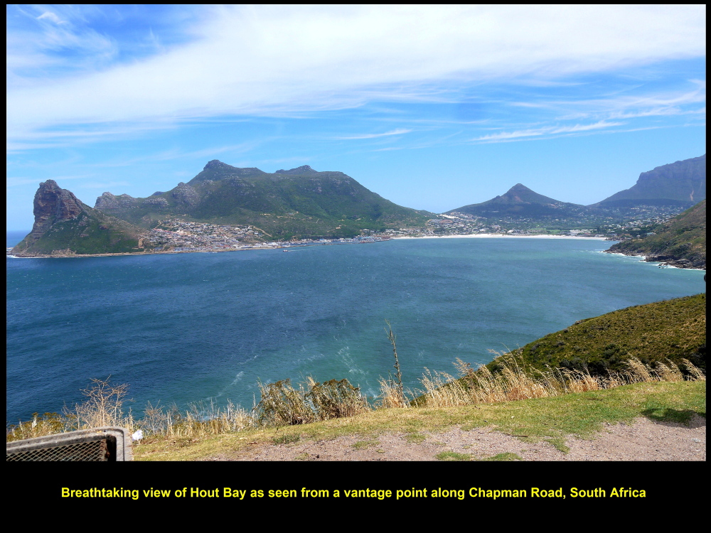
Spectacular view of Hout Bay as seen from a distance on a high ground of Chapman’s Peak
The Galley Restaurant
At 12.30 p.m. we arrived at a restaurant, The Galley Restaurant, at Fish Hoek Beach. We had a delicious sea-food of fried crayfish and prawns for lunch and tasty ice-cream at the end of the meal. The staff was friendly and helpful. In fact, the owner of the restaurant went round greeting us and was willing to take a photo with my wife and I.
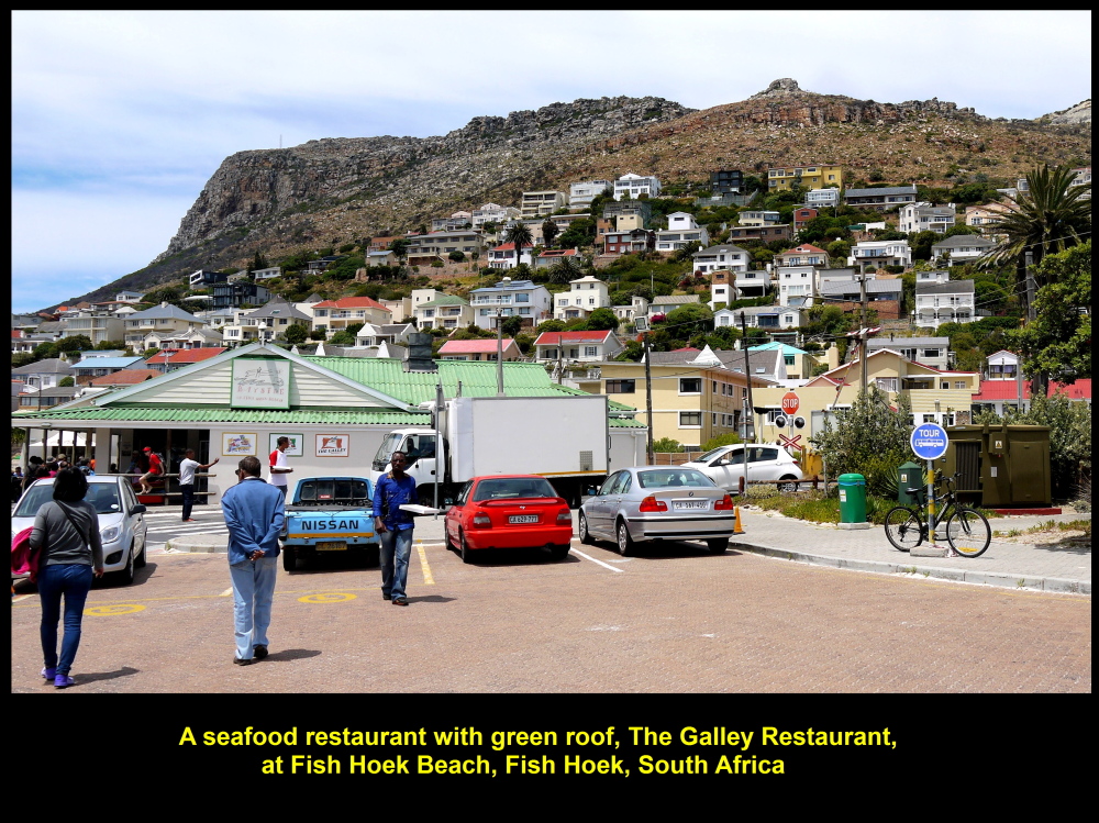
The Galley Restaurant at Fish Hoek Beach
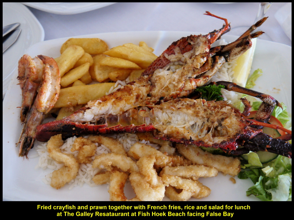
The Galley Restaurant served many kinds of dishes, e.g. fried crayfish and prawn as shown in photo
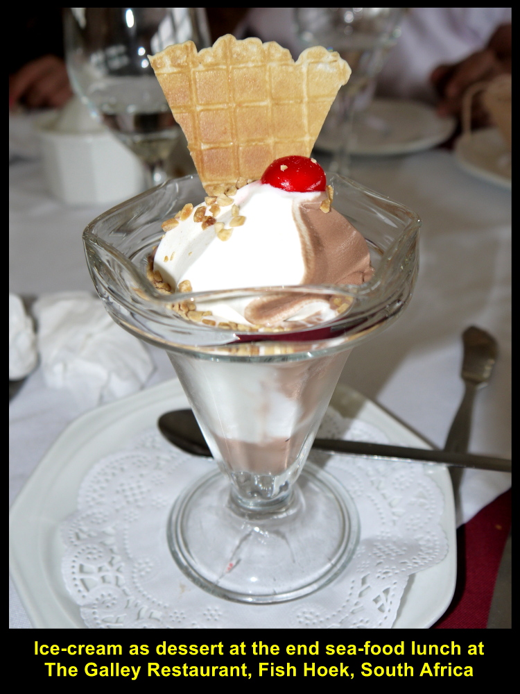
Ice-Cream at the end of lunch
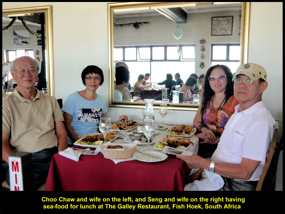
Choo Chaw and wife having lunch together with Seng and wife at The Galley Restaurant

The friendly owner of The Galley Restaurant, Fish Hoek, South Africa
Board of Foreign Currencies
After lunch, as we went out of the restaurant, we were attracted by a board on a wall near the exit door. It was full of foreign currencies put up by its former customers. Out of curiosity, I looked for the currency of my country, Malaysia, and was surprised to see two Malaysian banknotes of denominations, RM 1 and RM 10, pinned onto the board. It was a testimony that other Malaysians did visit Fish Hoek Beach in South Africa.
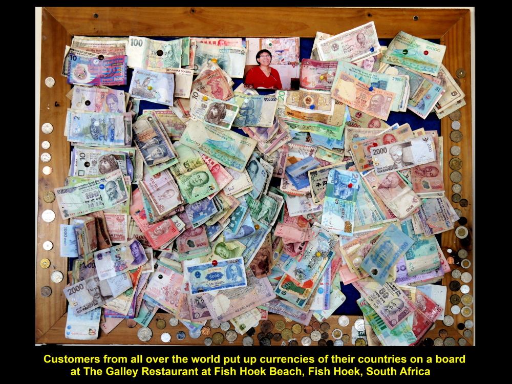
Foreign currencies pinned on a board by foreign customers of The Galley Restaurant
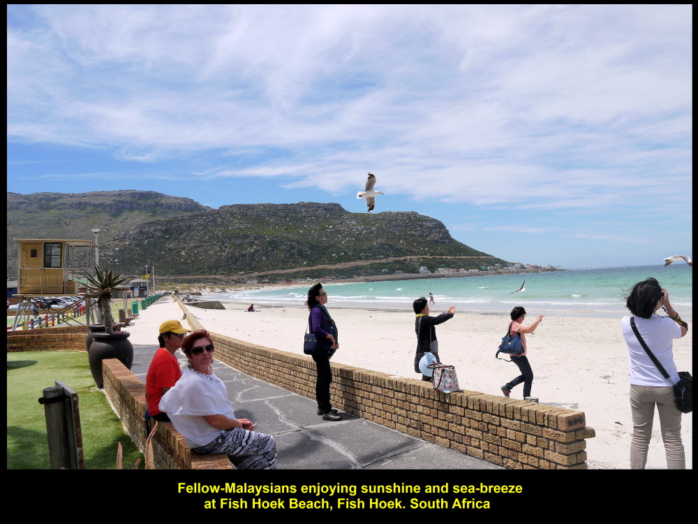
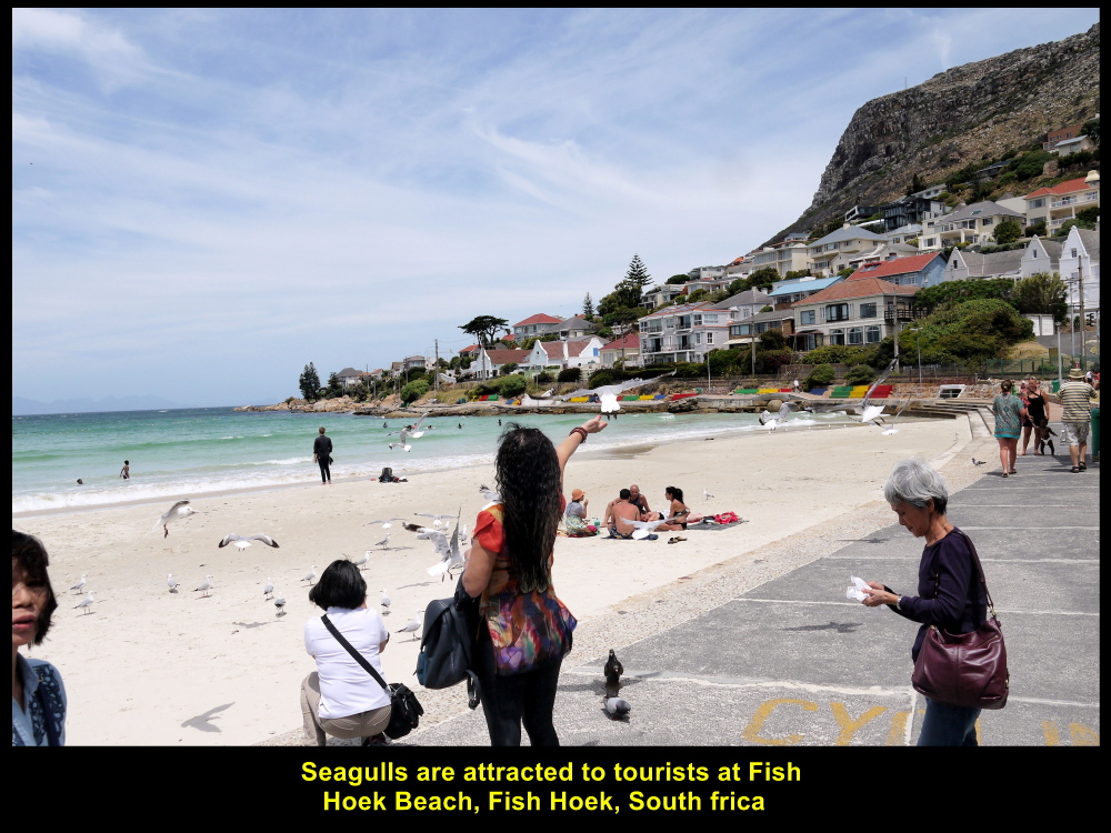
Seagulls
Outside the restaurant, we spent a few minutes at the white, sandy beach, Fish Hoek Beach, enjoying the sunshine and sea-breeze, and the scenery, too. At the same time some of our fellow-Malaysians were playing with the active seagulls without fear of receiving a “gift” from them.
Sunshine and sea-breeze at Fish Hoek Beach
Fellow-Malaysians playing with seagulls
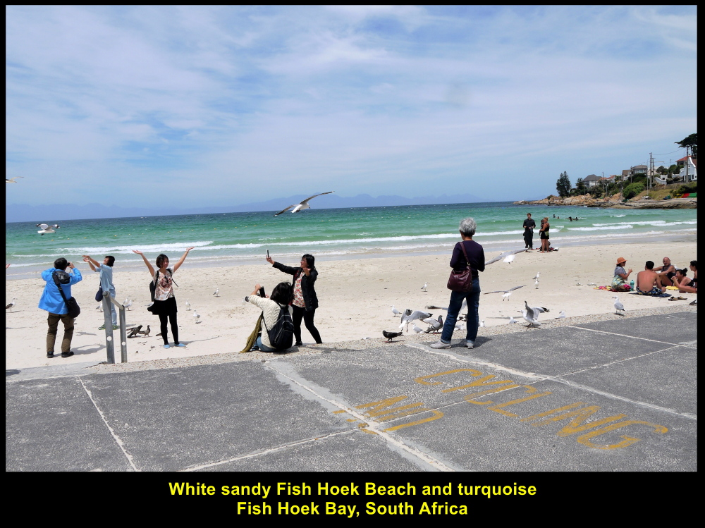
Sandy Fish Hoek Beach and turquoise Fish Hoek Bay
Simon’s Town
Boulders was our next destination. We travelled south of Fish Hoek, passed through Simon’s Town and arrived at Boulders.
Simon’s Town had been an important harbour and naval base for more than 200 years.
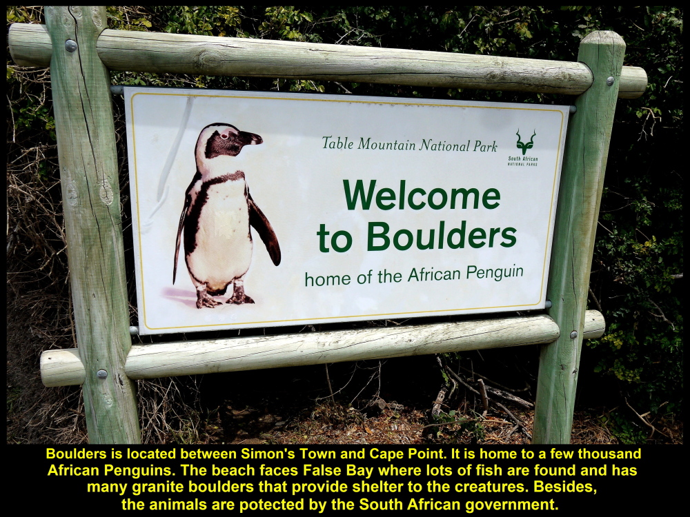
A signboard welcoming visitors to Boulders to see Africa Penguins
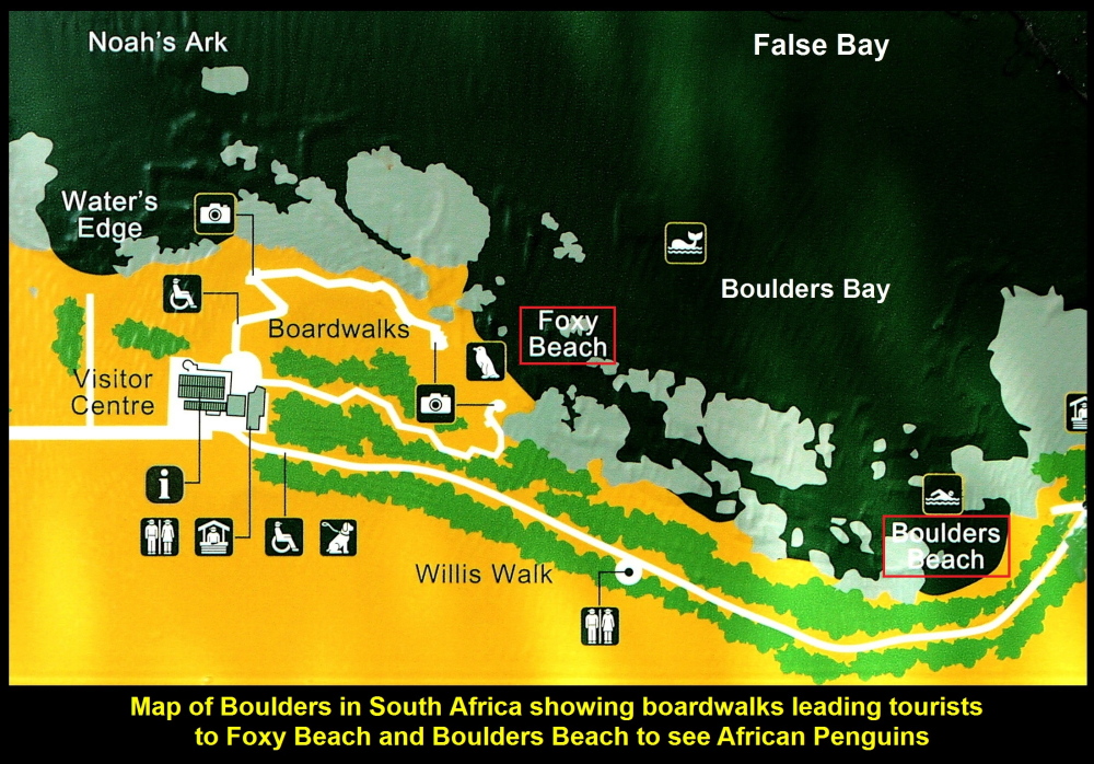
Map showing the location of Foxy Beach and Boulders Beach at Boulders
Haven for African Penguins
Boulders is located along the coast between Simon’s Town and Cape Point. As there are many granite boulders there hence the place is called Boulders. These boulders in water and at beaches provide good shelter to penguins from rough sea and their enemies, like sharks, seals and whales. So Boulders is a haven for African Penguins.
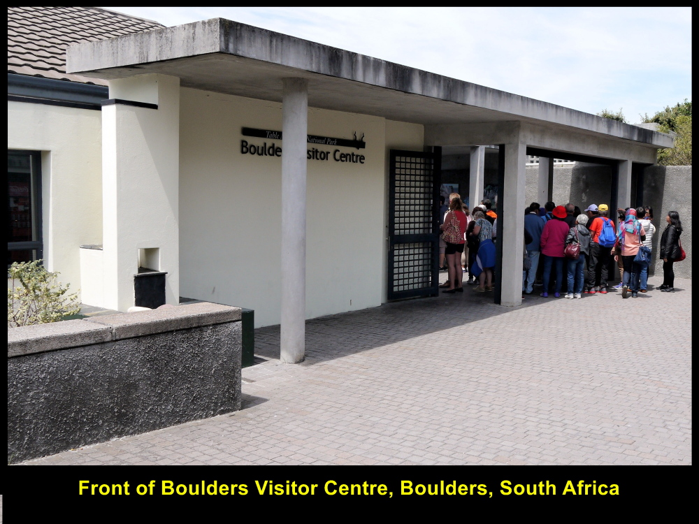
Boulders Visitor Centre, entrance to African Penguins’ home
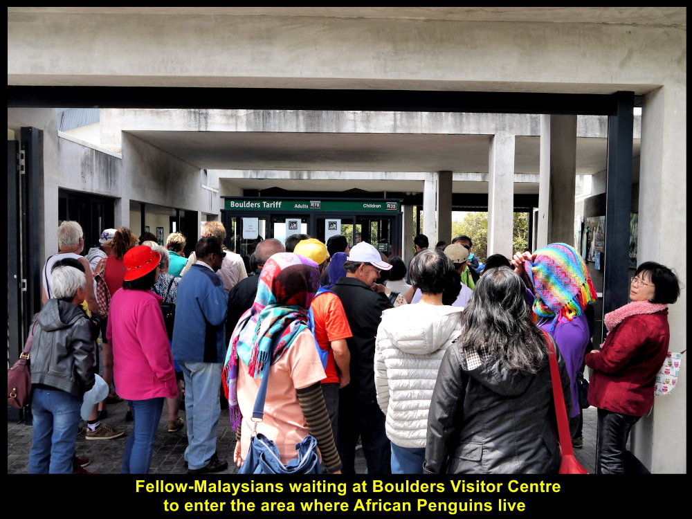
Fellow-Malaysians visiting Boulders to see African Penguins
Foxy Beach and Boulders Beach
To see African Penguins at the beaches of Boulders, we had to enter Boulders Visitor Centre with tickets. Then we walked along boardwalks from the centre to two beaches, Foxy Beach and Boulders Beach, where penguins lived.

A boardwalk to Foxy Beach where penguins live
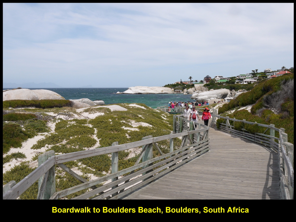
Boardwalk to Boulders Beach which is home to many penguins

Tourists looking at penguins that were moulting
Moulting Penguins and Chicks
As we were walking to Boulders Beach we saw among the boulders and bushes at the sandy beach some penguins that were moulting and some chicks waiting for their parents to come back from the sea with food.
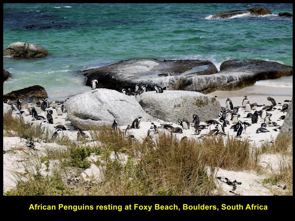
Foxy Beach is the best place to watch penguins as it is very close to the the boardwalks
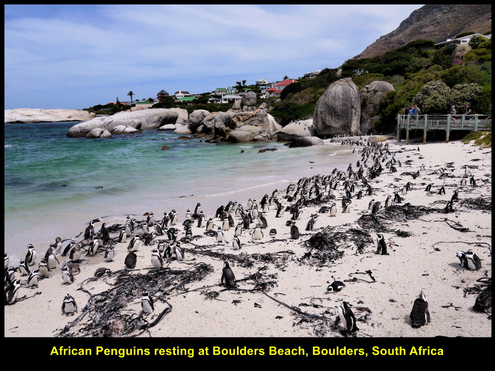
Boulders Beach with lots of African Penguins basking in the sun
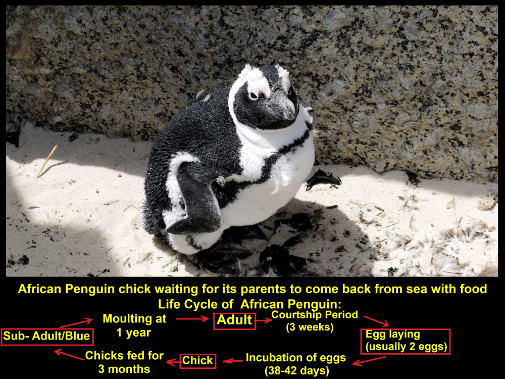
Young penguin chick waiting for its parents to come back from sea with food
Penguin Life Cycle
Below is a diagram of the life cycle of an African Penguin:
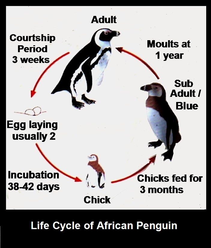
Life Cycle of African Penguin
South of Cape Peninsula
We spent half an hour at Boulders to see the African Penguins. At 2.30 p.m. we left the place and went further south to the end of Cape Peninsula which splits into two promontories. The southeastern promontory is called Cape Point whereas the southwestern one is known as Cape of Good Hope which is the most southwestern point of the continent of Africa.

Map showing Cape Point and Cape of Good Hope
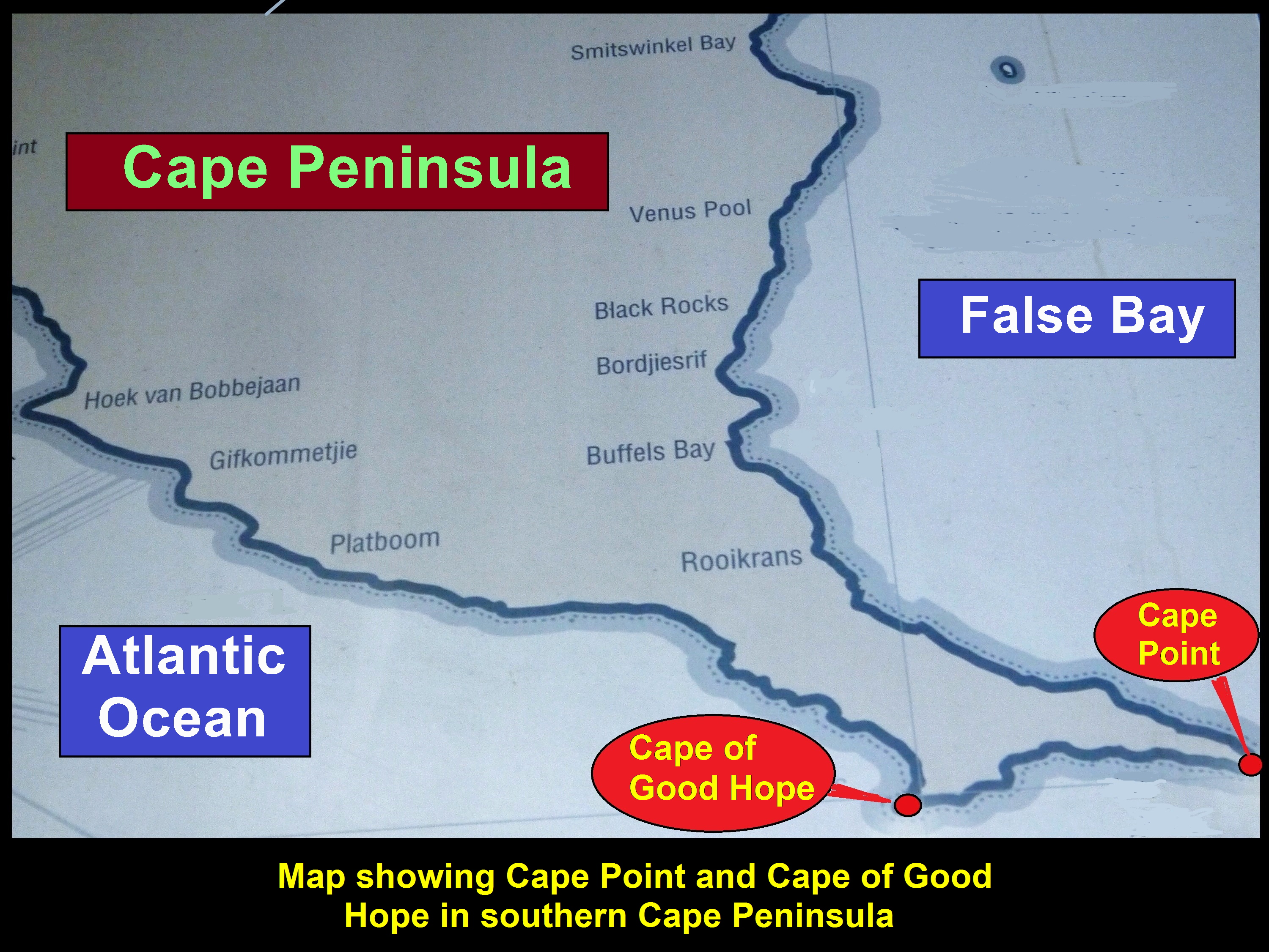
Map showing Cape Peninsula splits into two promontories in the south, Cape Point and Cape of Good Hope
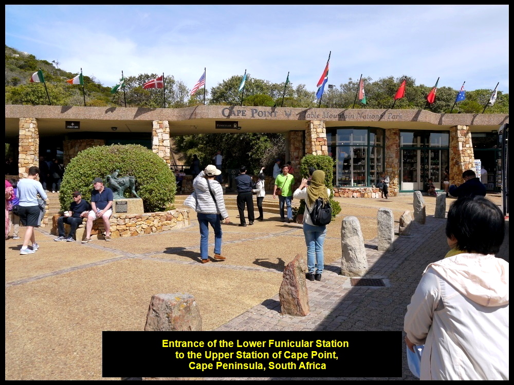
Funicular at Cape Point
At 3.30 p.m. we reached Cape Point first. We stopped at a coach-park and entered the Lower Funicular Station(127 m high). Then we took the Funicular, a train, to the Upper Funicular Station(214 m high). On arrival at the station, we walked up a few flights of steps to an old lighthouse on top of Cape Point Peak.
Funicular lower station to Cape Point Peak
Funicular Track
The Funicular track is 585 metres long and the train that is pulled by a strong cable takes 3 minutes to reach the upper station. It replaced the buses in 1995.

Cape Point Funicular replaced the “Flying Dutchman” bus services in 1995.
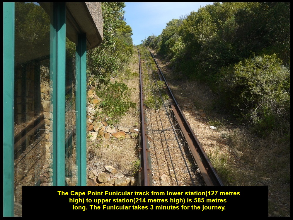
Funicular track is 585 metres long and the train takes about three minutes to make the journey.
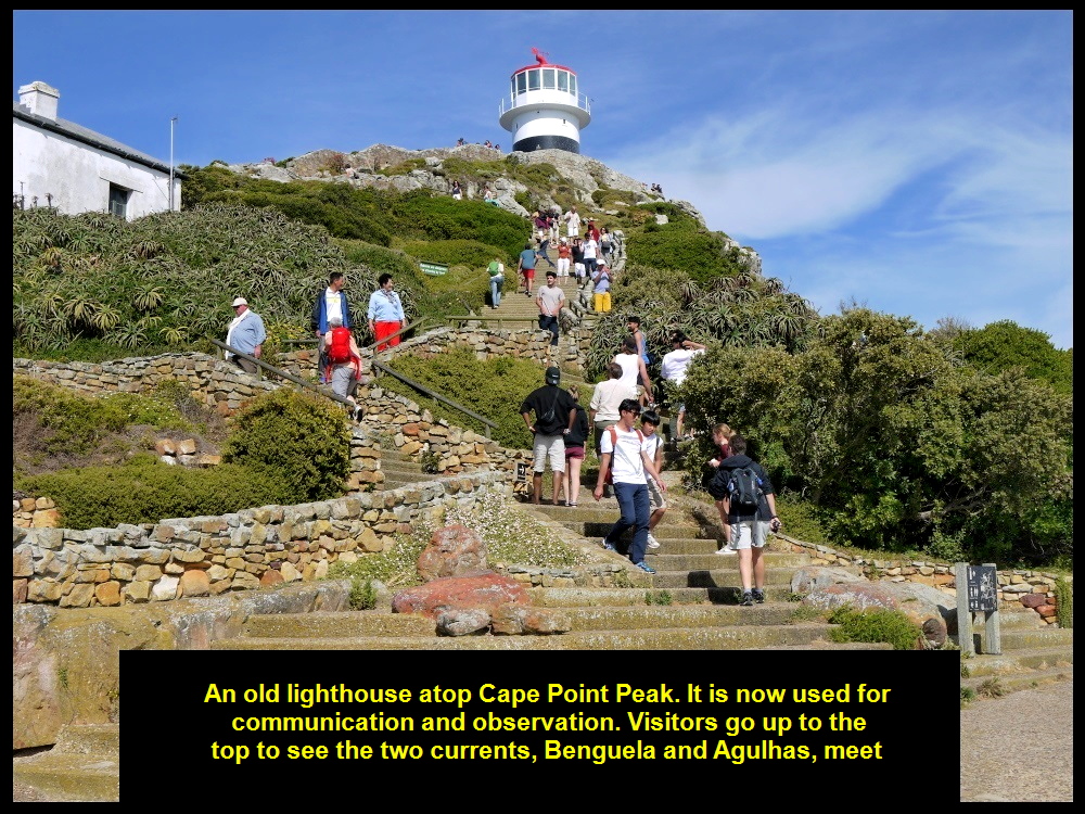
Tourists climbing up the steps to the olf lighthouse
Old Lighthouse of Cape Point
The old lighthouse was built in 1860 but decommissioned in 1919 when the most powerful one in South Africa was built nearby. The old one was then used for observation and communication.
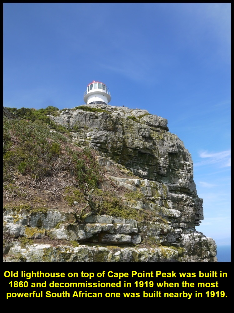
Old lighthouse was built in 1860 and decommissioned in 1919. It is now used for observation and communication.
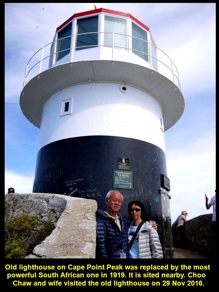
Choo Chaw and wife visited the old lighthouse which was replaced by a more powerful one nearby in 1919.
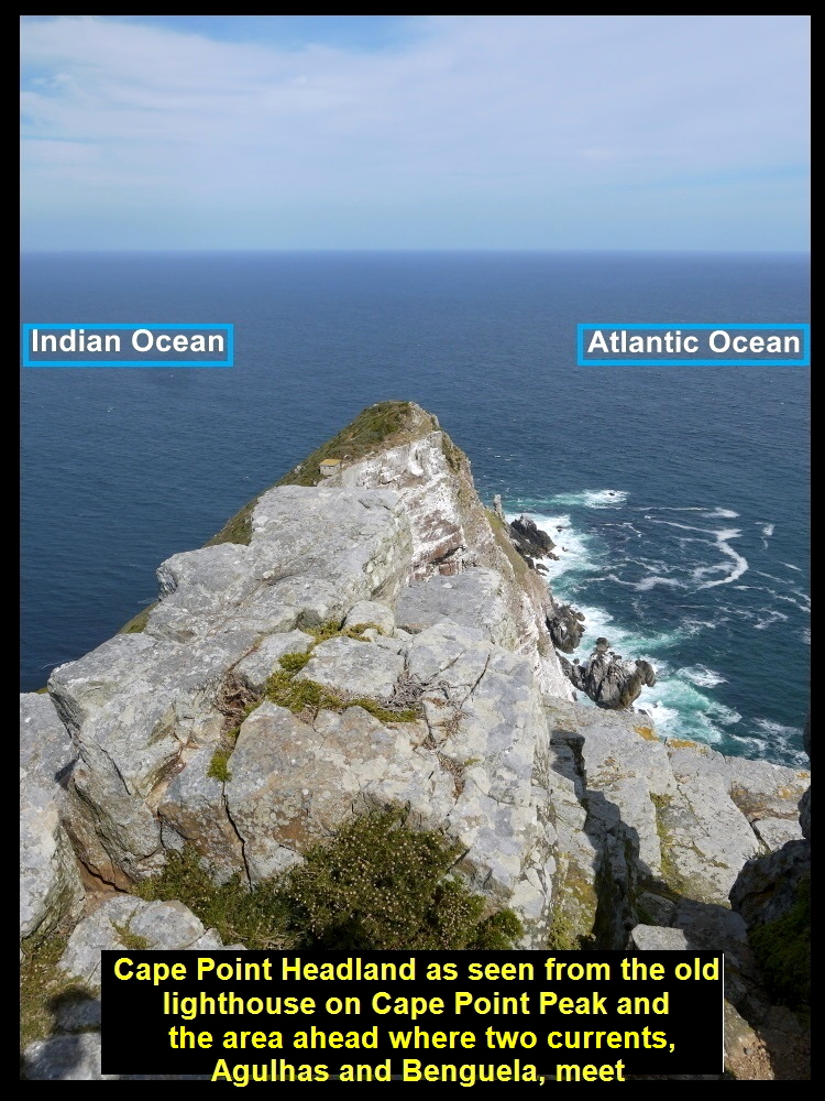
Spectacular, Panoramic View
From the lighthouse we could see a spectacular panoramic view of Cape Peninsula, Atlantic Ocean, Cape of Good Hope, Indian Ocean and False Bay. Besides, there was a post at its base that showed distances of foreign cities from it.

A spectacular panoramic view of the Cape Peninsula landscapes from the old lighthouse
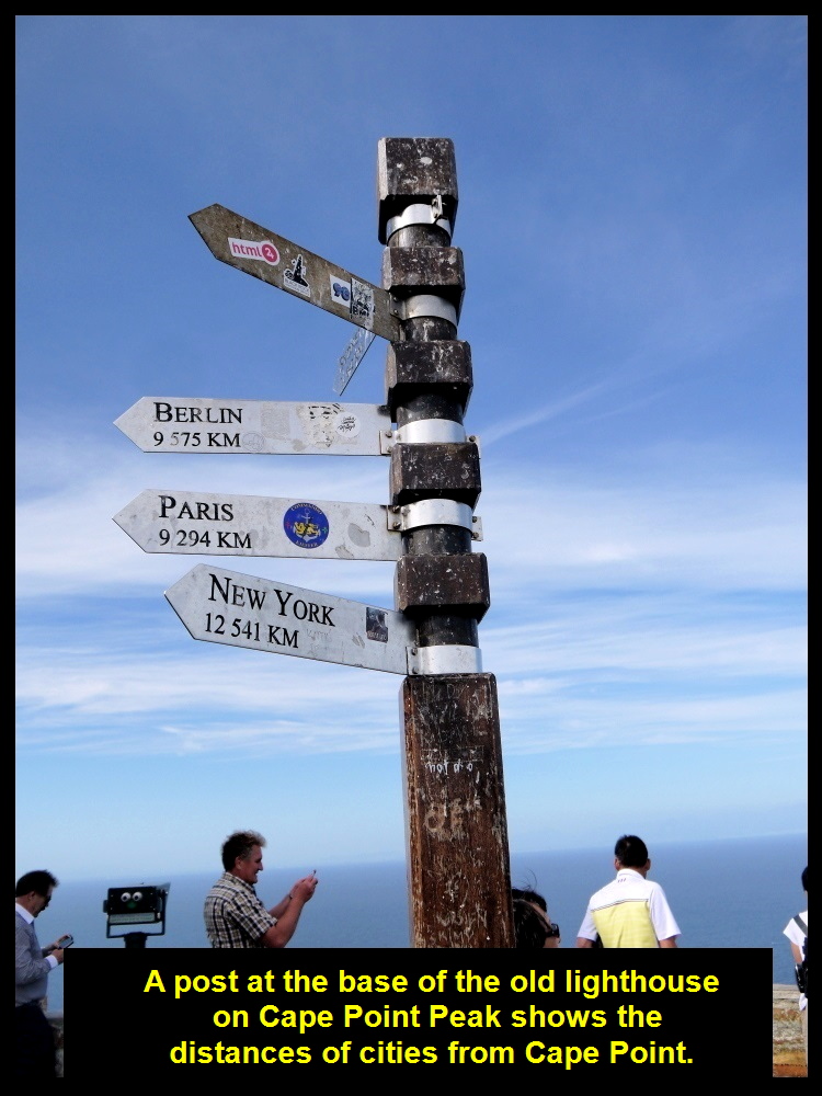
A post at the old lighthouse showing the distances of foreign cities from the lighthouse
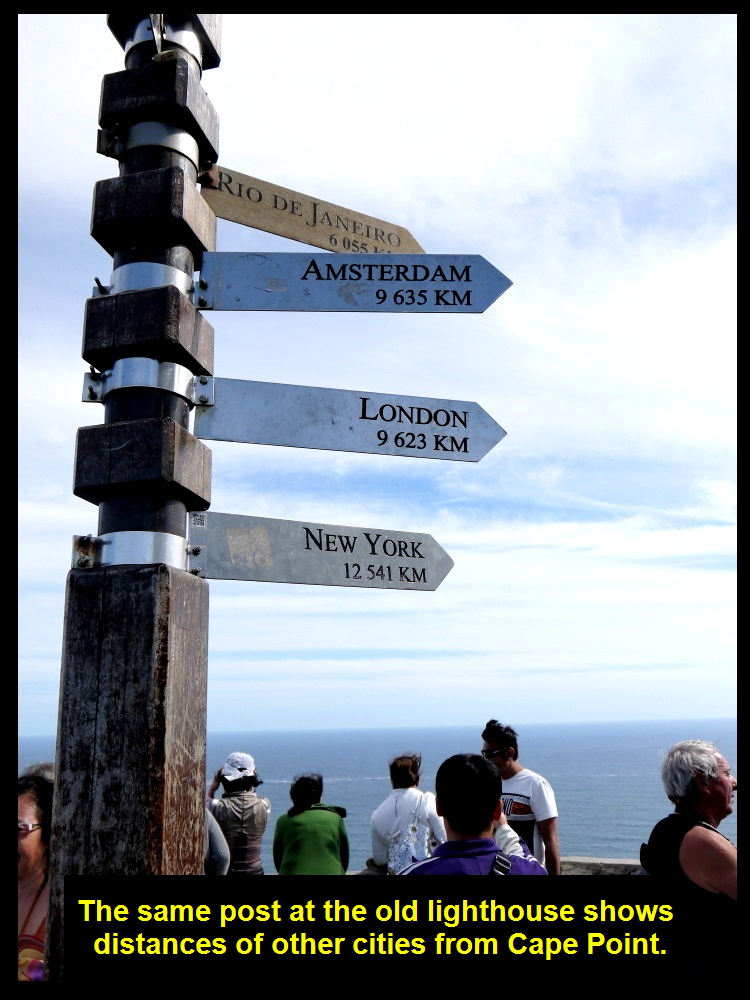
The same post showing the distances of other foreign cities from the lighthouse
Wonderful Feeling at Cape Point Old Lighthouse
All my fellow-Malaysians, my wife and I were having a wonderful feeling at the Cape Point old lighthouse. We were 9600 km away from our home and enjoying the sights and sounds of the two oceans which were next to each other, and the spectacular view of Cape Peninsula.
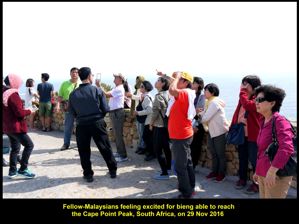
Fellow-Malaysians at old lighthouse on 29 Nov 2016
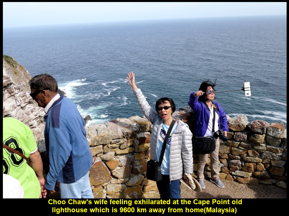
Choo Chaw’s wife feeling exhilarated at the Cape Point old lighthouse that is 9600 km from home(Malaysia)
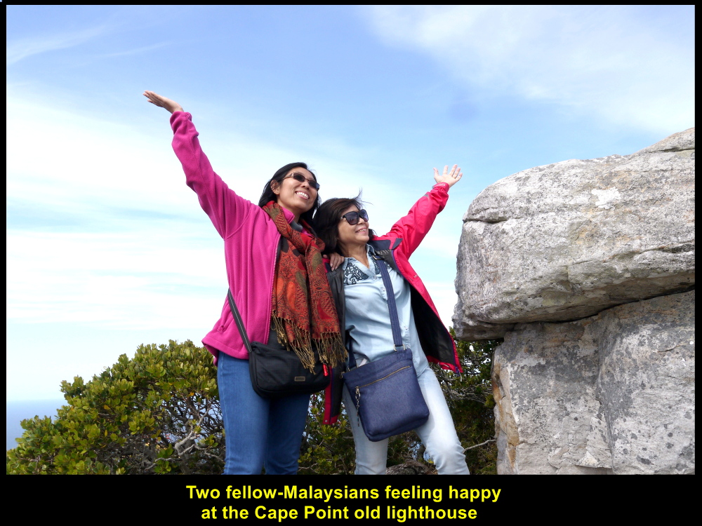
Two fellow-Malaysians feeling happy to be at the Cape Point old lighthouse
Meeting of Two Currents
Right in front of Cape Point in the south, two currents meet each other. They are the cold Benguela Current from Atlantic Ocean that flows eastwards and the warm Agulhas Current from Indian Ocean that flows westwards. It seems that the actual place where they meet is between Cape Point and Cape Agulhas.
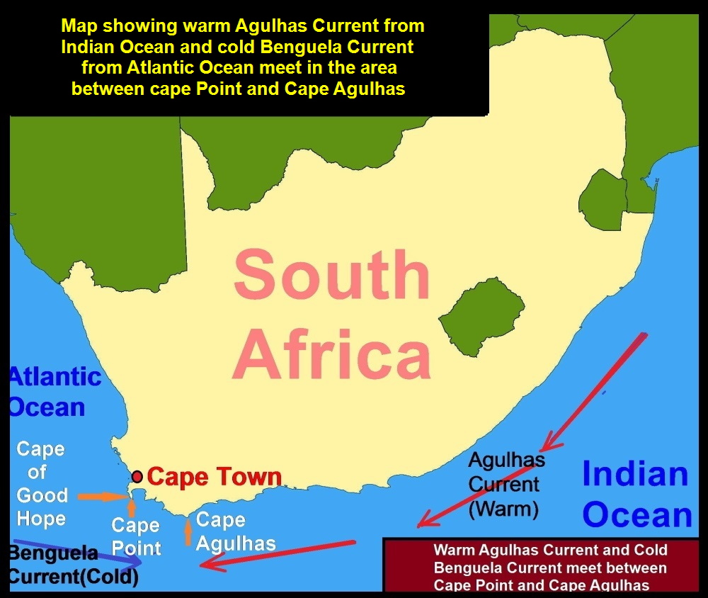
Map showing the meeting of two currents, cold Benguela Current and warm Agulhas Current
Two oceans, Atlantic Ocean and Indian Ocean next to each other in front of Cape Point Headland

Fellow-Malaysians watching the meeting of two currents, Benguela and Agulhas
Cape of Good Hope
After spending a short time at Cape Point we went to Cape of Good Hope which was a few kilometres away. It is located at the most south-western point of the continent of Africa and faces Atlantic Ocean.
Cape Agulhas which is 150 km south-east of Cape of Good Hope is considered to be the most southern point of the African continent.
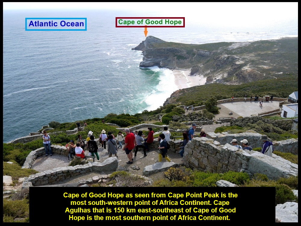
Cape of Good Hope as seen from Cape Point Peak
The Most South-Western Point of African Continent
When we reached Cape of Good Hope we saw a low, rocky headland with little grass on the coast of Atlantic Ocean. Owing to weathering and erosion, layers of sandstone were exposed. We made a beeline to a large, long and red signboard that declared that Cape of Good Hope was the most south-western point of the continent of Africa.
There were other tourists visiting the well-known place. Nobody left the place without taking a photo with the prominent signboard.
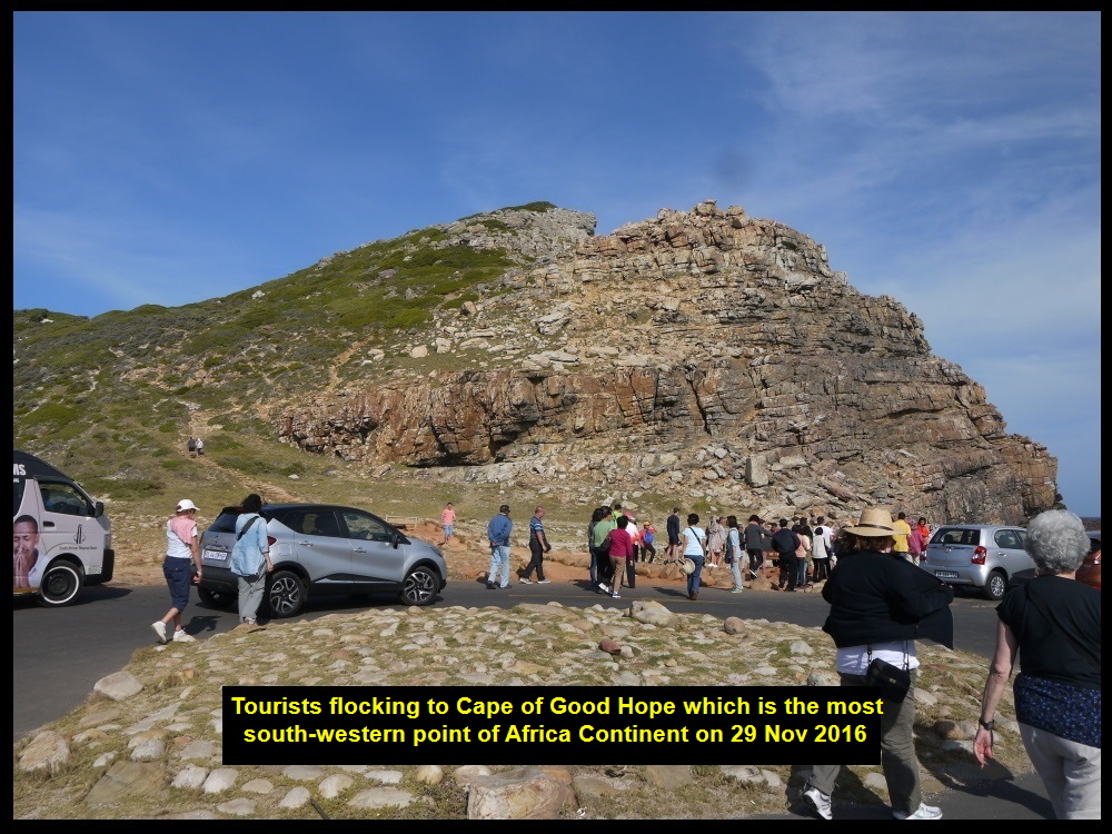
Tourists making a beeline to the most south-western point of the continent of Africa, Cape of Good Hope
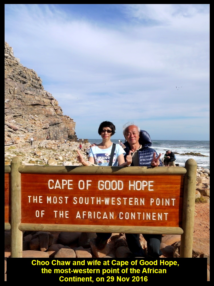
Choo Chaw and wife at the most south-western point of the continent of Africa
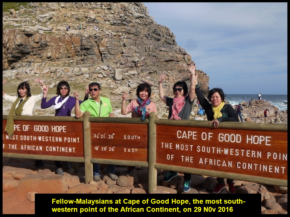
Fellow-Malaysians at Cape of Good Hope

Mr. & Mrs. Lee at Cape of Good Hope
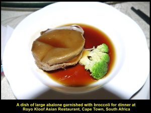
At 6 p.m. we left Cape of Good Hope leaving behind our foot-prints. We travelled back to Cape Town City where we had dinner at a Chinese restaurant known as Royo Kloof Asian Restaurant. Everyone was happy to have a dish of large abalone for dinner.
A dish of large abalone garnished with broccoli at Royo Kloof Asian Restaurant, Cape Town
Then we returned to our hotel, Southern Sun Hotel, to stay for the last night in the city. On the following day, we would fly north-east o Johannesburg from Cape Town, a distance of 1262 km between them, to visit more places of interest in the north of South Africa.
(continue in South Africa Travel Part V)
Written by Choo Chaw
South Africa Travel Part I: Air Flight from KLIA to Cape Town, Cape Town Shantytowns
South Africa Travel Part II: Table Mountain, Malay Quarter, Castle of Good Hope. A & V Waterfront
South Africa Travel Part III: Hermanus, Cheetah Outreach, Stellenbosch, Jewel Africa
South Africa Travel Part IV: Maiden’s Cove, Hout Bay, Duiker Island(Seals), Boulders, Cape Point, Cape of Good Hope
South Africa Travel Part V: Cape Town to Johannesburg, Pilanesberg National Park(Game Drive)
South Africa Travel Part VI: Sun City, Union Buildings, Vootrekker Monument
South Africa Travel Part VII Kruger Museum, Church Square, Melrose Museum, Carnivore Restaurant
South Africa Travel Final Part Gold Reef City: Gold Mine Museum